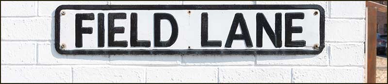
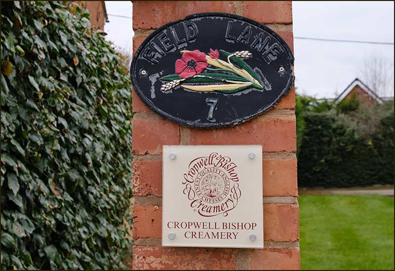
Cropwell Bishop Streets: — Field Lane (updated 19-1-23)
Field Lane is one of the oldest streets in Cropwell Bishop. It existed in 1800 and probably much earlier than that and yet, hardly anyone has ever lived on it.
Even though the same is true today, its importance as a transport link is greater than ever. Early, every morning, lorries deliver the essential ingredient for one of the village’s biggest companies; milk.
Cropwell Bishop Creamery is one of the handful of dairies allowed to make Stilton Cheese. A Creamery has been on the site for at least a century.
So, why was Field Lane chosen for its name – wouldn’t something like, Cheese Way or Stilton Round, have been more appropriate, I wonder.
It hasn’t always been called Field Lane.
Old written records of inhabitants can be very revealing but, unfortunately, in the early 1800s they did not include street names.
Nevertheless, we do know that from at least 1871 up to 1911, Field Lane was called Wilson’s Lane. There were members of the Wilson family living in the village in those days, and it is highly likely that one lived on the street, which is how it got the name.
From the early 1900s, there were no longer any Wilsons on the lane and we know that some people referred to it as Duffin’s Lane because a family of that name lived there. As so often happened in our village, a street was named after a family living there.
I have searched for a Field family in Cropwell Bishop and found one – and it is living here now. However, Mr Field assures me that his family has no long-term connection with the village so cannot be the source of the Lane's name.
So, just as I had anticipated, the street was named Field Lane because it led towards a field. With so few inhabitants living on the street to care whether it was called Field Lane, Dandelion Close or Gypsum View, the name stuck.
These days, only the Beresford family lives on Field Lane; all the other buildings are used by Cropwell Bishop Creamery. I wonder if they could claim some ancient right to have it called Beresford Lane; there would certainly be no objections from other residents on the Lane.
With photos that are a hundred years old and maps going back over two hundred years, we can piece together some of its history. Let’s start with the maps.
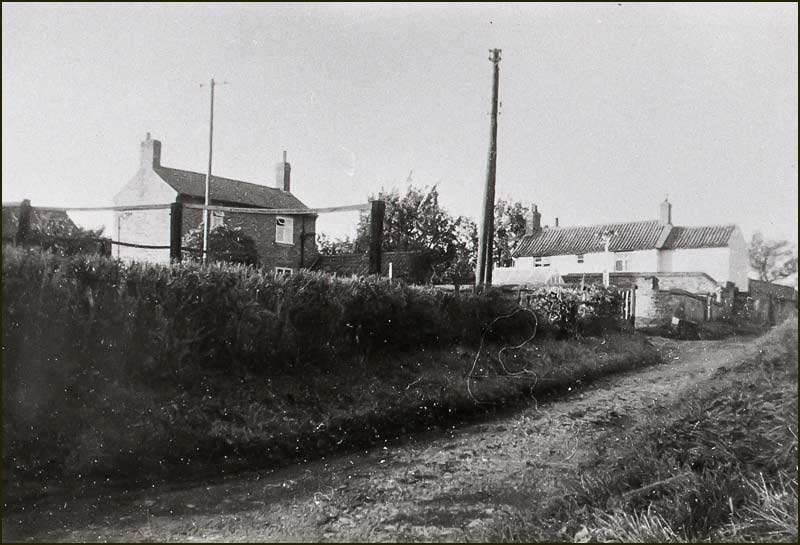
Much has changed, but the white house at the far end looks familiar and the leaning telegraph pole of the 1930s appears to have been sympathetically replaced by a leaning lampost!

Maps
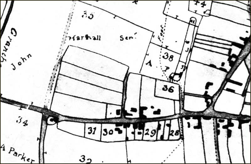
The Enclosure Map of 1804 shows Field Lane which, at first glance, appears much as it does today. At that time the village was much smaller and had far fewer houses. There were around 300 inhabitants: today, there are over 7x as many.
If we look at a 1960s map, we see that Field Lane was about the same length as in 1804, but with an extra lane on the left.
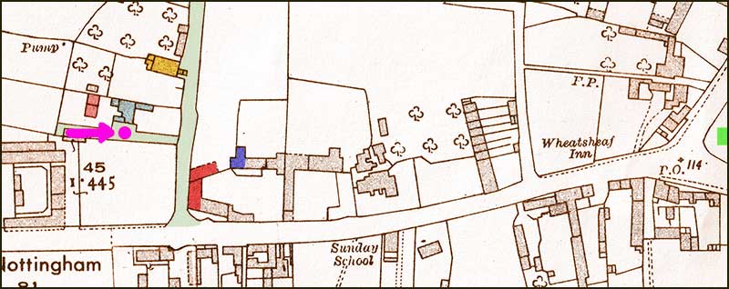
We know that there were four homes, numbered 1 to 7 (all on the left, so all odd numbered). There don’t seem to have ever been any homes on the right-hand side (we treat the Creamery as belonging to Nottingham Road).
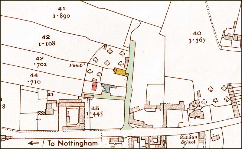
House numbers: 1 & 3 (red), 5 (blue) and 7 (yellow).
Since those days, 60 years ago, a great deal has changed. Buildings have been demolished and buildings have been built, but a few of the old building still stand. They have been modernised, but are still recognisable.
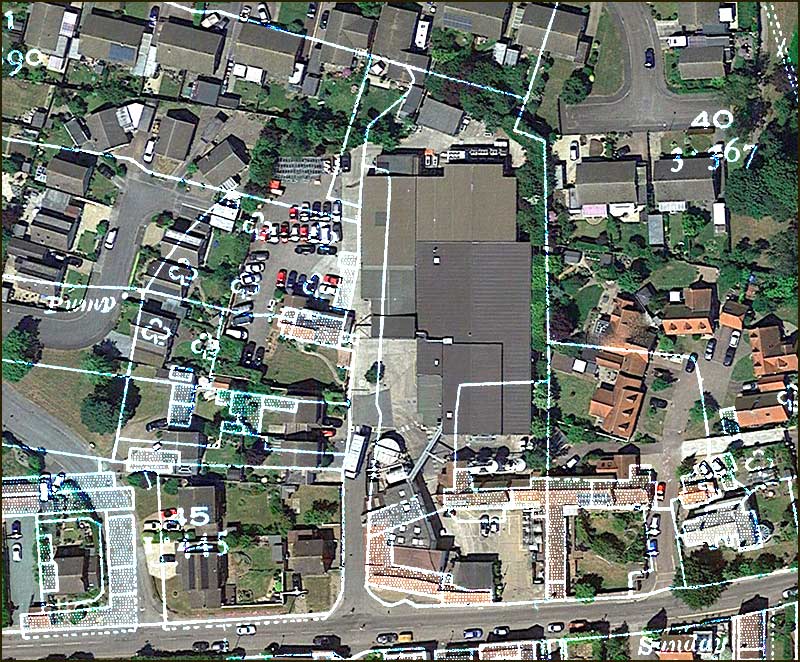
I have overlaid an up-to-date aerial view of the street with the 1960s map so that location of each house can be related the layout today.
Let’s take a detailed look at each home in turn.
Numbers 1 and 3
Number 1 and 3 were semi-detached cottages. In the 1960s map I coloured them red.
In the early 1950s, number 1 was occupied by Mary Wallace, her husband Amos and their three children, Myra (b 1942), Peter (b 1944) and Clive (b 1949).
Mary had grown up just around the corner, at number 5 Field Lane; her mother was Lucy Downs, wife of Arthur Downs. You can read more about them in the story about number 5 Field Lane, just below.
Mary’s youngest child, Clive, has contacted me to say that the family left number 1 in 1952 and went to live at 32 Hoe View Road. They left Cropwell Bishop altogether in 1957 when Clive's father became landlord of a village pub in Lincolnshire.
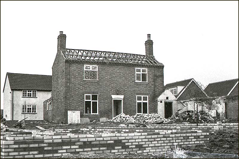
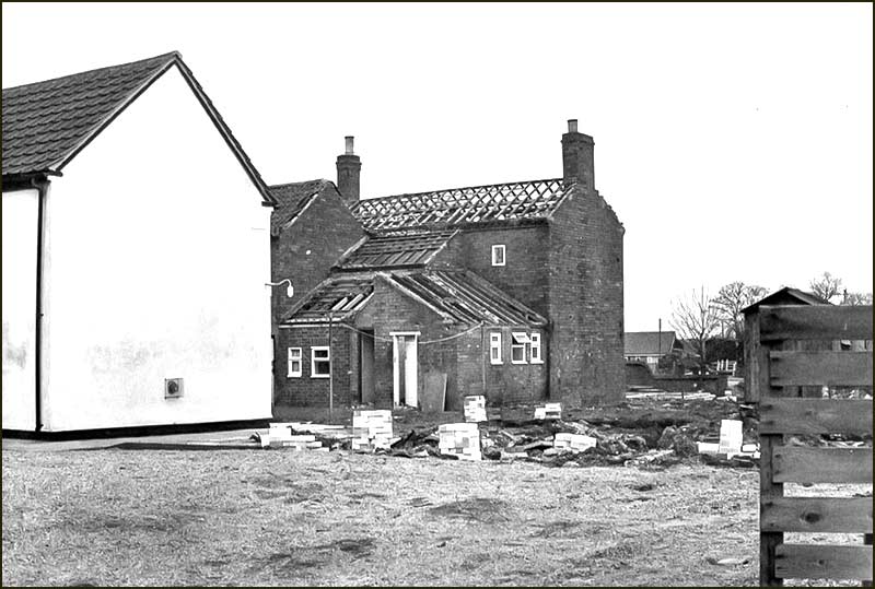
In spite of the upheaval of building work in the 1970s and 1980s, the house still stands, but has been modernised and converted into a single detached home.
You can see the unmodernised cottages in these 1960s and 1965 aerial photos.
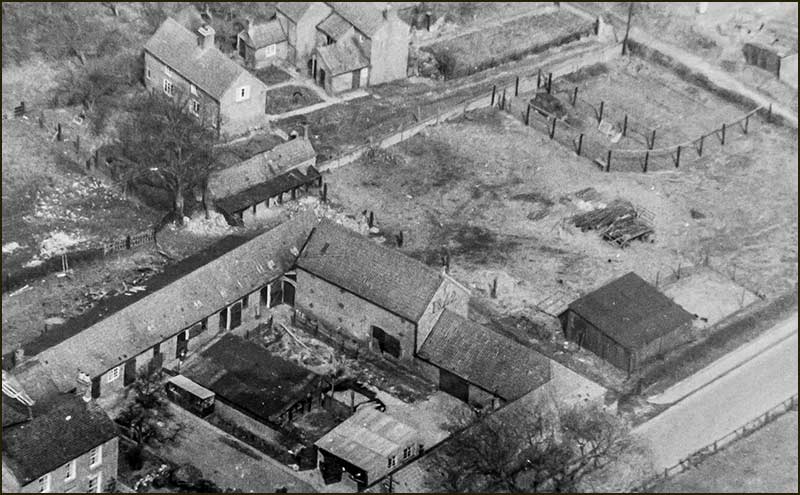
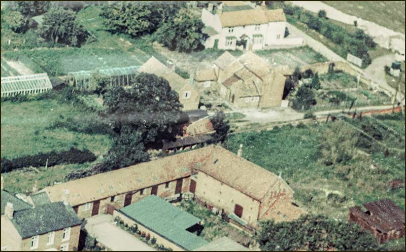
We can also see them (the white building) in the background of the photo below that was taken in the 1980s when new houses were being built on Field Lane.
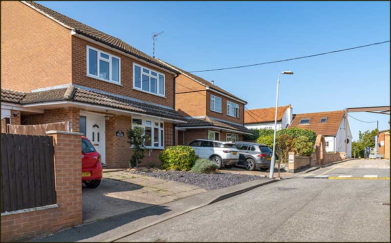
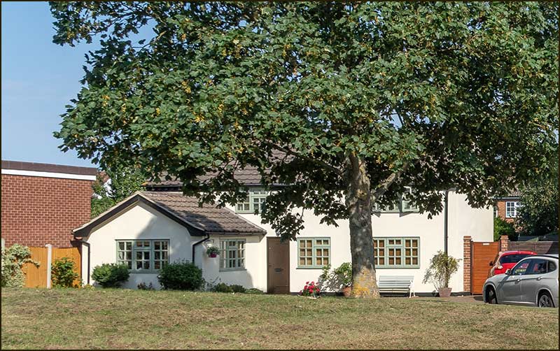
The 2020 photo shows the cottage today – it has moved from Field Lane to Hoe View Road! It hasn’t actually moved, of course, but once Hoe View Road was built, it became the closest accessible road. The house is now called Willow Cottage.
In the foreground are foundations for the houses being built on Field Lane. (1980s)
Number 5
House number 5 has gone; it was demolished in the 1980s. I coloured it blue in the 1960s map.
We can see from the two aerial photos that it was a large house with a good-sized garden at the front. The 1980s photo below, shows several extensions that must have been built on to it over the years.
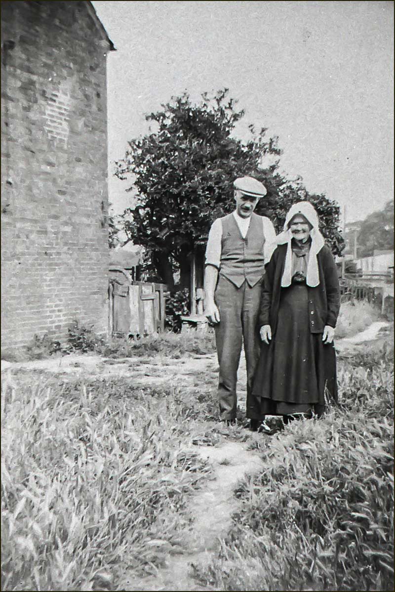
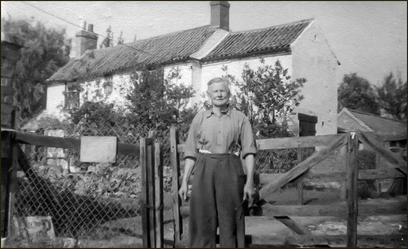
The end of the house is the same one as in the photo of Arthur and his mother.
In the 1930s, the Downs family lived there. Arthur Downs was born in Owthorpe. After moving to Cropwell Bishop, he worked in the gypsum mine and then, in the 1930s, as a lorry driver.
As well as his wife, Lucy, and their two daughters, Lucy and Mary, his mother also lived at the house.
When daughter Mary married, she move to number 1 Field Lane – as described in the story of number 1.
Daughter Lucy married a man who worked at AVRO-Langar and moved to live in Nottingham. However, in the 1960s, they moved backed to Cropwell Bishop and lived on Hoe View Road. Her married name was Lucy Ely.
Where was that photo taken from?
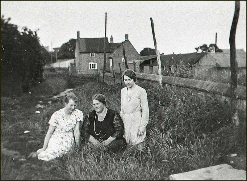
The photo of Lucy Downs and her two daughters is a good quality photograph with lots of detail. It was included on the Cropwell Bishop Heritage Group’s DVD. It had their names on, but not the location of the photograph.
Once I discovered that the family had lived on Field Lane, I tried to figure out the location of the picture by examining the background features – but, at first, couldn’t make sense of it.
When I first started researching this story of Field Lane, I only knew of Field Lane as it is now, I hadn’t realised there was once an additional small lane off it.
It was the 1960s map that opened my eyes to it, but still I couldn’t identify the spot where they were sitting.
Then I was given the photo of house number 5 from the 1980s and the photo of Arthur and his mother standing next to a house and guessed they were the same house: Arthur was standing outside number 5.
Studying the path, hedge and distant buildings in the photo of Arthur, convinced me that they were the same as those in the photo of Lucy Downs and the girls: both photos were taken outside number 5, on virtually the same spot.
The sharpness, exposure and focal length of the camera lens are different for each photo, which suggests a different photographer on a different day. However, the profile of the trees suggests that it could well have been the same year.
So, it looked like the two photos were taken outside number 5. Even though it was 90 years ago and number 5 no longer exists, would it be possible for me to prove this: eventually, yes.
First, I spotted a small part of a familiar profile in the Lucy Downs photo: St Giles Church Tower. See green box on the annotated photo below.
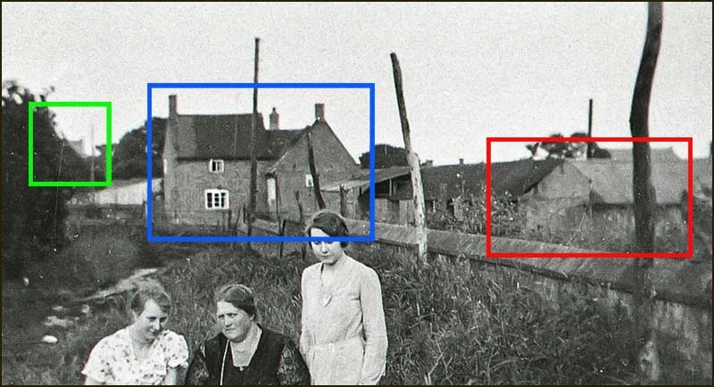
Green box: isn't that the tower of St Giles?
After studying the 1960s map, I plotted the spot where I thought they were sitting (a lilac spot on map below) and looked for buildings that should have been in the photographer's view.
This was not very easy to do because many new buildings block the view, and most old buildings have been modified.
Nevertheless, the side view of the Creamery building on Field Lane can be recognised (red box on photo).
After some searching, and with a bit more imagination, the profile of the old farmhouse can also be made out (blue box on photo).
It proved very satisfying to be able to pinpoint a place from the past by walking around the village, taking some photos and trying to fit it all together. Makes a change from doing a jigsaw puzzle – and no need to take it all apart afterwards.
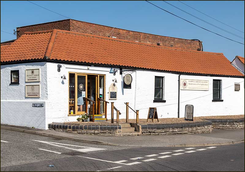
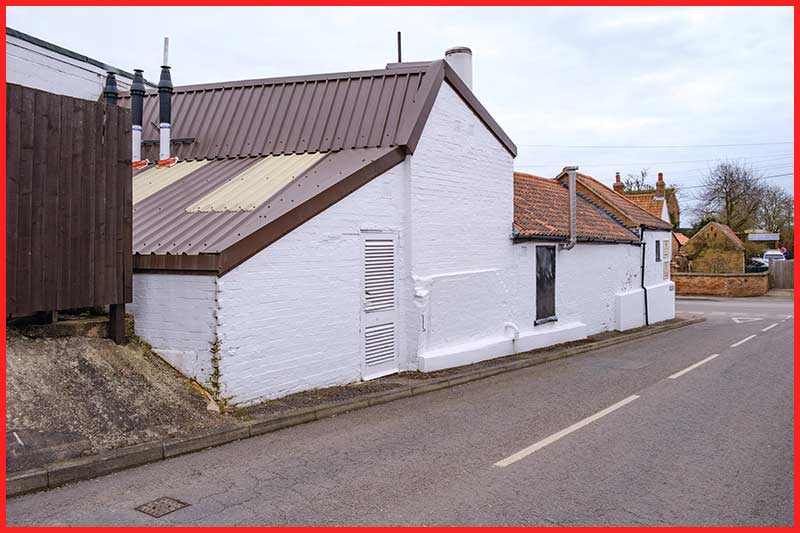
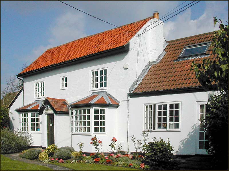
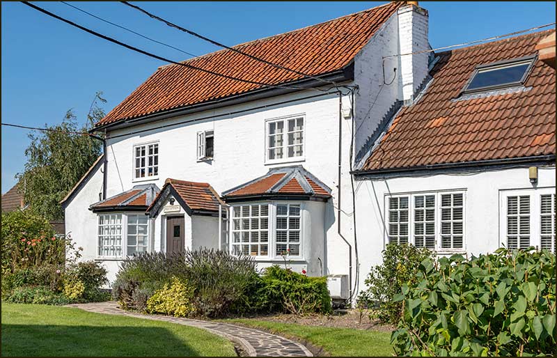
Number 7
If someone who had lived at number 7 a hundred years ago were to return to Field Lane today, I doubt they would much difficulty finding their old home.
The Lane has changed in almost every way, except for number 7, which has the same distinctive shape and style it had in the 1940s.
Look more closely, and you will see that the roof on the main house appears to have been raised, and the side extension has a lower, but steeper, roof. But it is still painted white and recognisable – and the house sign confirms its number, and its present owner.
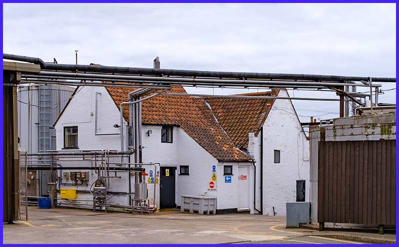
The building has been owned by the Creamery for many decades and become the home for its offices.
It used to be where the cheese shop was located – in the ‘front room’. In those days it consisted of little more than a couple of cool display cabinets with a small selection of cheeses.
The arrival of the Cheesemaker's Shop on Nottingham Road in December 2015, was a giant leap forward and gave the Creamery it 'public face' and a great place to stop for coffee, eats and, most of all, its cheese.
Back in the 1940s, number 7 was referred to as Harry Ing’s farm. You can see from the colour aerial photo from 1965 that there was good sized garden alongside the house and long greenhouses too. Behind the house there was an orchard.
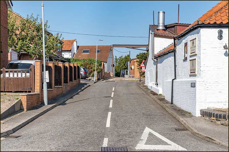
Field Lane Today
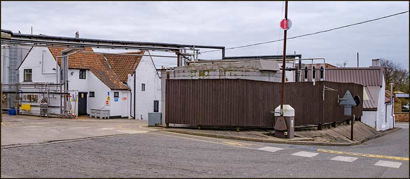
How does a little street in a village survive when the number of families living on it declines to just one? In this case, it is when a business on the street thrives.
Cropwell Bishop Creamery produces Stilton Cheese, and by identifying the right markets for its products and supplying them in the right quantities, it has managed to keep its head above water even in difficult economic times.
Early morning lorries arrive with milk from Derbyshire farms, and it wasn’t so long ago that they had to turn into the front entrance of the Creamery on Nottingham Road, sometimes struggling to do it with so many cars parked opposite.
Nowadays, they drive up Field Lane instead and have ample room to make their deliveries and turn around safely.
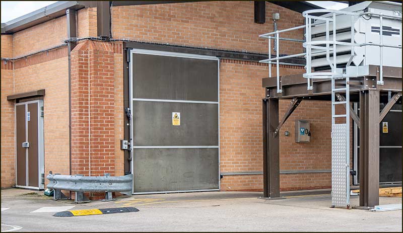
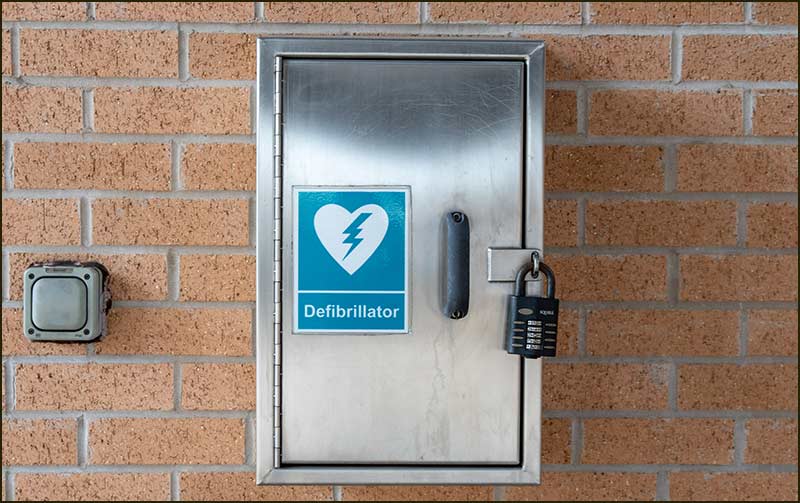
The Company has also made available something that anyone can use, but everybody hopes they never have to: a defibrillator.
It is mounted on a wall of the new building at the top of the Lane – on the right-hand side just after the lorry turning area (see the photos).
It is important to realise that you cannot just walk up to it and remove the, potentially life-saving, apparatus: the cabinet is locked. You must first call 999.
For details on how to access accessing this defibrillator, and for a link to a video explaining its use, click:
Whilst Field Lane no longer leads to a field, and few people live on it, it is a very important access road and, it is hoped, will continue to be so for a long time to come.
Tony Jarrow
Note:
Thanks to Anne Terzza for her help with this article.