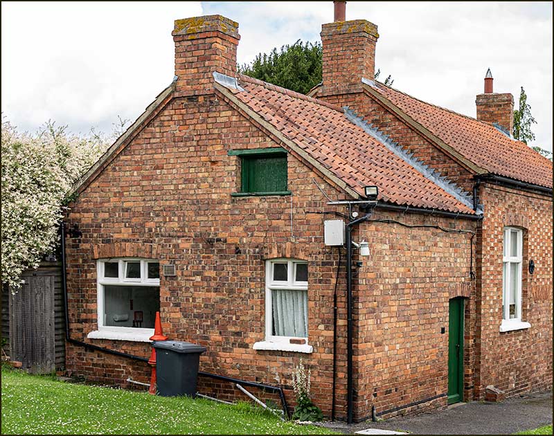
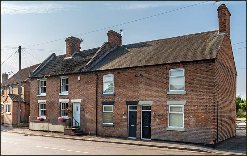
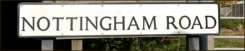
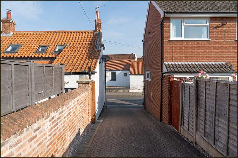
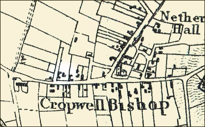
Cropwell Bishop Streets: — Nottingham Road - part 1 (6-6-21)
Nottingham Road must always have been the most heavily used road in Cropwell Bishop: you had to travel down it to reach the Fosse Way (A46), a Roman Road, and to reach Nottingham, our nearest city.
Going in the other direction was your route to the many villages in the Vale of Belvoir.
It must be as old as any in the area and, consequently, the buildings along it some of the oldest. Even so, we now see only the latest version of numerous forerunners that stood in their place.
This street story will cover the many and varied aspects of the road, and will be quite long. We will start at the top of the hill, where it begins its drop towards the church.
Gypsum
Gypsum and the Grantham Canal. There can be no doubt that these two had the biggest influence on the growth and expansion of Cropwell Bishop over the last 250 years.
Gypsum has been here, mostly hidden, for millions of years but it needed the machinery of the Industrial Revolution to mine large quantities. And it needed the Canal to easily transport it to customers for Cropwell Bishop to profit it.
Gypsum is a rare and valuable resource. Few sites in Europe could compete with the high-quality gypsum in Cropwell Bishop, and a hundred years ago, the demand from new, expanding industries for this super quality gypsum was growing – and so was its value.
But what is gypsum?
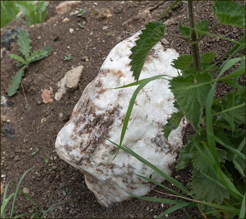
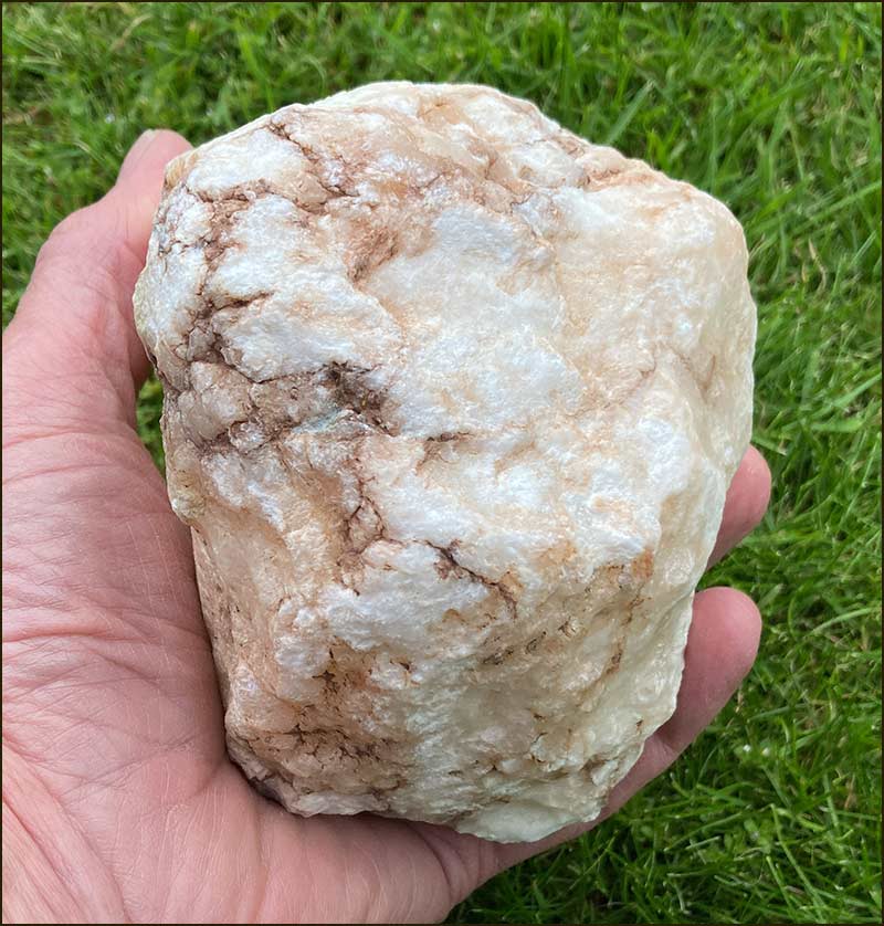
Until about 30 years ago, large, white lumps of gypsum rock could be seen everywhere around the village. They were evidence of our industrial past, but many people probably saw them as no more attractive than lumps of coal in a pit village.
Small lumps were scattered in every ploughed field, and large rocks revealed the boundaries of old mine sites. Some people had them in their garden rockery.
Cropwell Bishop gypsum rock – not so easy to spot these days
But these rocks don’t last, they are not hard and they quickly weather.
Gypsum is hydrated calcium sulfate: it is calcium sulfate that contains water. Heat it up to 200°C and it gives off 75% of this water. It is then called anhydrous calcium sulfate. Grind this ‘dry’ rock up and you get a fine white powder.
Older villager may remember this powder from their childhood: it was called plaster of Paris. Mix it with water, pour it into a flexible rubber mould, and half-an-hour later you had a small, sharply defined little animal, house or Micky Mouse. Next day, paint and varnish it and put it on the windowsill for the whole world to see.
These days, there is far more competition for the interests of children. Older folk, eager to relive their childhood, can buy complete kits online for just £14.
Any left-over plaster of Paris could, I suppose, be offered to a hospital; it has long been used with bandages to make plaster-casts for broken bones.
If this was the only use for gypsum, Cropwell Bishop would not have become as famous as it did 100 years ago.
Since the 14th Century, large lumps of gypsum were described as gypsum alabaster and used to make vases and ornaments. It is a soft rock and easy to carve – you can scratch it with your finger nail. But it will eventually dissolve in water so is no good for outdoor use. Even so, when polished, it can look like marble. It is highly likely that you have seen alabaster carvings in churches.
A century ago, the demand for ground gypsum – including the ‘undried’ form – rapidly increased as it started to play an important part in the manufacture of paper, cement, beer, paint, pottery, manures, medicines and other products.
Gypsum was formed at a time when much of the Earth was covered by seas – over 250 million years ago.
When seas dried out, they left behind the minerals dissolved in the water, including calcium sulfate, which forms gypsum.
During the hundreds of millions of years since then, continual movement of the Earth’s plates, has forced these layers underground.
Seams of gypsum exist in relatively few places in the world, but one such place is Paris (France) – hence the name, “plaster of Paris”.
In England, layers have been mined in Cumbria and Sussex, but, amazingly, there have been 6 gypsum mines within 30 miles of Cropwell Bishop
Whilst gypsum had been dug up in Cropwell Bishop for centuries, it was in the late 1800s that large-scale mining began. The initial site was down by the canal on Kinoulton Road.
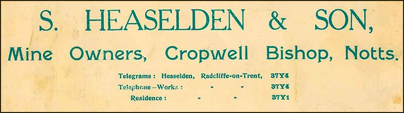
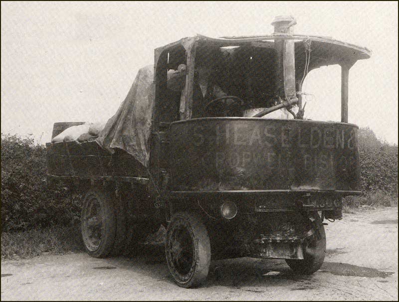
In the early 1900s, mining began on sites alongside Nottingham Road. It all started when a wealthy man named Samuel Heaselden, came to live in Cropwell Bishop.
He had had a house built on Church Street, Ebenezer House, and then began buying land around the village — including fields south of where the Creamery Storage Unit now stands on Nottingham Road.
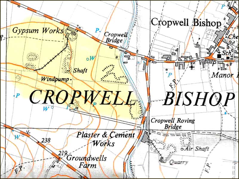
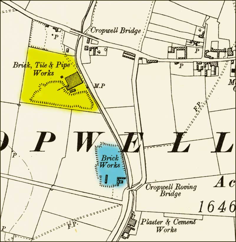
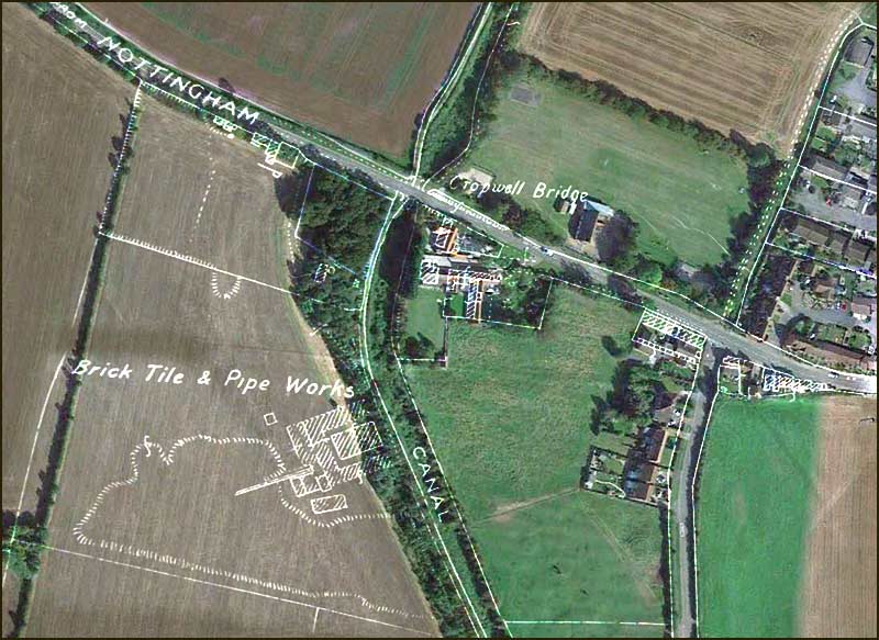
1940 map showing gypsum workings. The area tinted yellow was mined by Heaselden and Son Ltd.
In 1905 he sunk a shaft at a spot between Skylark Hill and where the Creamery’s Storage Building now stands. When the shaft was about 25m deep, he found what he was hoping for: gypsum.
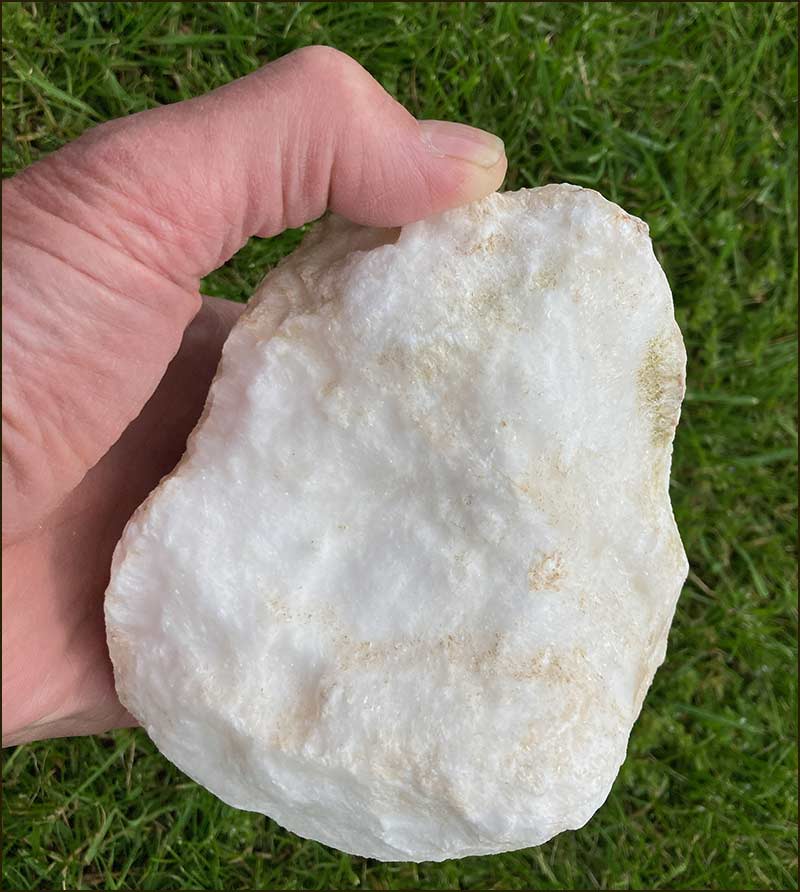
In some parts of the world, gypsum seams are several metres thick, but in Cropwell Bishop they were relatively thin. Nevertheless, the gypsum that Heaselden mined was very pure — probably the finest in England.
This made the gypsum mined by Heaselden particularly valuable to the medical, paint and paper industries and the resulting high demand made it highly profitable.
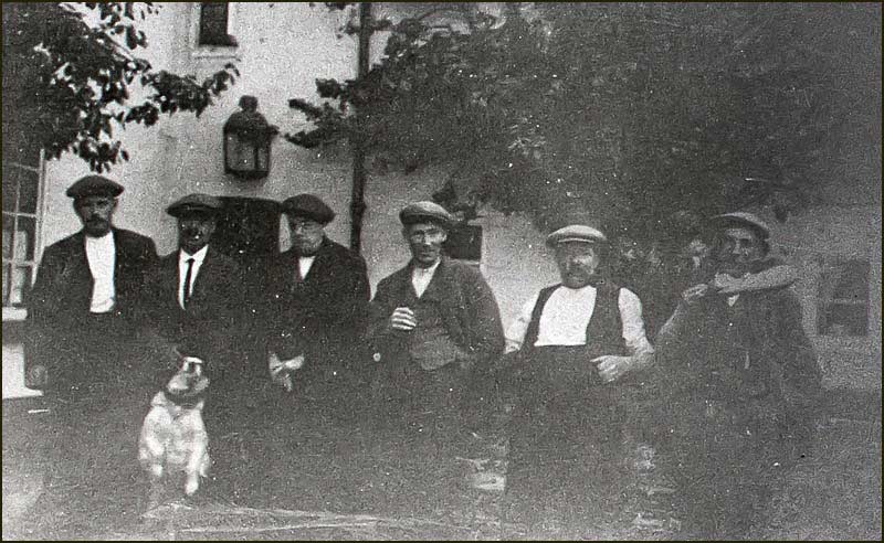
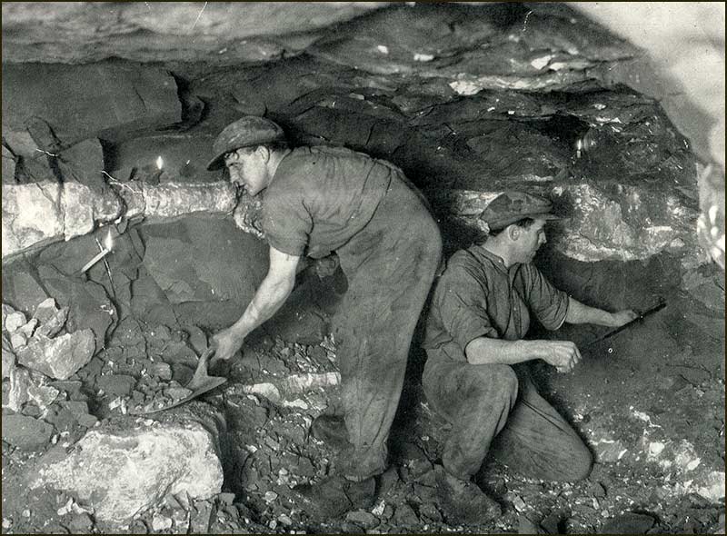
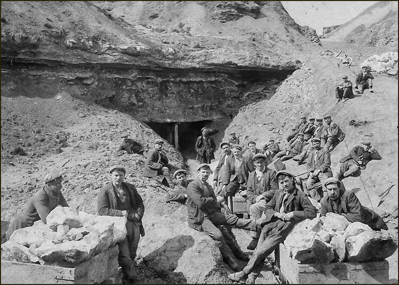
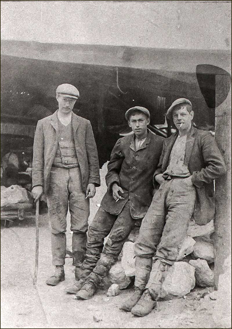
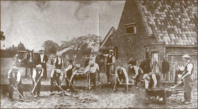
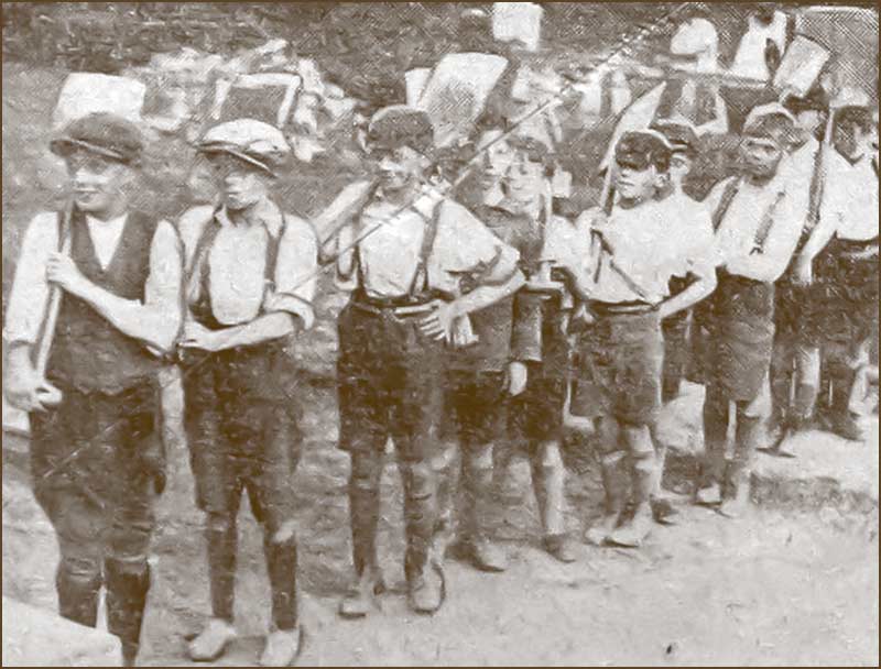
The mining of gypsum was hard manual work – and dangerous.
Gangs of miners would tunnel into the seams of gypsum to remove it – using explosives when necessary.
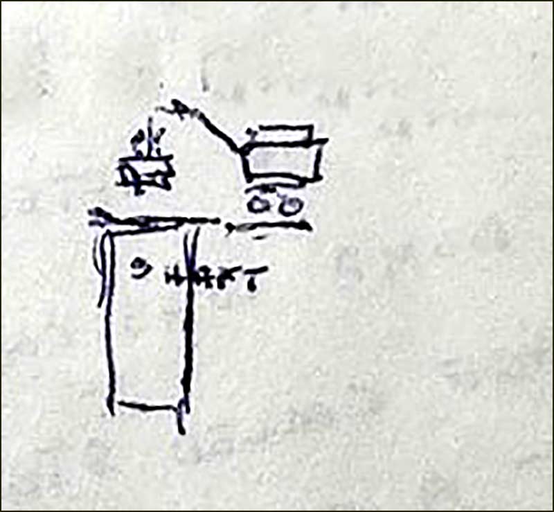
A Cropwell Bishop miner, Harold Lacey, wrote a description of his experiences at the Heaselden mine:
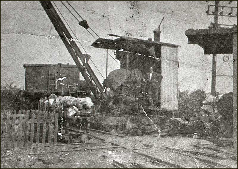
“Workers were lowered down the shaft in a small wooden tub (2 men at a time) by a crane”. He left a sketch of the arrangement:
More shafts were sunk and eventually there were a total of six.
From each one radiated workings down to a depth, ranging from 14 to 30 metres, with a slope of 1 in 60 running south.
The gypsum was found in three layers, each about 25 cm thick. About 90% was of the best quality – a higher proportion than anywhere else in the country.
During the 1920s, over 70% of output was for the paper trade.
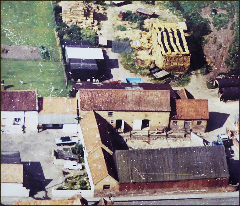
As a commercial operation, it was not enough just to mine the rocks, they had to be ‘processed’ to make the gypsum useful.
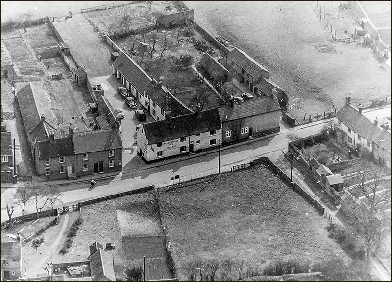
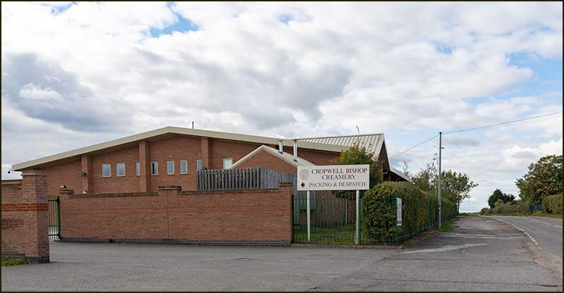
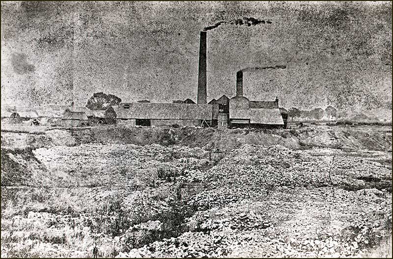
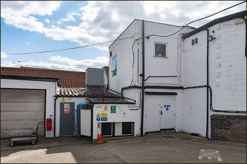
In 1909, Samuel Heaselden had a large, black, iron shed built: it acquired the name, "Heaselden Works", or just “the Works”. It stood just where the Creamery Storage Unit now stands.
In the Works, gypsum was processed in the same way as at the Cropwell Mill on Kinoulton Road — except there was no kiln for making anhydrous calcium sulfate. To find out more about Cropwell Mill, see the Kinoulton Road Street Story.
Now, everything was in place for full production.
Cropwell Bishop gypsum rock – probably the finest in the country
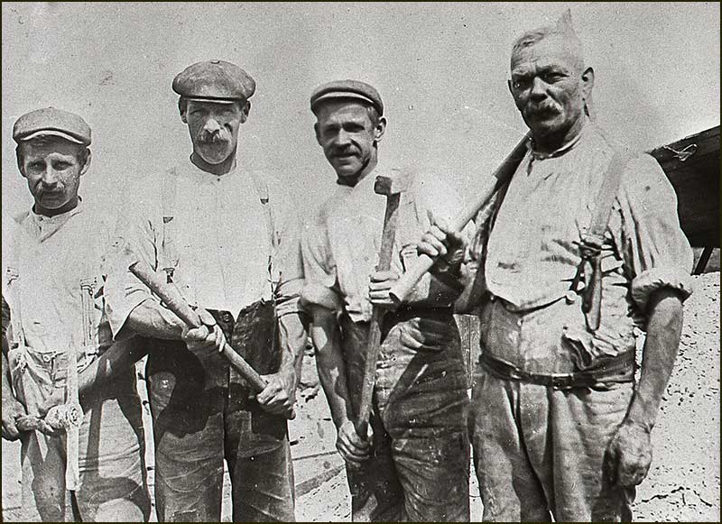
Digging out the rocks
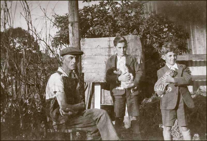
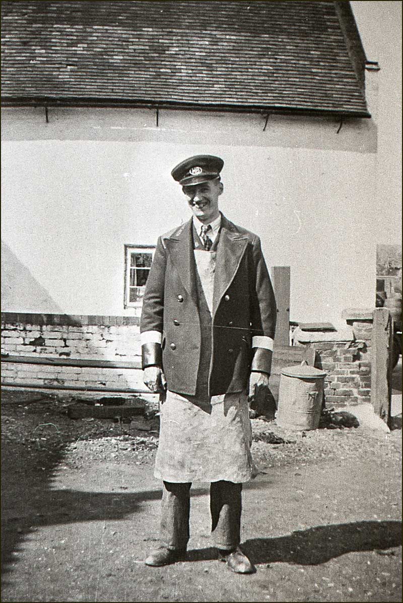
In the low tunnels underground, miners used axes and explosives to remove the white rock.
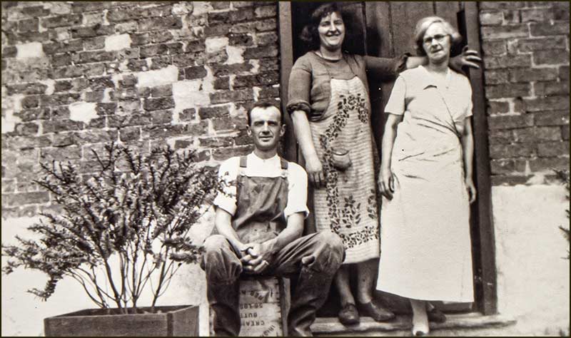
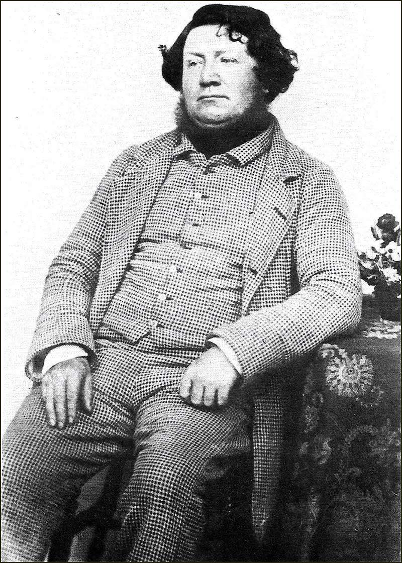
Cropwell Bishop miners, Walter Scott and Percy Dutton (1933)Miners, Bill Parnham and Len Taylor, with the Company owner, Herbert Heaselden, behind. Herbert was the son of founder, Samuel Heaselden. (1933)
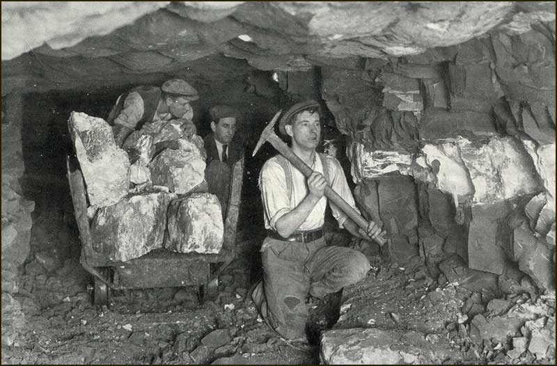
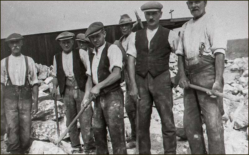
Getting rocks to the surface
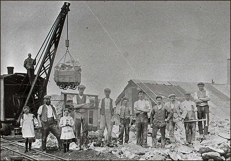
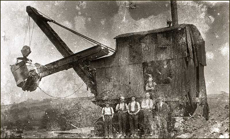
Lumps were transported in pit tubs to the shafts, where they were lifted to the surface by cranes.
Steam navvy used at Heaselden's mine to lift trucks out of the mine (1930s)Herbert Heaselden with two children and 8 workmen at Heaselden's Works (1930s)
Shallow seams could be accessed by a sloping track instead of a shaft.
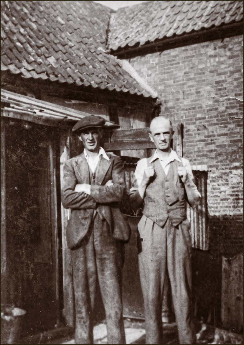
Entrance to a Cropwell Bishop gypsum mine (1910)Steam shovel at Heaselden's quarry with 6 men (1930s)The man on the left is holding a wooden Yard Stick, which indicates that he is a pit deputy – an underground supervisor. (1930)
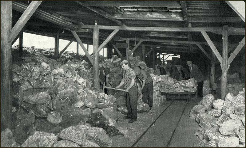
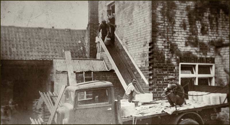
Processing the Gypsum
The tubs were then pushed on rail tracks into the Works.
Outside and inside the Works, the rocks were processed. This involved them being sorted, trimmed, cleaned and washed in hot water.
Once they were dry, the final step was to grind them to a powder.
Men outside the dressing shed (1920s)Men 'dressing' gypsum outside the Works (1920s)Men using pick-axes in the Sorting and Cleaning Shed (1933)
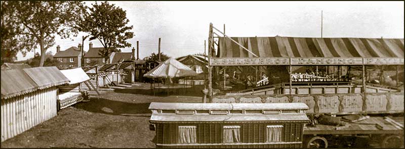
Getting gypsum to customers
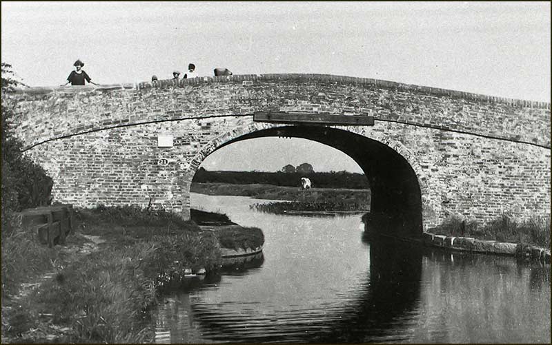
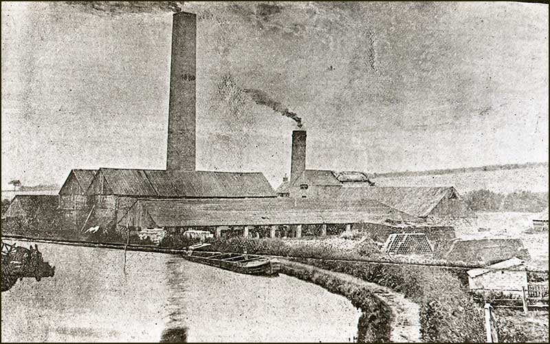
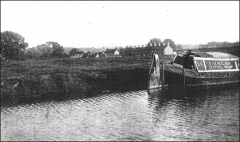
Most of the Company’s output was transported by barges on the Grantham Canal. There was a wharf near to the Works – next to ‘Town End Canal Bridge’ where Nottingham Road crossed the Canal.
The basin on the north side of the bridge was wide enough for barges to turn around — essential for return trips.
Within 15 years, output was over 150 tons a week — enough to send a full barge to Nottingham every day of the week.
Town End Bridge (1950)
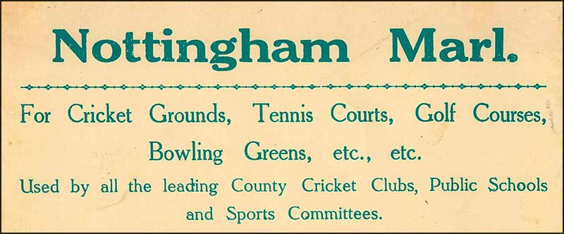
Marl
After the mine had been working for some years, it was discovered that the material that had been removed as waste from between the layers of gypsum rock, could also be marketed.
This marl (a mixture of clay and fine grains of calcium carbonate) was found to be exceptionally good as a top dressing for cricket pitches, tennis courts, bowling greens and golf courses.
In 1925 a mill was erected specially for handling the marl and output soon reached 50 tons per week.
Grey clay
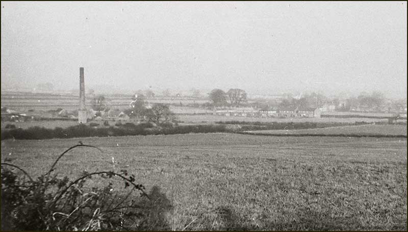
A third useful material was also mined at the site: grey clay. This proved to be a good heat insulator and was sold for the insulation of steam boilers and pipes.
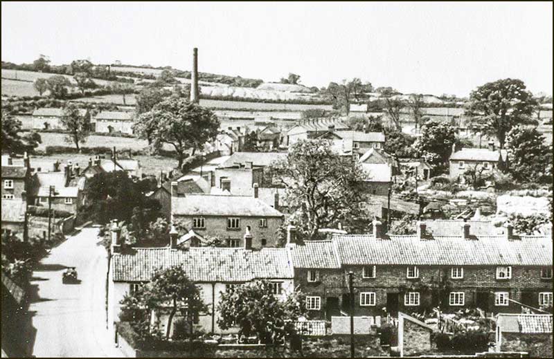
In this photo, taken from the church tower in 1949, you can see clay tips from the Heaselden mine in the far distance.
Lorries
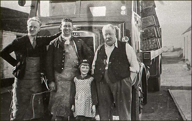
The Company also operated a separate haulage business and had 13 lorries in the early 1930s, including, “the latest type of diesel and steam lorries”.
This is a photo of a Heaselden steam lorry in the 1930s.
The Heaseldens
The expanding business of Heaselden & Son became a big employer in Cropwell Bishop: over 80 men were employed by the Company during the early decades of the 1900s.
The business became a limited company in 1927 when Samuel Heaselden’s son, Herbert, became the owner and managing director. He carried on developing all aspects of the business in the decades that followed.
Samuel Heaselden suffered ill health during his early 70s, and in 1935 he died at the age of 74.
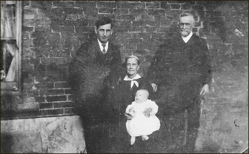
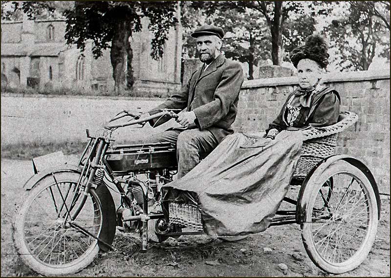
Herbert, Mary (holding baby Mary) and Samuel Heaselden (1919)Herbert Heaselden on the right (1920s)Samuel Heaselden and his wife, Mary, with motorcycle and wicker sidecar (1920s)
Herbert Heaselden continued developing his mining and other businesses throughout the first half of the 20th Century.
Gradually, open cast mining took over from underground working and the Heaselden mining business came to an end.
Deep, open cast mining by British Gypsum continued until the late 1990’s but, by the end of the century, the mining of gypsum in Cropwell Bishop finally came to an end.
Herbert Heaselden died in 1964 at the age of 72.
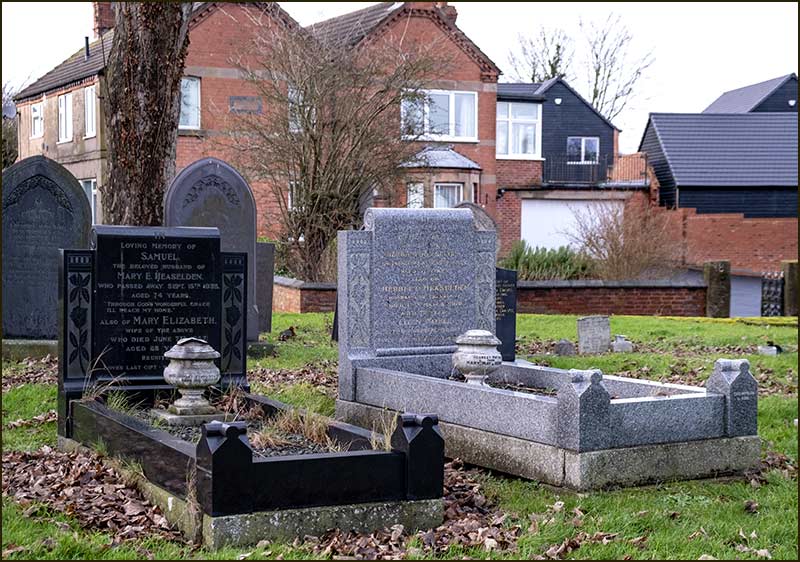
The graves of Samuel Heaselden and Mary (left) and Herbert Heaselden and Ethel (right). Behind is Ebenezer House, the family home.
You can find out more about gypsum mining in Cropwell Bishop by reading the Kinoulton Road Street Story.
You can also discover more about the Heaselden family in the Etheldene Street Story and about their home, Ebenezer House, in the Church Street Story.
Gypsum from across the road
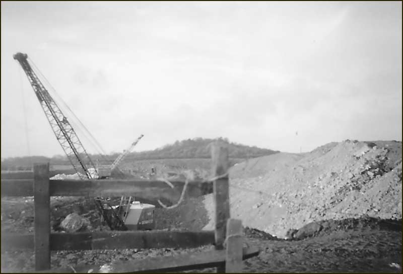
Even when the Heaselden mine closed and the Works shut its doors to gypsum, only to became a grain storage shed, it was not the end of gypsum mining on this side of the village.
In the 1960s, The Gotham Company dug an open-cast mine on the other side of Nottingham Road.
These photos show the view from Nottingham Road looking towards Hoe Hill. The mine was on the land between the Canal and Smalley's Farm.
Tony Jarrow
Note:
Thanks to Anne Terzza, Jacques Lacey, Tony Carter and Norman Sheppard for their contributions to this article.
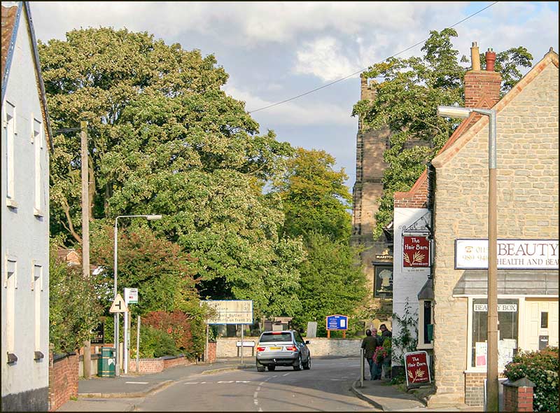
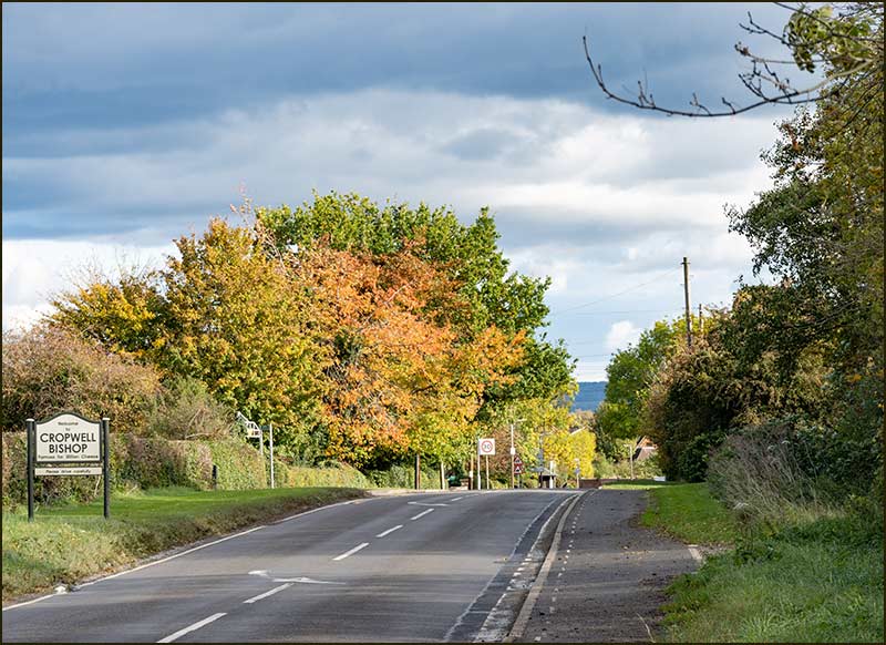
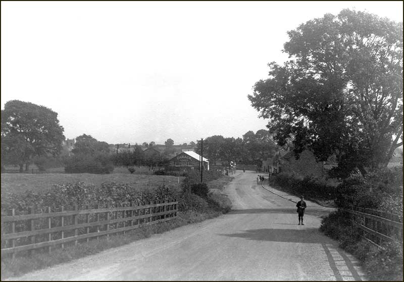
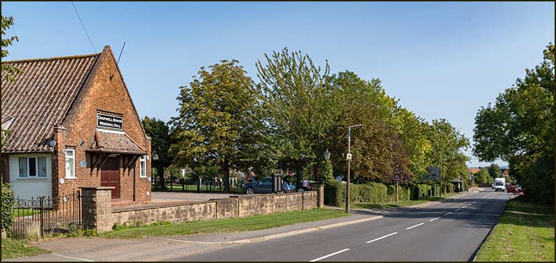
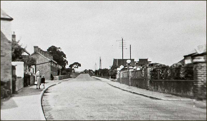
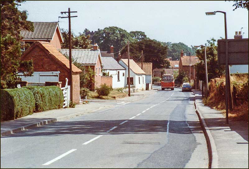
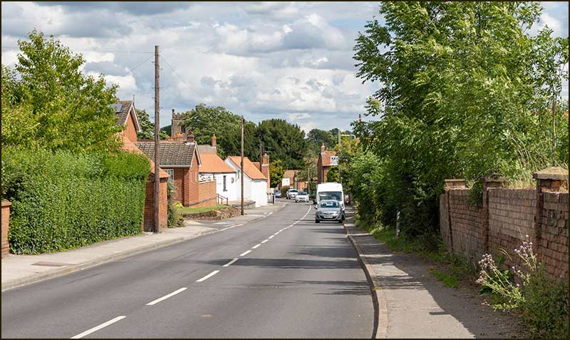
When you drive into the village from the A46, at what point on Nottingham Road do you think of yourself as having entered the village? Is it when you pass the Cropwell Bishop sign – or maybe not until you reach the 30mph sign and the Memorial Hall?
A hundred years ago, by the time you reached this point on a summer’s evening, you would have already passed through the busiest part of the village.
Walking down Nottingham Road
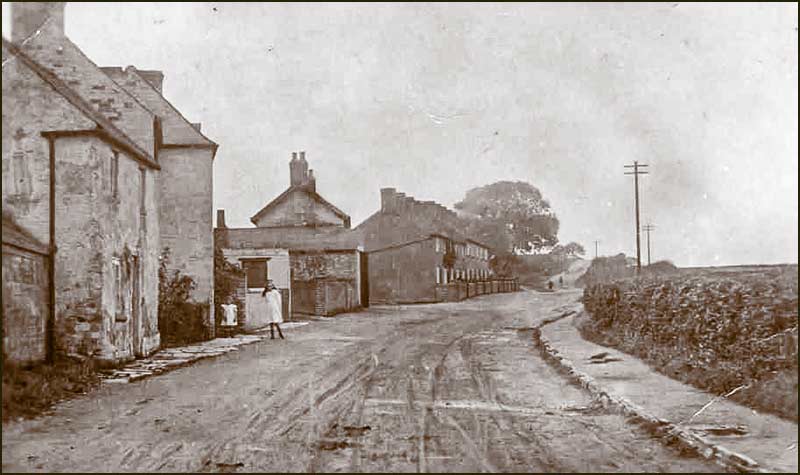
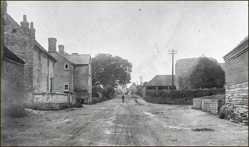
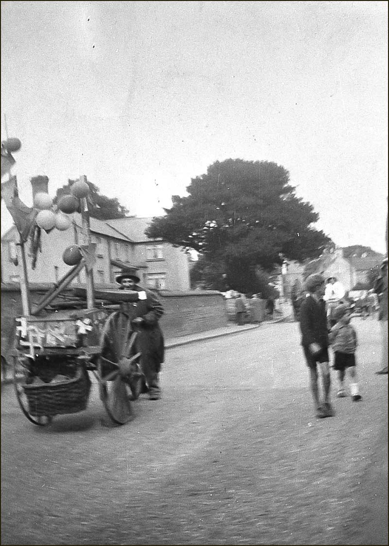
Walking down that dusty road in the early decades of the 1900s, you would probably witness a hive of activity ahead.
You might brush shoulders with chattering gypsum workers on their way home, ghostlike with their covering of white dust. And be passed by Heaselden's carts loaded with ground gypsum. And all this before you reached the Town End Canal Bridge.
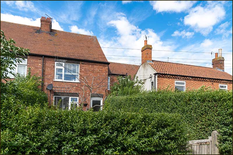
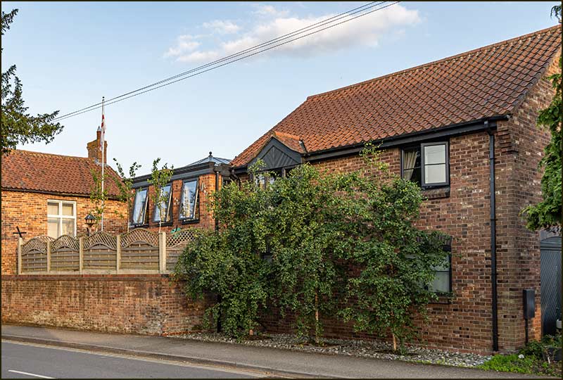
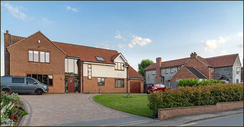
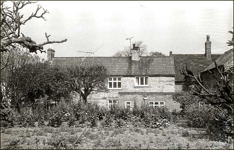
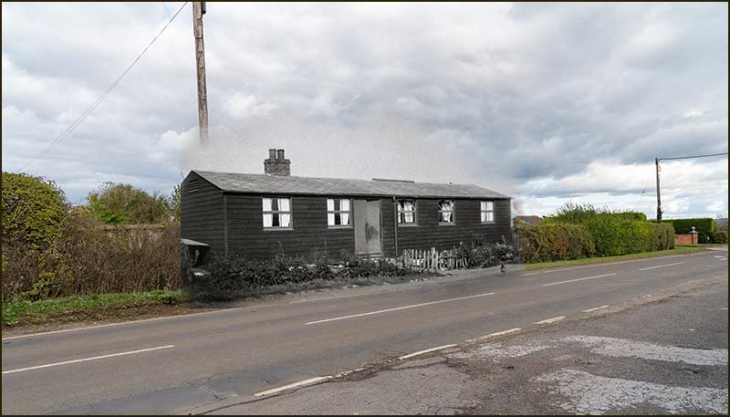
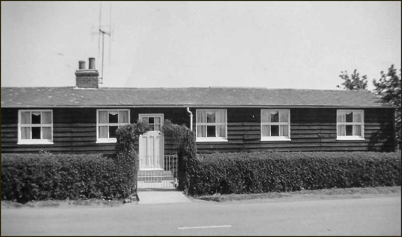
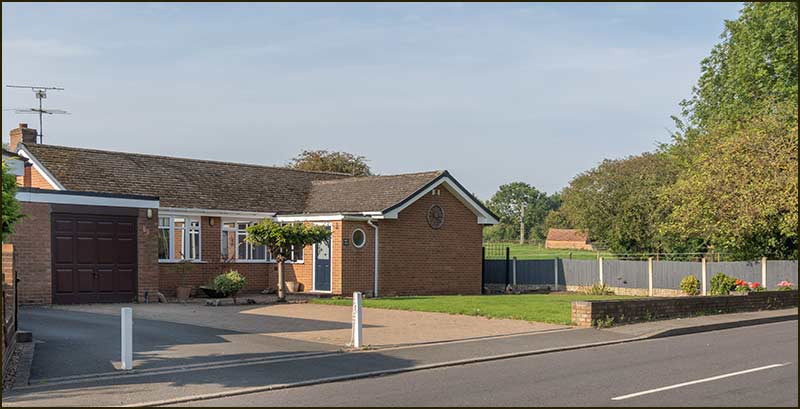
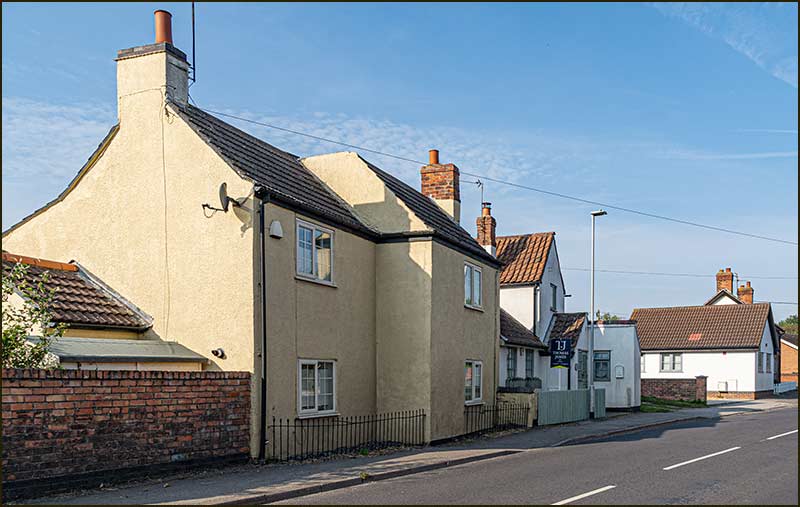
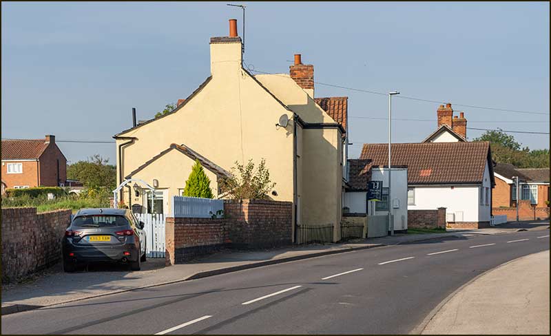
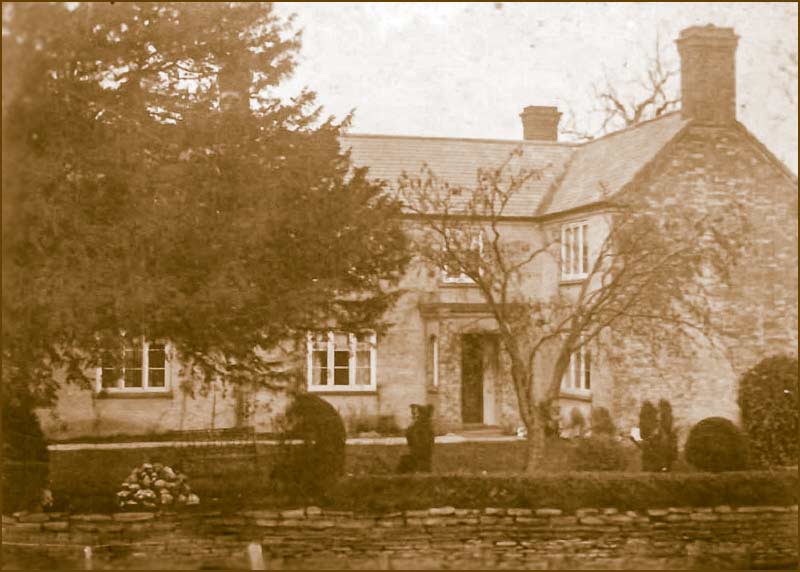
You would pass by the black wooden bungalow opposite Heaselden's Works.
The black wooden bungalow that stood here for over 70 years opposite the black Works Shed. The wooden bungalow in later years – now with TV (1960s)
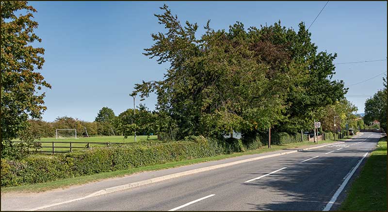
Wind forward 100 years and it all looks so different but somehow retains that feeling of being an entry zone – not somewhere to stop on your way to the village.
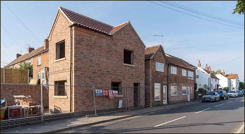
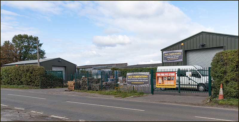
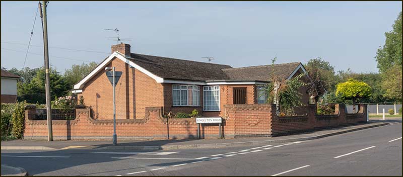
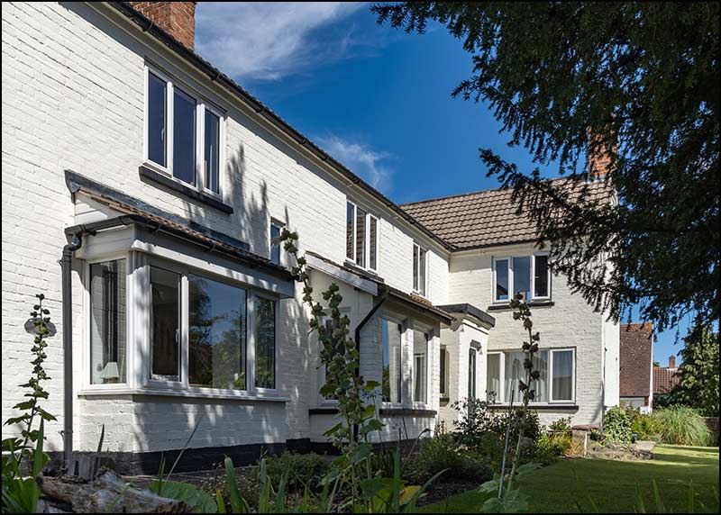
First on the left are modern industrial units and storage facilities (2020)Then comes the brick bungalow that replaced its wooden predecessor (2020)And then the entrance to Smalley's Farm (2020)On the other side if the road, in place of Heaselden's metal Works Shed, stands the
Creamery building. It looks more attractive and is no doubt a safer and more pleasant place to work than the Works Shed on a winter's day (2020)
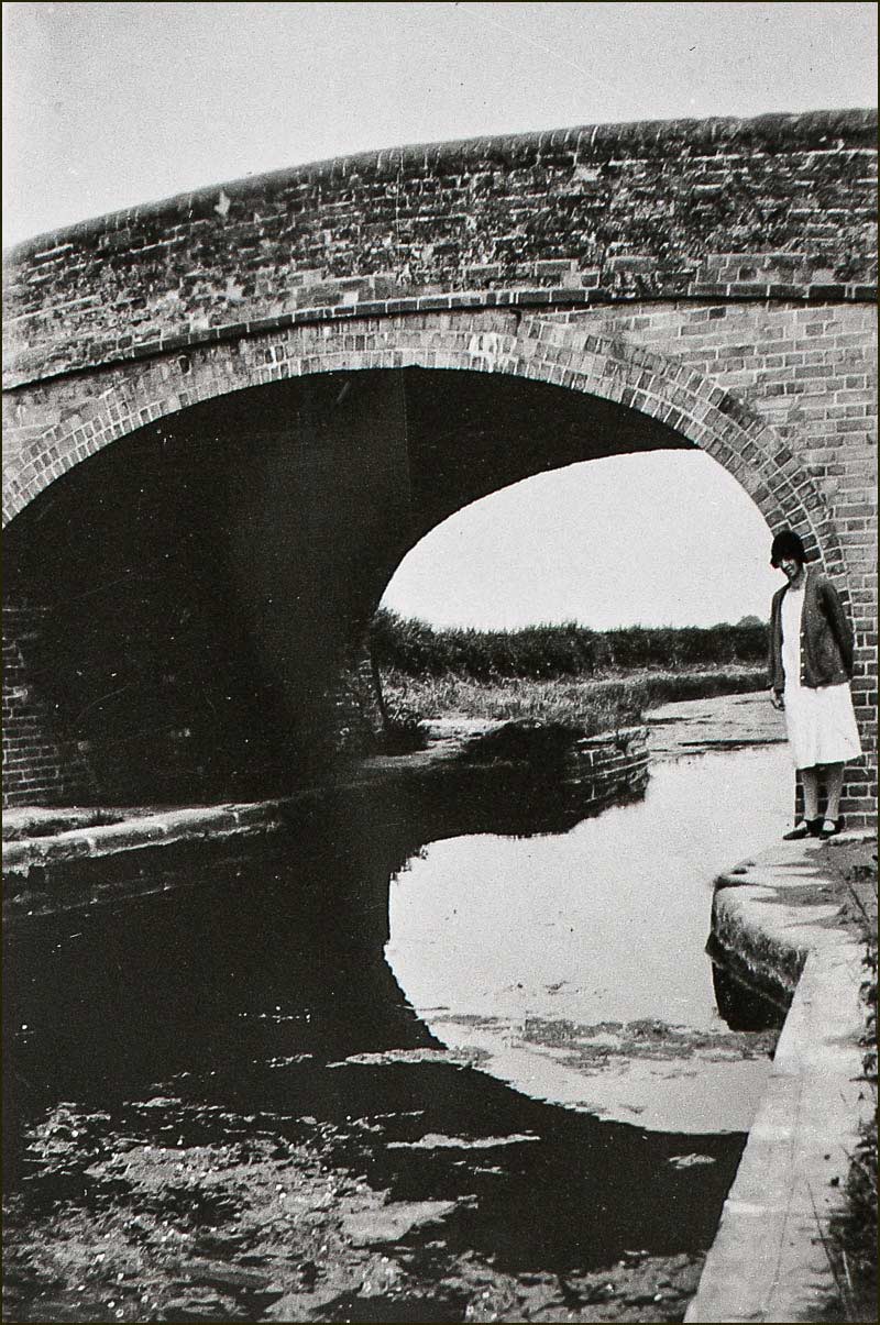
Continuing our walk, to reach the village centre we have to cross the Grantham Canal. No need to get our feet wet though, the Town End Bridge takes us up and over.
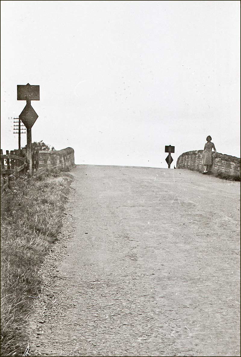
Approaching the Town End Bridge (1930s) The same stretch of road today – but without the bridge (2020)
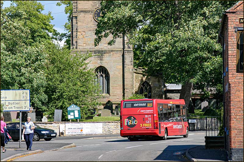
Once you reach the top of the humpback bridge, you pause and look to your right. Looking along the canal and beyond its curve – the scene is so busy, and mostly red.
That same view today. No longer from the top of the Town End Bridge, and a very different scene from 100 years ago (2020)
A Red Revolution in Cropwell Bishop
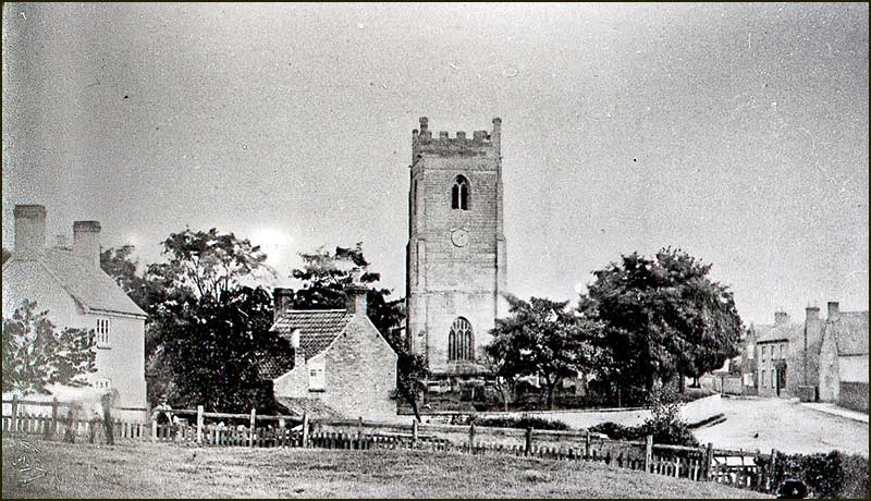
The view from Town End Bridge in 1898: what is going on?
The view from Town End Bridge would not have been obstructed by greenery as it is today. You would have faced more red than green.
Gypsum was certainly the dominant mineral output from Cropwell Bishop during the 1900s. Even in the 1800s its output was important, but it was outstripped by another mineral.
Long before the start of large-scale mining of gypsum began near the Old Mill on Kinoulton Road in 1880, there had been big factories in, and around, Cropwell Bishop.
They used miners too, but they weren't digging for white lumps of rock – they were scooping up clay. Red clay to make bricks, tiles and pipes.
It was the Grantham Canal that made these enterprises possible. For the first time in local history, heavy loads could be transported to the centre of large populations easily, quickly and profitably.
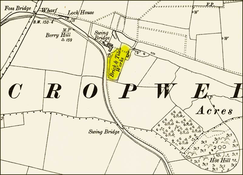
Small brickworks had existed on the outskirts on Cropwell Bishop in the early 1800s. There was one alongside the canal near the Fosse Way, the Hoe-Hill Brick and Tile Works.
It was just outside the parish of Cropwell Bishop but was certainly supplying bricks to local builder in the 1840s.
Hoe-Hill Brickworks in the 1840s (1880s map) Hoe-Hill Brickworks. In the 1840s, demand for bricks was so great that carts would turn up in the middle of the night to ensure they got fresh bricks, sometimes burning their hands as they loaded them fresh from the kiln. It closed in the 1850s (1870s photo)
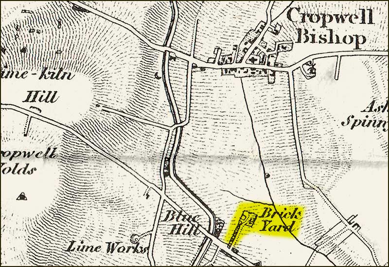
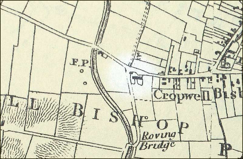
There was once a brickyard at the other end of the village, where the canal leaves Cropwell Bishop – near the Colston Bassett Road and Blue Hill. Maps show it was a working brickyard in the 1830s but seems to have ceased not long after.
A brickyard was near the canal on the Colston Bassett Road. (1836 map)
Then there were the brickyards that were in the centre of Cropwell Bishop – beside the canal, of course.
There was once a small one near the Roving Bridge on Kinoulton Road, but the biggest, and most recent, brickworks, was the 'Brick, Tile and Pipe Works' opposite Canal Farm near Nottingham Road.
These were the Works that could be seen from the top of Town End Bridge.
It was owned by the Midland Brick and Mineral Company, but everyone referred to it as the Cotton Brickworks: it was owned by a William Cotton.
The yellow tinted, 'Brick, Tile and Pipe Works' was the William Cotton Brickworks. The blue tinted brickworks was an older, smaller yard. (1898)
In the 1890s, the Cotton Brickworks was a thriving business and in 1898 it planned to go public. The prospectus printed for this step reveals interesting facts.
It was turning out 45,000 bricks a week and it was stated that, “an additional £500 could increase output to 75,000.” The clay reserves were thought to be sufficient for 50 years.
It is amusing to note that at this brickworks they were mining red clay and discarding the white gypsum as waste whilst, 500 metres away, over the Kinoulton Road, they were mining gypsum and discarding the clay.
Apparently, the brickworks had a great pile of "waste"; “several thousand tons of gypsum ready for grinding.”
It was stated that the company was making a profit of £3,500 p.a. and it was being sold for £23,000. Get your money back in 7 years – looks like a good investment for someone with the cash.
It is not known if William Cotton got his money but we do know that the brickworks had a life much shorter than anticipated.
Just 7 years later, Samuel Heaselden had purchased land next to the brickworks and was sinking shafts in his search for gypsum seams.
He appears to have been a smarter businessman than William Cotton: he not only sold the gypsum he mined, but also the clay (marl) that lay between the seams.
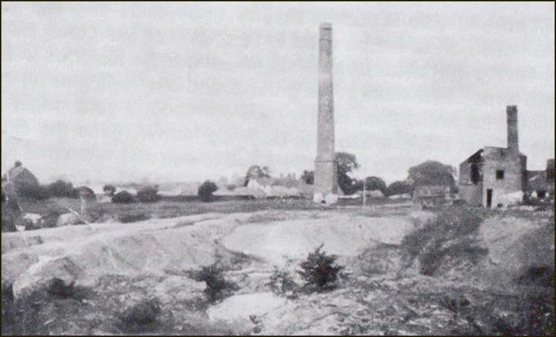
The view behind the Cotton brickworks. Are those the piles of "gypsum waste", I wonder. (1898) By the 1930s, the high chimney is all that remains of the Cotton brickworks. This is the view from Skylark Hill, looking towards Cropwell Bishop.
Town End Bridge
Descending from the brow of Town End Canal Bridge on our imaginary walk, we might well have been faced, not by buildings, but by hordes of people.
A crowd of village folk, waiting outside Canal Farm for the arrival of its farmer, Joe Blades.
It was not Joe they were after, but what he might bring them. Joe Blades, not only looked after the farm, but also the village bus.
Twice a week he drove to Nottingham, and when he returned to Canal Farm at dusk, he would unload his passengers, and also any packages that village folk had arranged to be collected from the city.
Old Canal Farm today (2020)
Joe enjoyed a long working day. As well as looking after village folk, he also took care of canal barges. They moored up outside his farm or in the Cropwell Basin on the other side of the bridge.
He carried out any repairs that needed doing. Even the barge horses were not forgotten – they could bed down in his stables. Joe was said to be a happy character with his fingers into everything.
He would use his motor bus for day trips, but this new form of transport had yet to be perfected.
When horses had pulled the carriages, they always managed to haul their full load up every hill, but the motorbus couldn’t cope: passengers had to get out and walk up hills.
We have to thank villager and gypsum worker, Norman Sheppard, for these recollections. He recounted them to his son, Colin, in 1981.
He also recalled the remarkable feat of two Cropwell Bishop men, Bill Fogg and Gershom Hampson, one winter when the Grantham Canal was frozen over. They skated all the way to Grantham – and back again on the same day.
Nottingham Road as it drops down from Town End Bridge (1920s)The same stretch of road today (2020)Town End Bridge (1930s)A Heaselden barge. Behind, you can see the houses at the junction of Nottingham Road, including the houses known as Parkers Row (1920s)Town End Bridge: 1920 map overlay on a 2020 satellite imageGrantham Canal with Hoe Hill in the background (2020)
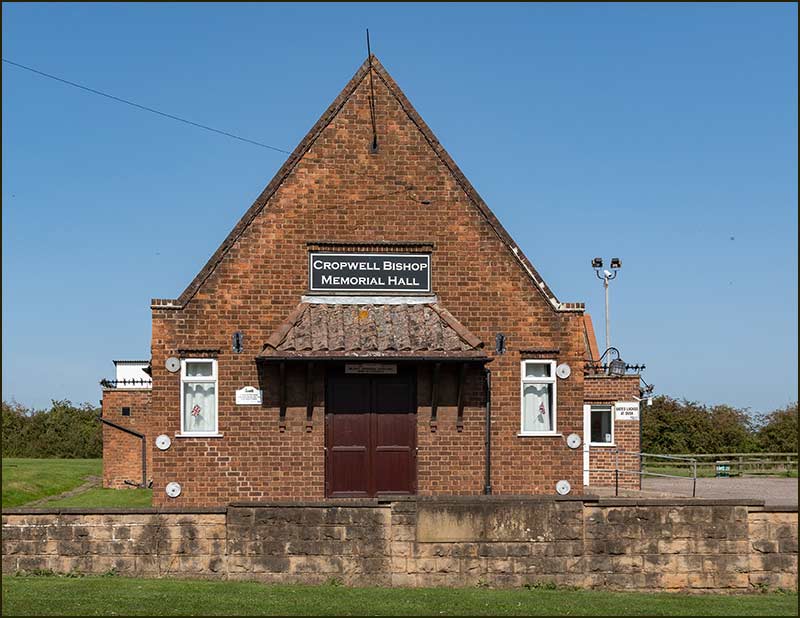
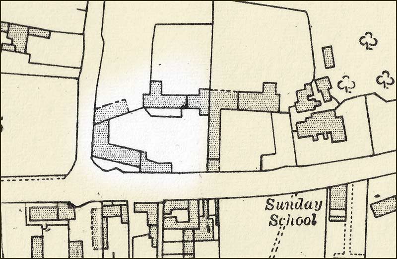
Memorial Hall
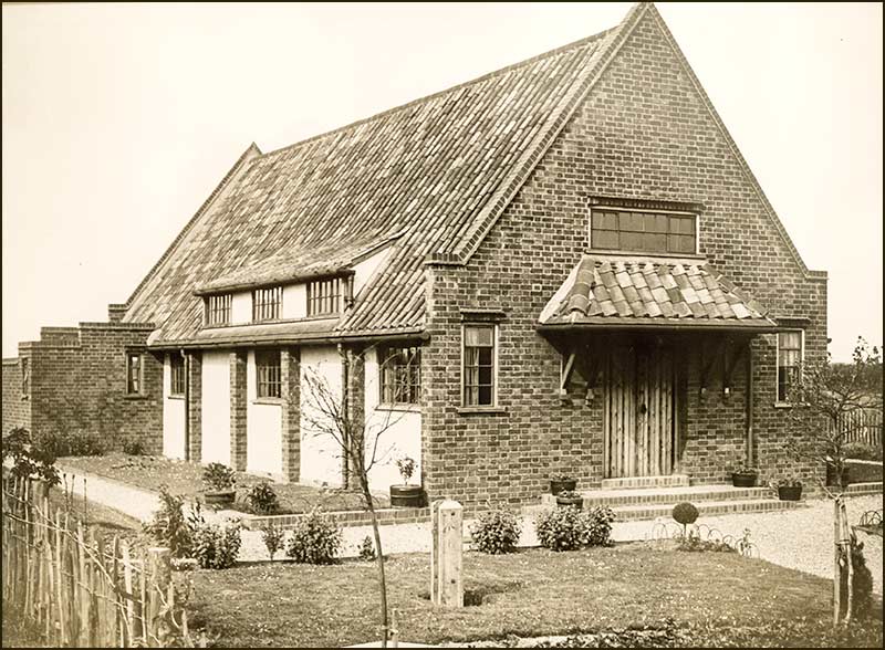
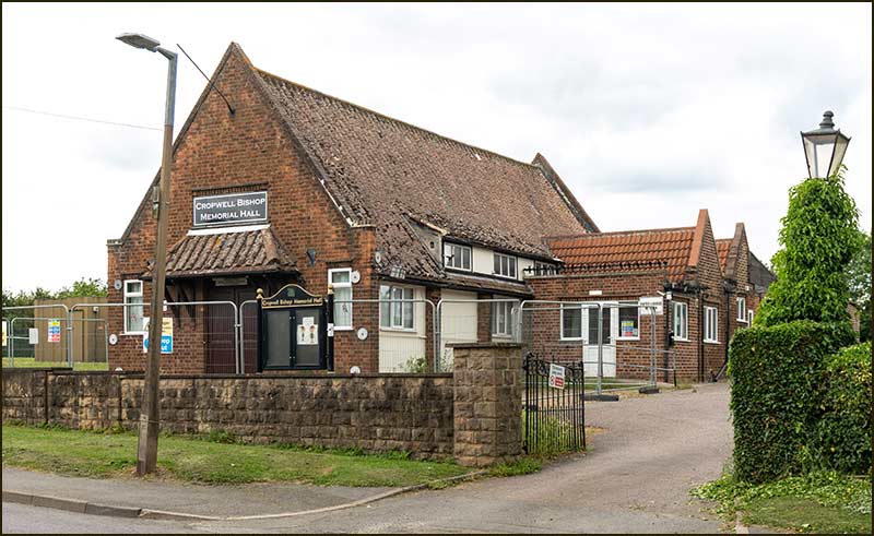
The Memorial Hall is a familiar part of Cropwell Bishop’s heritage but, compared to many many of our old buildings, it is relatively new.
Memorial Hall (2020)
In the early 1910s when the gypsum mines and brickworks were in full swing, the Memorial Hall hadn’t been imagined: neither had the First World War.
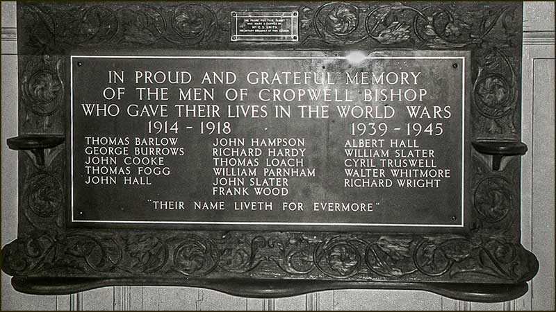
Eleven Cropwell Bishop men died in that War.
In March 1919, there was a public meeting to discuss proposals for a suitable memorial within the village. By the end of 1920, a Memorial Window had been installed inside St Giles Church and a Roll of Honour inside the school (now the Old School).
Even so, there was still a band of villagers who wished to see a hut or hall built within the village.
Encouraged by the moral and financial support of Mr J. N. Derbyshire, owner of the Gotham Company that mined gypsum east of Kinoulton Road, a building committee was formed in 1924. Herbert Heaselden also gave valuable financial support
Initial plans were drawn up in 1925 and fundraising for its completion began.
As part of this effort, the first Village Fete was held on 1st August 1925. The charges for admission and afternoon teas made it a successful event. A Fete, or similar event, has been held in the village most years ever since – usually at the end of July.
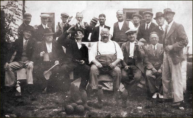
At that first Fete, skittles was especially popular with the prize of a pig for the winning man and a Stilton cheese for the winning woman.
Nevertheless, before they could move forward with the project, a site first had to be found for the building.
Their search ended when the present 4 acres site was bought from the Ministry of Health. The decision to build the Hall there seemed sensible: it was already an area of intense human activity.
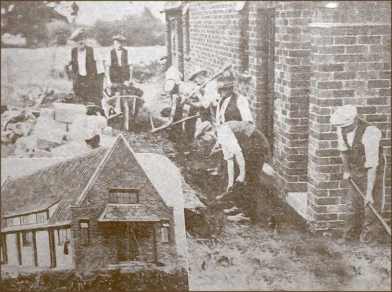
It was on Friday 6th July 1928 that the project was given the go-ahead.
It would cost £1220 and over half of this total was raised by the people of Cropwell Bishop. They also helped keep costs down by doing a lot of the hard work themselves. Men, wives and children devoted their spare evenings to getting the job done.
Men helping to build the Memorial HallBoys helped too
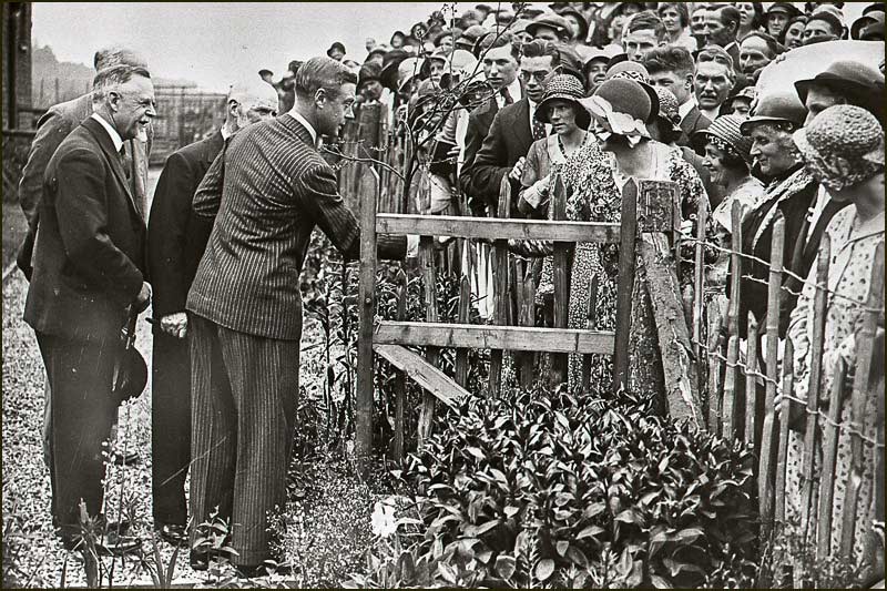
Just 12 months later, in the summer of 1929, it was finished and, on the 3rd August 1929, Mrs J.N. Derbyshire officially opened the Memorial Hall.
Memorial Hall shortly after it was built (1930s)
In October 1929, the Charity Commissioners were asked to become Trustees, and all organisations which were involved with or used the Hall were asked to appoint representatives to serve on the Memorial Hall Committee.
The first trustees were: Mary Elnor, Thomas Barlow, Mr Duncalf, Herbert Heaselden and William Parkin.
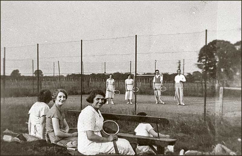
Tennis courts were laid out on the playing field in 1932, and electric lighting was also installed – but it would be 1938 before mains water arrived.
Anyone for tennis? (1930s)
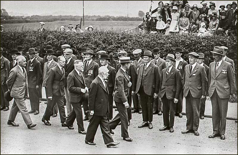
The most important date in the history of the Cropwell Bishop Memorial Hall was Wednesday 29th June 1932 when His Royal Highness the Prince of Wales visited the Hall.
Edward Prince of Wales inspects Ex-Service Men (June 1932)Prince Edward meets the people of Cropwell Bishop (June 1932)
There was a report of the visit in the Nottingham Guardian Newspaper, in which stated:
It was a hard struggle and in the last stage the Notts Rural Community Council obtained a free grant of £190 from the Carnegie Trustees, and a loan of £150 for five years free of interest. Largely through the efforts of Alderman J. N. Derbyshire, a site was secured for a playing field as well as for the Hall.
The latter is admirably adapted to its object, and it is an asset to the village. Movable partitions enable it to be used for teas, dances, meetings, and a variety of other purposes.
A condition of the grant is that the Hall will be managed in perpetuity by a committee representative of all organised interests in the parish – social, religious and sporting.
For more information on this visit, including photographs, see the Parkin Close Street Story.
Developments continued, and 1934 saw the introduction of a cricket pitch for boys, and swings and a see-saw for the younger children of the village.
By 1935 the Memorial Hall was being used for weekly cinema shows. Then a bowling green was proposed and it was completed in August 1936
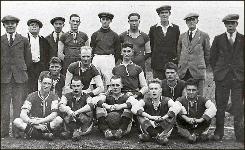
Cropwell Bishop Football Team (1933)
In October 1935 Mr Derbyshire generously offered to pay half of the outstanding £ 275 which was owed to the Gotham Co, if the remainder could be raised by April 30th 1936: and it was.
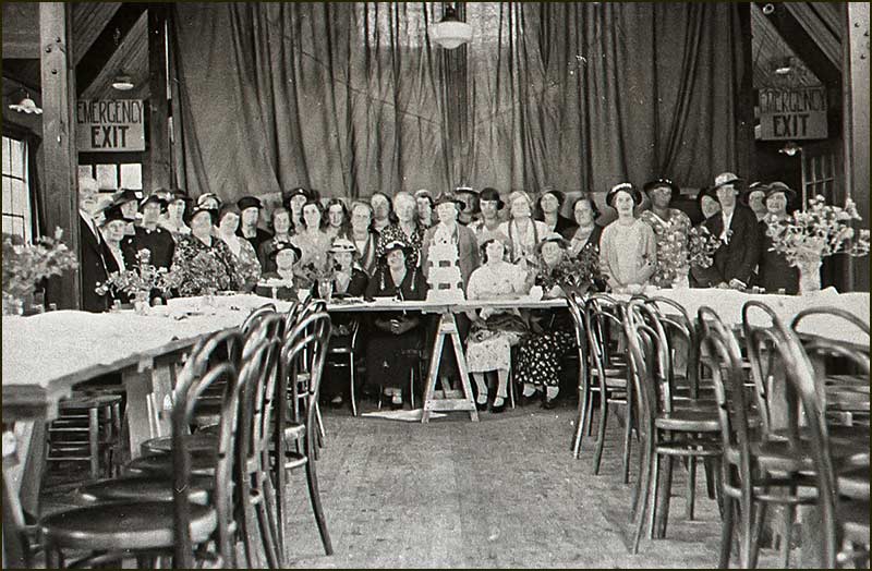
Women's Institute 21st birthday party at Memorial Hall (21st July 1937)
The next major change didn’t occur until 1948 when Notts County Council announced it was to flatten Town Bridge and widen and re-align the road.
The widening and re-alignment of the road lead to the loss of a significant portion of land, so the Committee negotiated with the Council to have a double entry drive with wrought iron gates, and a stone wall with a stone tablet in the centre.
The wrought iron gates installed in 1948 are still there today (2020)
The Memorial Hall Today
The Memorial Hall in June 2021: fenced off
It is now almost 100 years since the Memorial Hall was built. It was built on a tight budget and is now showing its age.
For many years the Parish Council hired the Memorial Hall for its meetings and, for a brief period, had a tiny office there.
In 2006 the Parish Council decided to take out a 25-year lease on the playing field to ensure that the refurbished play equipment would be maintained to a high standard. Costs have been met from public funds.
It was at this time that the Parish Council decided to have a structural survey of the Hall carried out.
The alarming findings of the survey led to the Parish Council offering to take over the Memorial Hall with a view to demolishing it and replacing it with a larger, more sustainable building whilst retaining the iconic frontage.
The plan was to include office space for the Parish Council but leave the Memorial Hall Committee to run the new building as before.
The Memorial Hall Committee voted to reject this offer.
A few years later, when Rushcliffe Borough Council threatened to demolish the Old School building and sell the land it stood on, the Parish Council decided to buy the building. It saw it as an opportunity to save this, basically sound, building for the benefit of the community and to provide office space for itself.
It felt secure in the knowledge that such a move had the support of 82% of the residents of Cropwell Bishop (as indicated by the Parish Plan Survey of 2008).
Sadly, the Memorial Hall structure has since deteriorated further to the point where, in 2021, it was declared unsafe to enter. This is why it is now closed and fenced off.
Its future remains uncertain.
According to the Charity Commission, the declared Objective of the Memorial Hall’s Trustees is the:
“Provision and maintenance of a village hall for the use of the inhabitants of the parish of Cropwell Bishop without distinction of political religious or other opinions, including the use for meetings, lectures and classes and for other forms of recreation and leisure time occupation with the object of improving the conditions of life of the inhabitants.”
It is to be hoped that a way will be found to build the facilities expected in the 21st Century so that the committee’s noble objectives can be achieved for both current and future generations in Cropwell Bishop.
It may be that some people are reluctant to see demolished a building that was built (with the help of village folk) in memory of those who didn’t return from the Great War of 1914-18.
In this Street Story we have seen how invigorated people were both during and after the building of the Hall. In the first 6 years they built tennis courts and bowling greens, they established clubs and put on plays, they started a cinema and a football team, and they continued having a village fete every year.
Yes, a Hall was built, which was a satisfying achievement, but, I wonder, did the feeling of optimism stem more from the spirit of togetherness brought on by working together on a great project with real meaning.
Maybe this feeling was as valuable as the building itself in helping families face up to the sorrow brought on by a terrible war.
A century later and the village will soon have to make decisions about the future of the Memorial Hall. Could it be that, once again, the process will be just as important as the bricks and mortar.
The young men who had their future stolen by the Great War, are surely best remembered by something that supports a safer, more stable future for new future generations of our village.
It is the duty of Trustees to make decisions about the future of the Hall but following recent resignations, there is currently, only one trustee – an alarming situation that is out of step with the recommendations of the Charity Commission.
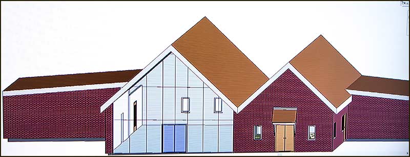
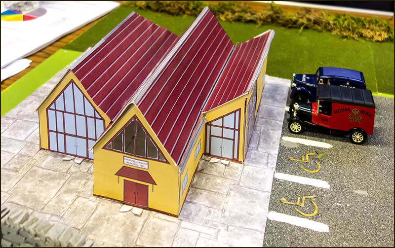
In the past decade, Chris Keast has, on several occasions, asked teams of university students to put forward their ideas for a replacement Hall. Even from the few examples below, you can see that by careful design it is possible to maintain a link with the original design.
A student design that reflects some features of the original Hall (2016)The model of a design idea (2016)At the time this design was submitted, it was thought that the repair and refurbishment of the Hall might be a feasible option (2016)
I wonder if a team of villagers can be formed to make the dreams of century ago come alive again on those historic 4 acres of land that we all share. They will need a clear vision and they will need drive to succeed, but it happened once, and it can happen again.
Fingers crossed.
Town End Bridge to Kinoulton Road
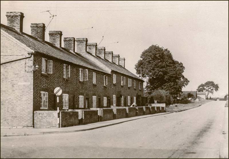
Continuing our imaginary walk from Town End Bridge to the junction with Kinoulton Road takes us past a row of terrace houses that was known as Parkers Row.
Parkers Row (1950s)
These homes were built in the 1860s and were occupied by workers of all kinds and their families.
The row of houses was named after the owner, Vincent Parker, who was a wealthy farmer/publican at Canal Farm. He died in 1897.
The Row was demolished in the 1960s.
Nottingham Road when the Town End Bridge stood but the Memorial Hall didn't (1910s)The bungalow on the corner of Kinoulton Road where Parkers Row once began (2020)The top end of Parkers Row once stood where this modern bungalow now stands (2020)
Tony Jarrow
Note:
Thanks to Anne Terzza, Pam Barlow, Tony Carter, Chris Keast and the Sheppard family for information and help. I also wish to acknowledge the value of a document by the late Rick Hickman describing the history of the Memorial Hall.
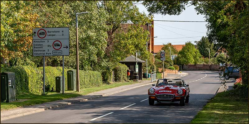
This E-Type Jaguar was built 60 years ago, but only 40 years after our imaginary walk down Nottingham Road (2020)The view beyond Kinoulton Road (2020)
Cropwell Bishop Streets: — Nottingham Road - part 3 (24-06-21)
On our journey down Nottingham Road into the village centre, we have reached its junction with Kinoulton Road.
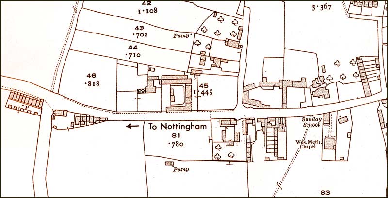
The houses on the opposite corner look a jumbled assortment of homes but maybe they are merely a reflection of Town and Country Planning 200 years ago.
Maps going back to 1835 show buildings on this spot and it is highly likely that they are the same ones.
Did they have a bigger back garden in those days – it is hard to say, but the fact that owners have never been able to buy extra land at the rear does reflect badly on the priorities of many absent land-owners in the 21st century.
1960s: the basic pattern of buildings on this stretch of Nottm Road is still easily recognisable 60 years later. Parkers Row has gone, some others have been 'trimmed', and new homes have filled the gaps. Hoe View Road has been the biggest addition.1835: the present houses were almost certainly standing 200 years ago.
Looking towards the village with Kinoulton Road on the right. (2020)The early history of these three homes is probably an interesting story but, alas, one apparently lost in time. (2020)
This 2008 picture shows the homes looking much the same as today.In fact, little has changed since the 1950s.
20202020
Lentons and Hoe View
Next on the left is Old Lenton Close.
Not so long ago, a garage and filling station was here – and a small paddock and a vegetable garden.
You can find out all about them in the Old Lenton Close Street Story.
Old Lenton Close: for decades, a filling station stood here. (2020)1930s: you can see Parkers Row and, in the distance on the right, the roof of the newly completed Memorial Hall. In the foreground on the right is Tinsley's Garage.
After Old Lenton Close, comes Lenton House. To discover its history, go to the Old Lenton Close Street Story. (2020)Lenton House. (2020)
Hoe View Road: to make way for its building, outbuildings at Lenton House farm were demolished. See the Hoe View Road Street Story to discover its history. (2020)1930s: the view down Nottingham Road. The brick barn at Lenton House was long.
1983: the distant view has changed little, but the long barn has been shortened to make room for Hoe View Road. 2020: hedges and trees grow, as do the numbers of cars, but otherwise little has changed in the last 40 years.
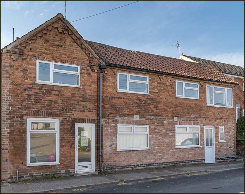
51 to Quixhill
The old houses on Nottingham Road have stood up well to the ravages of the British weather, but home owners have had to find their own ways of dealing with the shortcomings of 19th Century buildings lacking cavity walls, plastic damp-proof layers and central heating. Come to think of it, the first half of the 20th Century was no better. But find ways, they did.
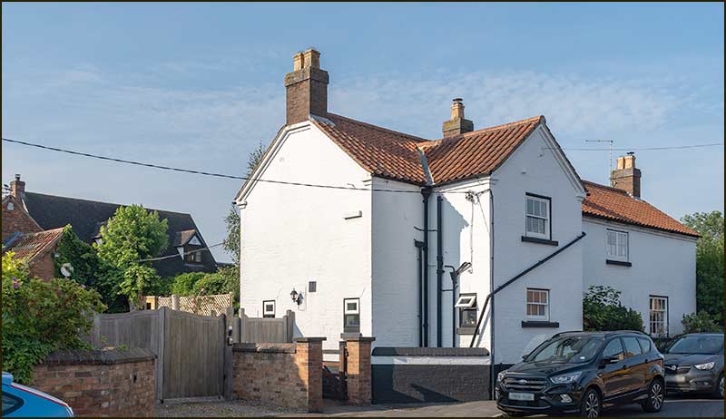
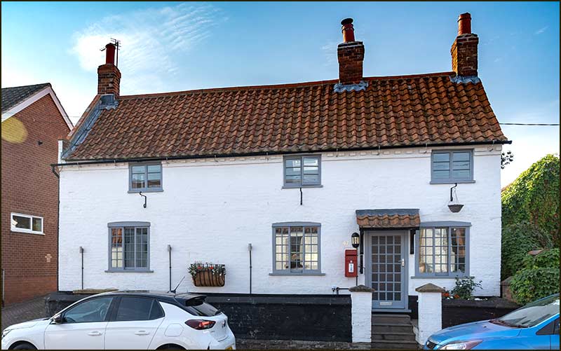
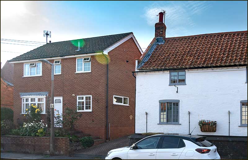
First, we come to 51 Nottingham Road which sits behind 49. It was built in, what was once, the back garden of number 49. (2020)49 Nottingham Road has a long history. In 1817 it was the home of Reverand Richard Sutton and in 1824 of Reverend Cleaver who stayed for 32 years. From then on, for many decades, the building was owned by Matthew Cooper and then Matthew Richards who were members of a powerful farming family in the village. In 1968, Tony Carter bought the house and lived there until 2001. Its outward appearance has changed little in all those years. (2020)
1930s: sisters Sarah, Florrie, Ethel and Edith Knight outside 49 Nottingham Road.Number 51 is behind 49
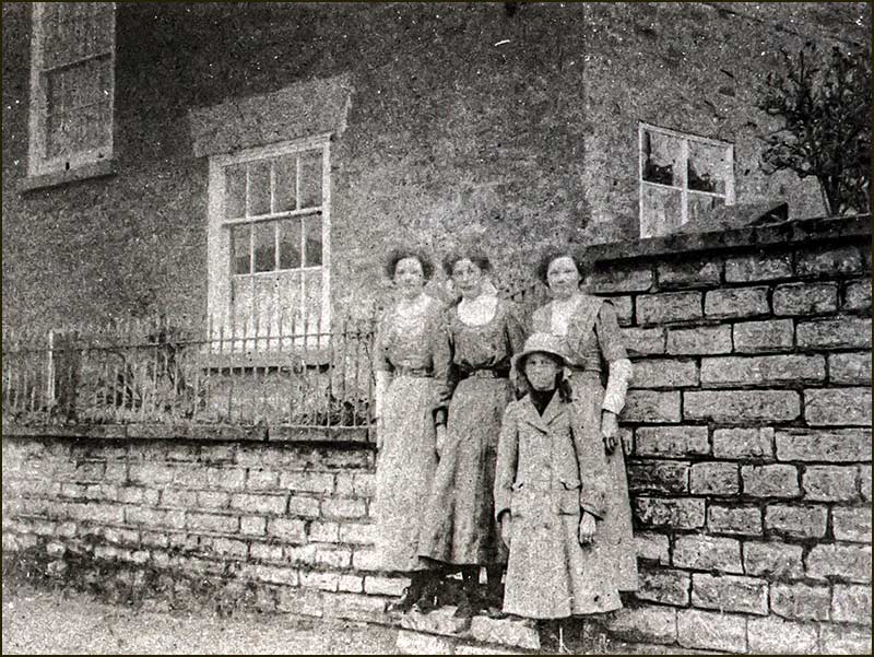
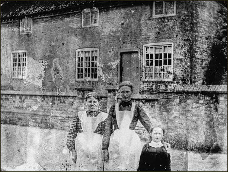
Quixhill Cottage, as it was called, in 1973. In the 1880s, a Mr Porter moved into the village and lived here. A short time after, the job of village post-master became available and he took on the job. This is still celebrated by the private red post-box. However, Mr Porter soon found the task too demanding and resigned. For more about the history of the village post office, see the Shelton Gardens Street Story. Outside Quixhill Cottage: Mrs Hand, Mrs Parnham and Eleanor Parnham. (1905)
Quixhill Cottage in 2020Across the road, new and old buildings are kept apart by Field Lane (2020)
1905: Quixhill Cottage and then number 49. On the right, from the back, the brick barn at Lenton House, a haystack where Hoe View Road now starts, and the Creamery at the corner of Field Lane.The view is still recognisable, 115 years later. (2020)
Out of Sight
Number 41 on the left and number 47 (Quixhill Cottage) on the right. Where are 43 and 45?The narrow road between 41 and 47. (2020)
At the top, 43 and 45. (2020)Beyond the houses, open fields. (2020)
Tony Jarrow
Note:
Thanks to Anne Terzza and Tony Carter for their help with this article.
Cropwell Bishop Streets: – Nottingham Road - part 4 (4-7-21)
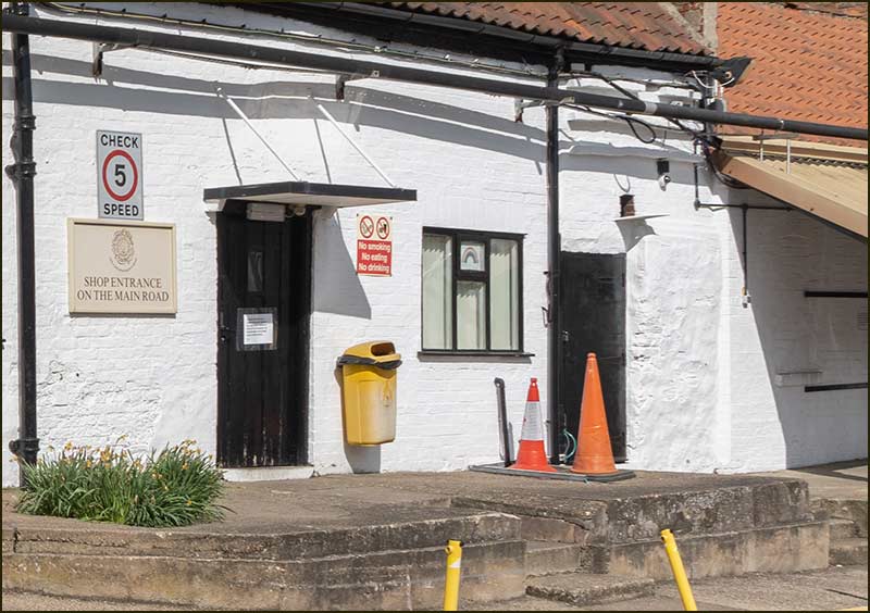
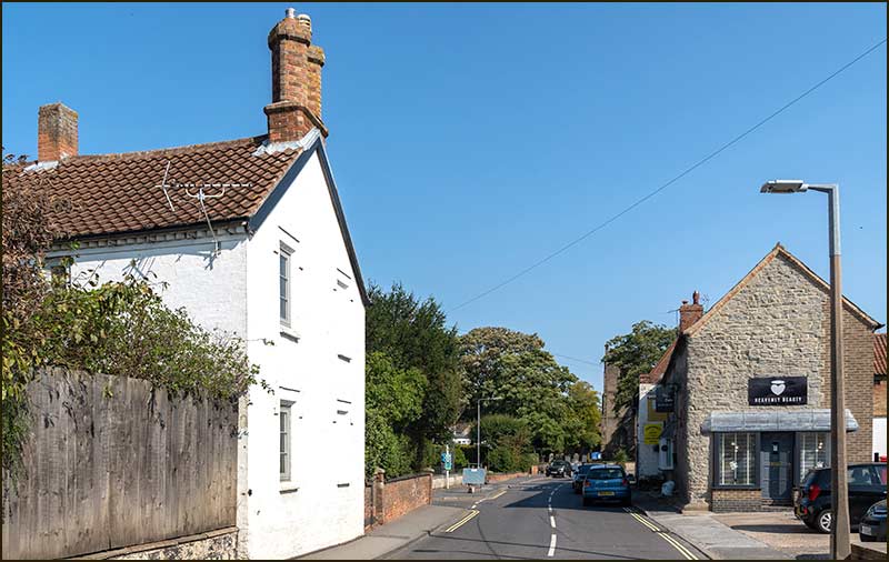
A Shop
These days, there is only one shop on this stretch of Nottingham Road and that is the one at the Creamery, but long before it opened, there was another shop – just across the road.
It is not there now, but the building it occupied is.
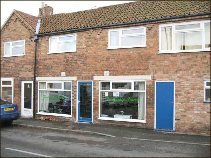
25 & 25A Nottingham Road (2020)
Numbers 25 and 25A are homes today but, until about 10 years ago, it was a meeting place with tables, chairs and a small kitchen at the back. It was known as the Friendship Centre.
In 2007, 25A was the Friendship Centre.
It was run by a group called, Cropwell Care, which was made up of volunteers from the village who regularly provided coffee mornings, lunches, etc, for elderly village folk in the village.
Other villagers could book it cheaply on an ad hoc basis. These were the days before the Old School had been converted for community use.
But, as you can see by its appearance, the place wasn't originally built to be a community centre, but to be a shop.
And it was a shop for over 40 years.
In the early 1960s, it was run by Betty and George Dooley. However, over the years, family illness took its toll, and it gradually became less commercially active.
Eventually, it was left empty for several years until the premises were converted into the Friendship Centre.
Nevertheless, previous to that, in the 1950s, it was a popular and busy shop owned and run by the Starbucks – a family long established in Cropwell Bishop. They lived in the house that was at the back of the shop.
In the 1950s it was run by Hannah and Billy Starbuck. Hannah Starbuck took charge of the grocery shop, helped by her daughter Dorothy, and husband, Billy Starbuck, sold second-hand bicycles and did bike repairs next door.
At one time, Hannah sold fish & chips.
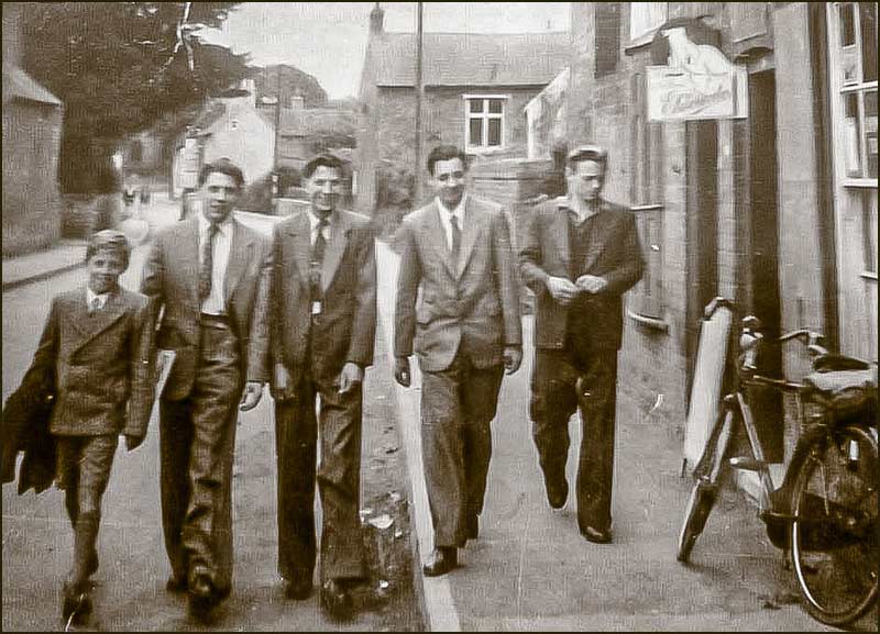
Outside Starbuck's shop in 1958. The metal sign over the door advertises Eldorado Ice Cream. Apparently, you could order an Eldorado ice cream cake for Christmas Day: you would go and collect it at 4pm.
In the middle of the picture is teenager, Lol Simpson, who, years later, was Chairman of Cropwell Bishop Parish Council. Either side of him are his cousins, Michael on the left and Tony on the right. On the extreme right is John Thornton. The younger boy on the left is unknown.
The bicycle is outside Billy Starbuck's half of the shop.
This shows the Starbuck's shop in the 1950s. It is clear from the advertising that cigarettes were being sold.
On the extreme right, you can make-out the doors to Billy Starbuck's garage which was at the end of the building.
The brick barn on the opposite side of the road was part of The Yews farmyard. In 2020 there is only a wall where the barn once stood – but the Yew tree has kept its shape over the last 90 years.
The Yews Farm
It is worth looking at that brick barn in more detail. You would normally imagine that a high brick wall like that would stay that way for decades, but the following photos reveal a different story.
1930s: no barn at all. In this picture, a Mr Hone is pushing his decorated cart along Nottingham Road for some (unknown) celebration.1965: the barn has a solid brick wall, just like it did in the earlier photo of Starbuck's shop in the 1950s. 1970: the barn now has a wall with the top-third open.1983: just prior to being demolished to make way for Barratt Close, it still had the open walls seen in 1970.
The photographic evidence suggests that the barn was built with a solid brick wall in the 1930s but in the 1960s this was demolished and replaced with a 2m high (approx) wall, plus pillars to support the roof – which may well have been preserved from the original version.
Maybe a villager can recall some of these events: their feedback would be welcomed.
This barn, and the buildings around it, were part of The Yews Farm: its farmhouse, The Yews, is next door.
The Yews in 1926Yew Tree House today (2020)
The Yews has been occupied by several notable Cropwell Bishop characters and crops up in a number of other Street Stories.
References to it are in records and maps as far back as 200 years ago.
However, a book written by a William Baldock (1829-1905) of Cropwell Butler, suggests that the house standing today is not the same one as in those early days.
He wrote: " in my earliest days, and for a long time after, there was an old thatched farmhouse with a huge thatched barn and other buildings near to it standing on the west side of the central part of the village (Cropwell Bishop)".
He refers to it being occupied by a Johnny Parr and then, later on, by Mr (Matthew) Cooper — which fits the documented history of The Yews.
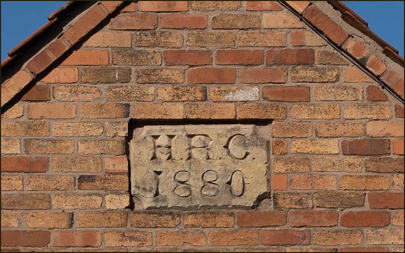
He goes on to say that during the early part of Matthew Cooper's residency: "the owner, Clifton Esqr. built a good new farmhouse on the site of the old one, and also new farm premises near to it."
Recent research (see the website News article of 21-9-20 in the Archive-2020) confirmed that new farm buildings were indeed added by Henry Robert Clifton in 1880 – and the plaque on the end of the present building confirms this date.
Nottingham Road
What William Baldock's account claims, is that The Yews farmhouse was built at the same time, replacing an earlier version.
The 1835 map shows that a building did exist then, although with a slightly different shape and further from the road than today. This gives support to the idea of a rebuild.
More importantly, the present building does not display the irregular brickwork, low upstairs windows, or high gable walls that are present in known old buildings – like the nearby Old Dairy and Quixhill Cottage.
Whatever are the precise facts about The Yews farmhouse, there is no doubting that it has been a pivotal building in the history of Cropwell Bishop.
Dairy
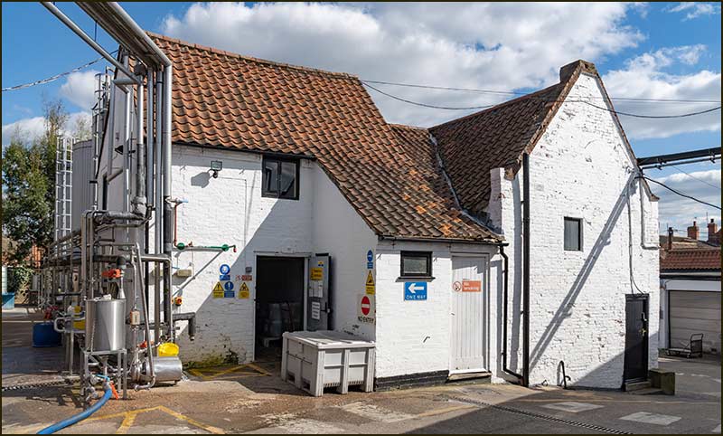
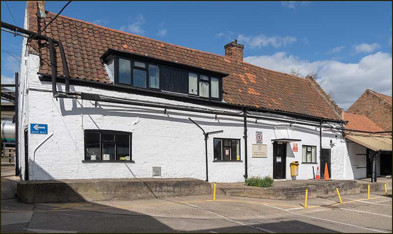
The Creamery building does look old, but when the brickwork is hidden by layers of white paint it is difficult to be sure if it really is.
The Old Dairy (2021)
Fortunately, we do have photos taken before the walls were painted and they show that the brickwork looked old, even 80 years ago.
Also, we can see that the gable walls are higher than the level of the tiled roof, which indicates that the roof was originally thatched.
Maps from 1830 show buildings at the same location and I think it is safe to assume that they are the same ones standing today.
1835: two buildings occupied the site of the present Creamery.1960s: a more precise map but, in general, the shape and position of the buildings is the same as in 1835. 1965: behind the Dairy were just fields; the big cheese-factory building had not yet been planned – neither had Barratt Close.
So, a Dairy has been here for a long time, although nowadays it is referred to as The Creamery.
The making of Stilton Cheese has also been happening for a long time in Cropwell Bishop.
Stilton cheese was awarded as a prize in the Village Fete in 1925 and we have photos of Stilton Cheeses being loaded onto a lorry in 1939.
Loading Stilton Cheeses in 1939The same view in 2021
It was in the years leading up to the Second World War, that the family of a young Brian Howell lived at the Old Dairy.
Their home was Dairy Cottage, which, in reality, was the back of the Old Dairy building. He lived there with his parents, Claude and Minnie Howell, and his older brother, James.
At the start of the War, in 1939, he was only 6 years old but he had learned to use his parent's Kodak Brownie camera – and we have the photos to prove it.
Brian Howell in 1939Brian, with brother James, and their cousin and her mother (1939)A photo taken from the same spot in 2021
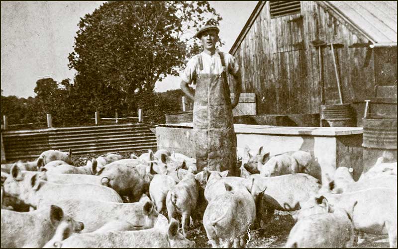
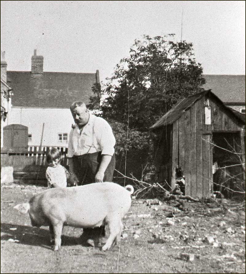
Brian's father, Claude Howell, worked at the Dairy and had a variety of tasks, but his main job was looking after the pigs that lived in a field at the back of the Dairy.
It was profitable for the Dairy to have pigs because they could be fed for free with the whey that was a by-product of cheese making.
Claude with his pigs (1939)
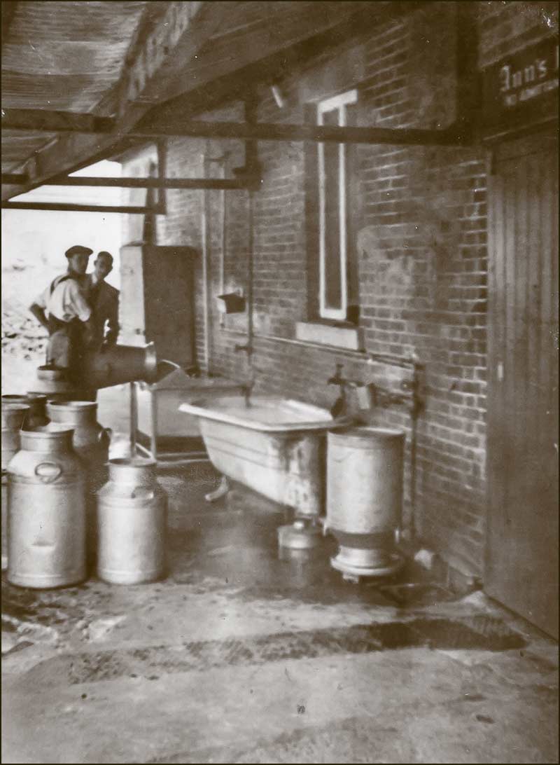
The owner of the Dairy did not live in Cropwell Bishop, but in St Ann’s in Nottingham, and this may be why he called the Dairy building, “Ann’s Farmhouse”.
The Dairy loading bay in 1939. In the top right-hand corner, you can see the first part of the name plaque with, "Ann's Farmhouse", on it.
After the start of the War, workers would be ‘called up’ one by one, and eventually cheese production came to a halt.
The cottage at the back of the Dairy (1939)Claude with his wife, Minnie and a Mrs Woodhouse (1939)Claude, on the left, with his brother Ernest (1939)The corner, in which the previous photo was taken, is hidden by a large tank today. (2021)James was two years older than Brian and both went to Cropwell Bishop School. Tony Carter (still living in Cropwell Bishop) was at School with Brian Howell. (1939)Claude with James and Brian in their garden behind the Dairy building (1939)
Tony Carter recalls joining a Rabbit Club that Claude set up for children during the War years.
Claude taught them how to look after their pet rabbits. Later on, he also showed them how to kill them, skin them, and make gloves from their fur. Tony made a pair for his auntie for Christmas.
Not sure that such a Rabbit Club would go down well today, but, there can be no denying that those children were learning some practical skills, and also some facts about 'real-life' – especially relevant during those War years.
In the 1940s and 1950s, rabbits were a common source of meat, and butchers would often have a row of furry rabbits (dead) hanging outside their shop.
Brian Howell in later yearsThe Old Dairy (2021)The Old Dairy (2021)
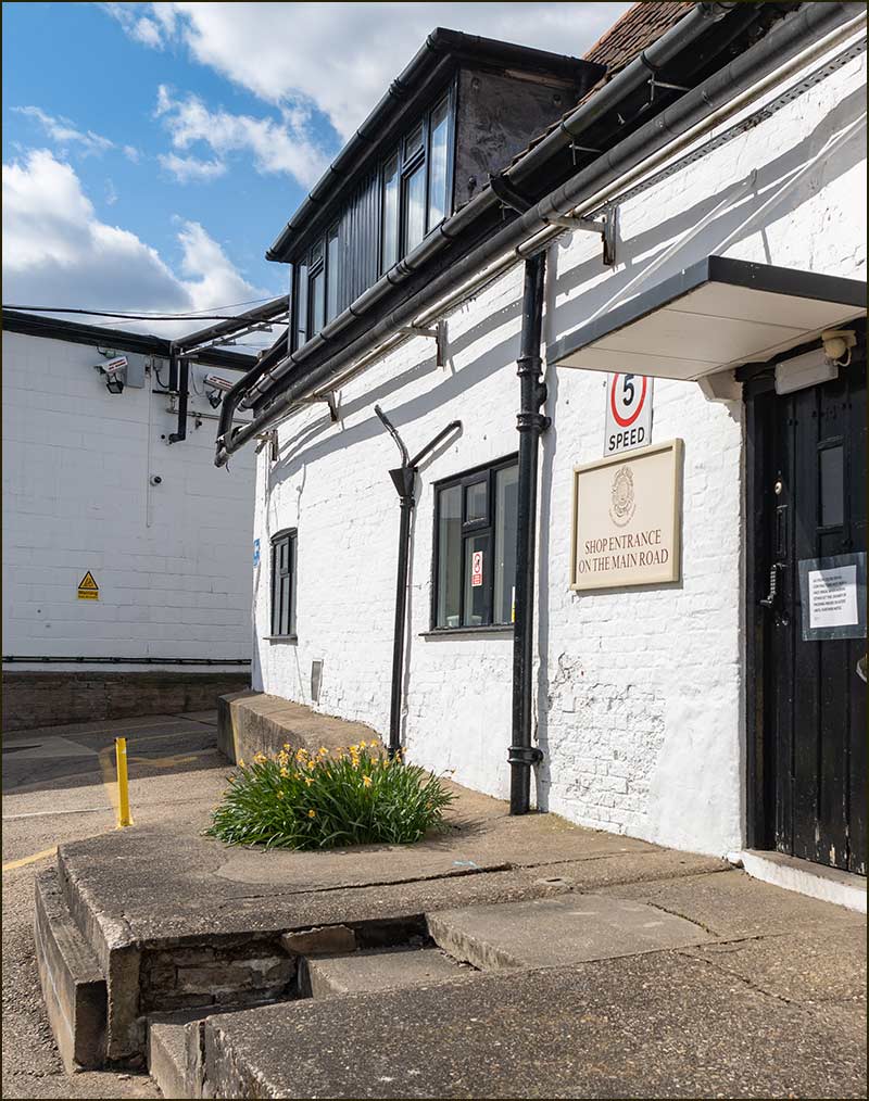
The Creamery Shop is inside the Old Dairy building (2020)The Creamery Shop (2020)
Jubilee Drive
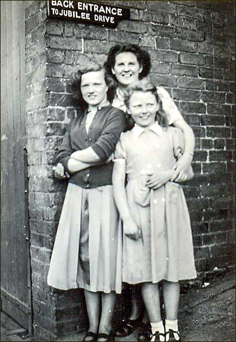
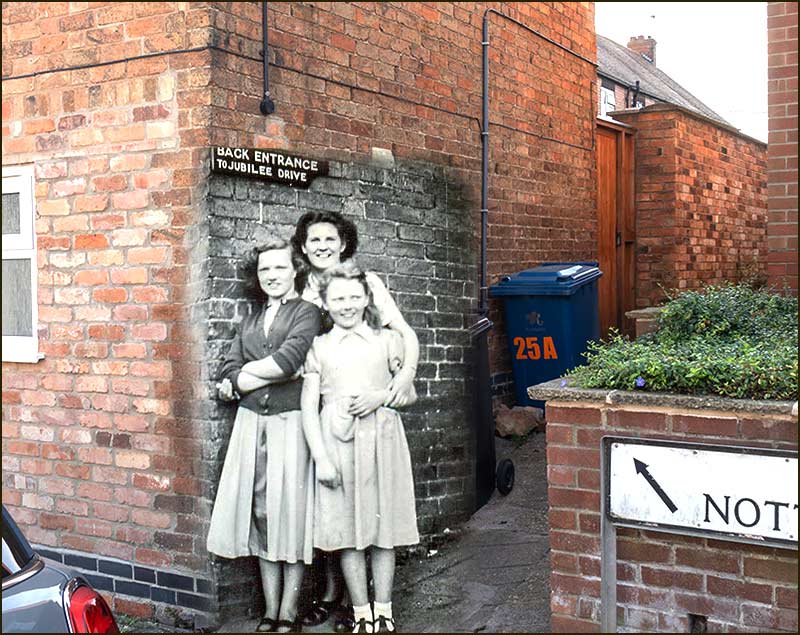
The old Cropwell Bishop photo below, was taken in in the 1950s – but where, you may be wondering.
Even the sign is of little help – unless you have lived in Cropwell Bishop for many decades and have a good memory. Does the garage door on the left provide a clue, I wonder.
Well, the brickwork does still exist and inserting the picture into a modern photo, may help.
The girl in the middle is Lol Simpson's sister, MargaretIt's at the corner of 25A Nottingham Road – the building where Billy Starbuck once had his bike shop.The entrance to, what was once, Jubilee Drive, is beside the parked car in this 1978 photo. You can see the garage door that is in the old photo.
Even the postman has never heard of Jubilee Drive, so we will have to delve deeper into the history of this part of the village.
If we walk up this same alley today, we see the back of a row of houses. And, if we go up Richards Close and follow the public footpath, we see the front of them.
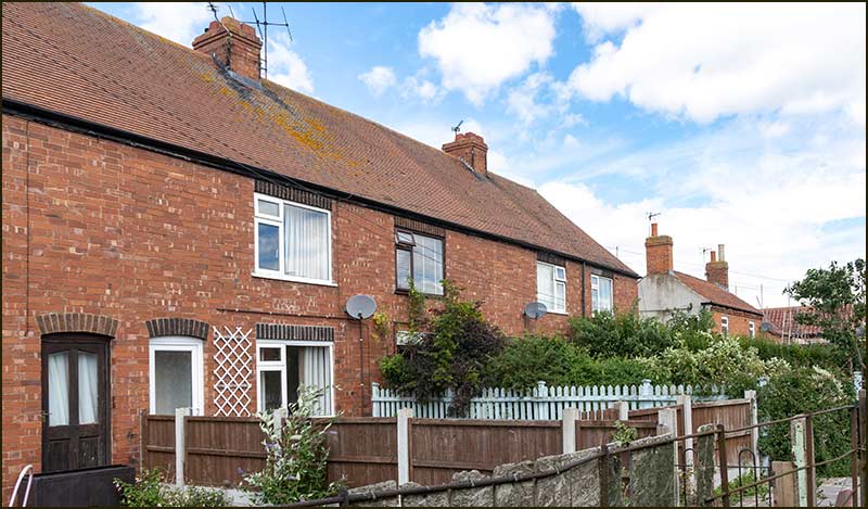
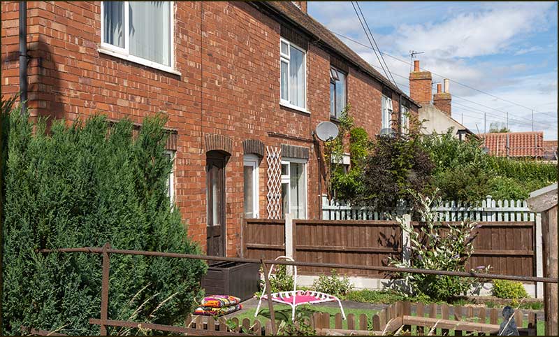
These are the houses that made up Jubilee Drive. In reality, they still do, it's just that the name has been dropped.
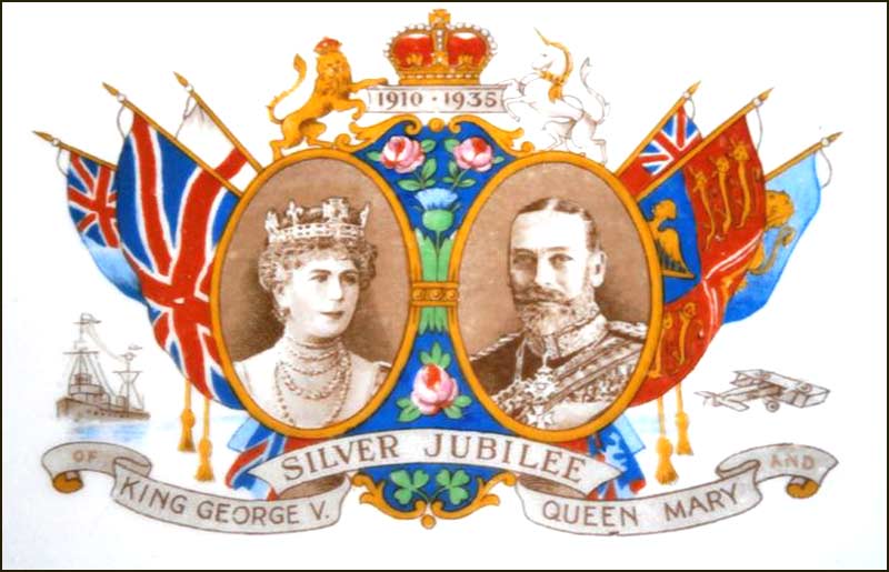
The name came from the year they were built, 1935, which was the Silver Jubilee year of King George V and Queen Mary.
At some point in the past, the name was discarded, and the homes now have a Nottingham Road address. A pity, I think; Jubilee Drive sounds much more interesting.
Previous to Jubilee Drive being built, there was a row of houses on the same spot. It was known as Wests Row.
It got that name after a Benjamin West lived in the first house, and Wests Row was listed in the 1881 census.
They were poor homes: you had to use a ladder to go upstairs and the outside toilets were across the yard. It was in the 1930s that they were condemned and, in 1935, rebuilt as Jubilee Drive.
The naming of Jubilee Drive must have triggered patriotic emotions of villagers: they also named the house at the end, Jubilee Cottage, and the adjacent field, Jubilee Field (Richards Close has been built in it).
"Jubilee Drive" Today
The homes that once belonged on Jubilee Drive but are now part of Nottingham Road (2020)A "Jubilee Drive" front garden (2020)The end house of "Jubilee Drive" is next to open fields (2020) The detached house on the right was called Jubilee Cottage (2020)
Jubilee Drive – Past and Future
This 1890s map shows a row of houses behind 25 Nottingham Road: it was called, Wests Row.This 1960s map shows a similar row, but they are newer houses and were originally called Jubilee Drive
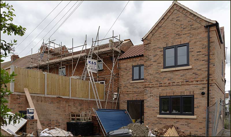
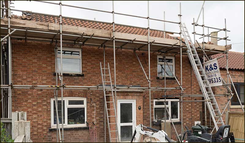
The "Jubilee Drive" homes as they appeared in 1983 when Barratt Close was being builtThe tiny end house is in the process of being replaced with a modern one, built in a style that blends in well with the adjacent old shop (2020)
The replacement house nears completion (2021)The old Jubilee Cottage is being updated (2021)
Thanks to Anne Terzza, Brian Howell, Lol Simpson, Tony Carter, John Greenwood and Sue Ward for their help with this article.
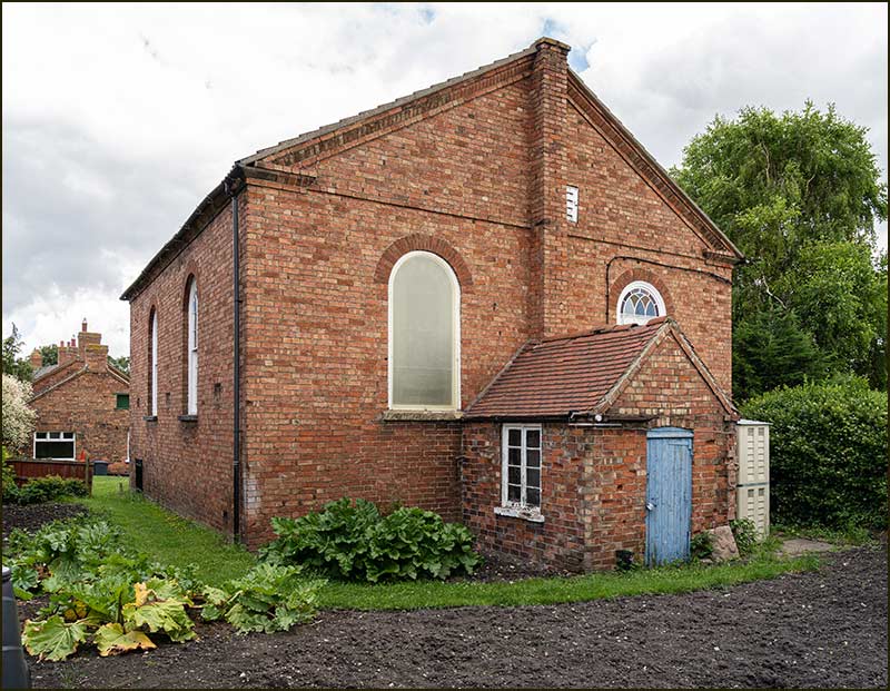
A hundred years earlier, there were no Methodist chapels anywhere. John Wesley had only just started preaching his alternative approach to the Christian religion.
Wesley's ideas on Methodism attracted a growing number of people and, in 1802, its seed was sown in Cropwell Bishop.
Robert Hopewell, a farmer living opposite the Chequers on Church Street, registered his house with the Archbishop of York, as a place of public worship.
The number of villagers to join him was small at first, but steadily grew, until his house was no longer big enough for the congregation. No matter, he had a solution.
In 1817, he converted a barn into a chapel and registered that with the Archbishop of York.
Methodist ministers included this makeshift chapel on their Circuit and over the next twenty years, the congregation continued to grow.
The need for a more worthy place of worship led to the opening of a ‘subscription list’ – a list of people willing to invest their money in a scheme to build a chapel.
There were 250 subscribers on the list and it included several prominent local names like: Hopewell, Shelton, Squires and Clifton, who gave up to £20 each. The smallest amount a person offered was 3 pence.
They soon had the money to buy a suitable piece of land from a Mr J. Bell of Hickling – who also happened to be one of the subscribers.
John Bell (1815-1876) of Hickling who sold the land on which the Chapel was built. Photo provided by Rev. Owain Bell, an ancestor.
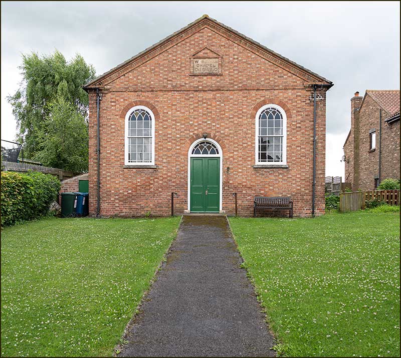
In early 1842, they paid £156 for the land on which the Chapel now stands – including the building that we now call, the School Room.
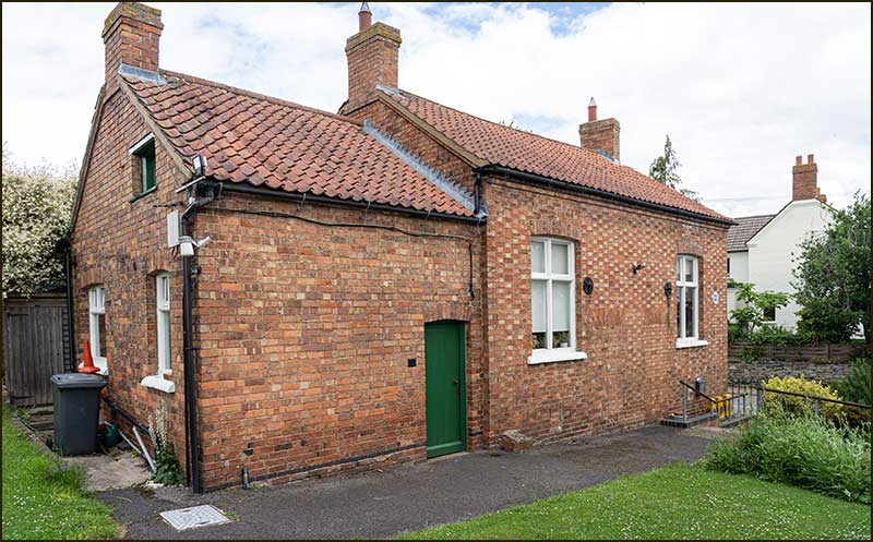
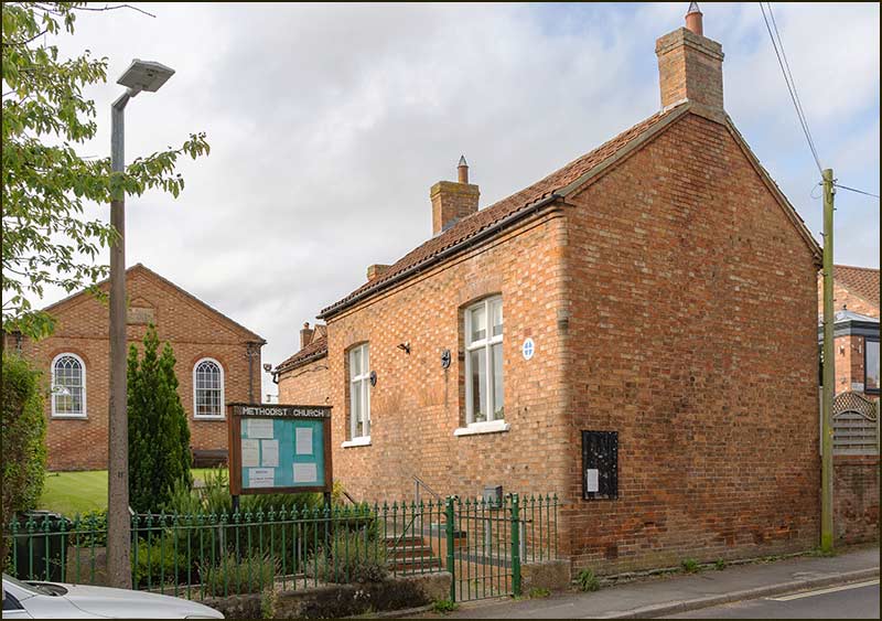
This building came with the plot of land bought for the Chapel (2021)
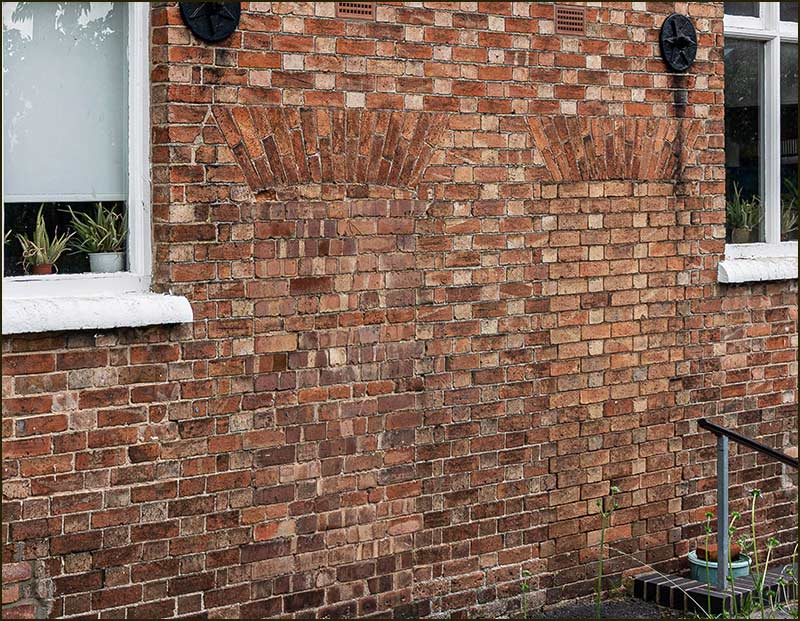
At the time, the building contained two cottages, and this is still evident in the brickwork.
Between the two windows, the brick pattern clearly reveals where the doorways to the cottages once were. (2021)
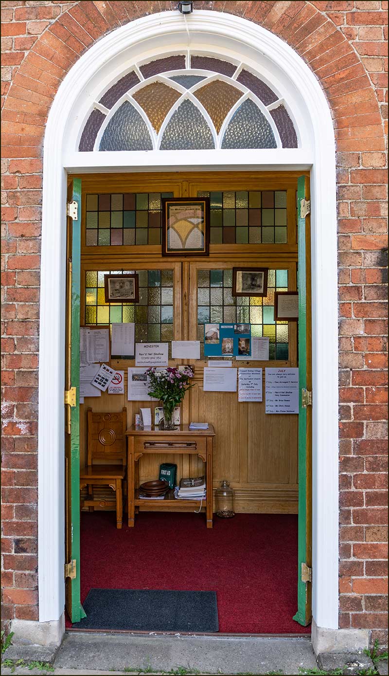
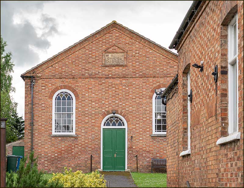
So, they bought the land early in 1842 and on 8th September 1842 the Wesleyan Methodist Chapel held its opening service. That is fast work, and the workmanship was sound: the Chapel still looks good after nearly 180 years. The total cost, including the land, was £516.
It was calculated that the Chapel could accommodate 400 people. That should have been plenty large enough for a small village. Or, at least, you would have thought so.
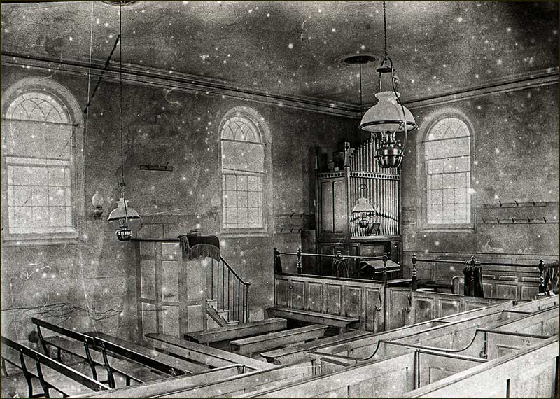
Chapel in the 1880s: the pulpit was on the left-hand sideThere was tiered seating against the right-hand wall (1880s)
Much was made of Chapel Anniversaries, and on the second one in 1844, people even came from neighbouring villages to attend the last event of the day, the evening service.
There were so many people that only half of the congregation could fit inside the Chapel!
A temporary platform was quickly erected at the chapel door and the preacher used it to address both the people inside the chapel, and those outside on the grass.
Preaching to 400 people inside the front door and 400 people outside – at the same time – must have been challenging. I wonder what he chose for his text. (2020)
In 1859, a harmonium was purchased for the Chapel but 13 years later a pipe organ was bought to replace it.
The same organ is still there today although it was enlarged in 1929 and now the blower is electric.
In the 1890s, a large number of improvements were made for the benefit of both the congregation and children.
Until then, the Chapel had also been used as a meeting place for the Sunday School and this, it was increasingly being felt, was far from ideal.
In the 1850s, over 100 children attended Sunday School and, for some, this was the only schooling they had, this being the time before free compulsory state education.
In 1893, the decision was made to adapt the two cottages to form a Schoolroom. This was done using voluntary labour at no cost to the Trust funds.
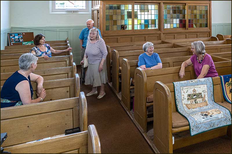
You have to imagine this room full of Sunday School children in the 1890s. The building is now about 200 years old. (2010)How many children have entered the Schoolroom through that door, I wonder. (2019)
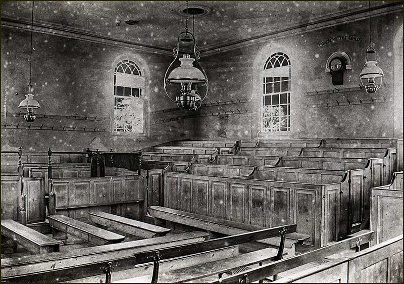
In 1897, the interior of the Chapel was upgraded by members who removed the interior fittings and then created a different layout with new pews and a rostrum – which are still there today.
The cost was £134 but this sum was raised by fundraising efforts so that no debt was incurred by the Trust.
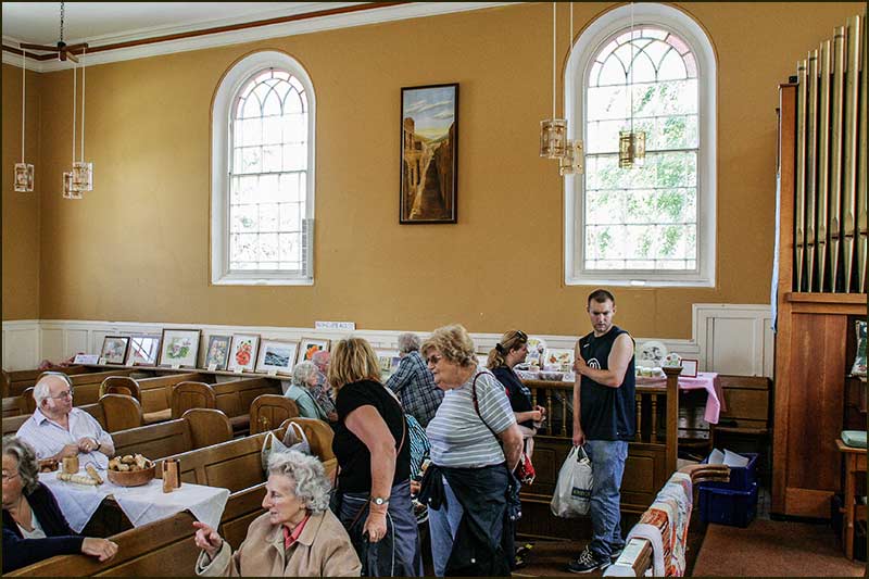
The pews and fittings in the Chapel today were fitted over 120 years ago. The stained-glass window was given by Herbert Heaselden in 1953, in memory of his wife, Ethel. (2018)The pipe organ was installed almost 150 years ago (2008)The pews were popular on this day in 2018.
In 1899 the Chapel was licensed for marriages and many marriages have taken place since then.
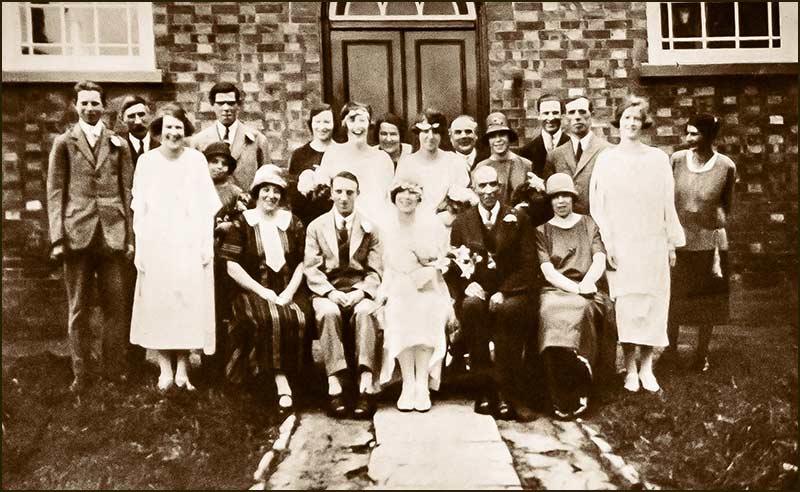
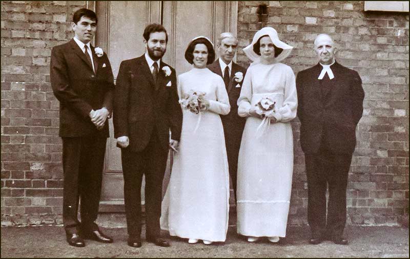
The marriage of George Hopkinson and Annie Simpson at the Chapel in the 1920s.Married at the Chapel in 1971: Peter Mason and Marian Robinson of Fern Hill Nursery. On the right, Marian's older sister, Jean Robinson, who served the Chapel her whole life, and lived on Hardys Close until her death in 2019.
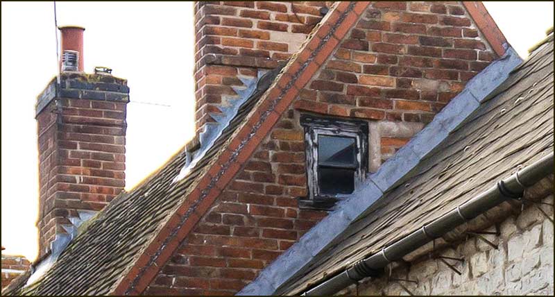
You will no doubt have noticed that the Schoolroom has an extra bit of building on the end of it. It wasn't there when they bought the land:, so where did it come from?
The Schoolroom has a 'new' extension. (2021)
It was in 1922 that the decision was made to build this extension to accomodate a classroom and a kitchen. Think of it as a modern addition: only 100 years old compared to the Schoolroom which is about twice as old.
I wonder what the loft was used for. (2021)
Methodist Chapels were visited by ministers and preachers who called on the chapels on their ‘circuit’. Cropwell Bishop was originally on the Newark Circuit.
These people did not, in general, live close to the chapels they served, so were not available to consult members in the same way as, say, a local vicar.
As a consequence, every chapel had its class leaders. These were people who the congregation looked upon as spiritual leaders.
They were not preachers, but facilitators – someone who could organise small meetings of followers and also look after day-to-day practical affairs, including the state of the Chapel, its finances, and the welfare of the congregation.
Class leaders played an important role in Chapels and it is interesting to note who took on the task in Cropwell Bishop during the early days.
Initially, they included Robert Hopewell, who held that first meeting at his home in 1802, and John Squires, who served as a class leader for nearly 50 years.
Then there was: William Knight, Richard Barlow, John Cumberland, William Parkin, Herbert Simpson, Harold Smith, Ernest Smith, Leslie Simpson, plus a host of others over the years. Many of these characters we have come across in other Street Stories.
People who served the Chapel in other ways, include all members of the Heaselden family. Sam Heaselden took an interest following his arrival in the Village in 1903 and his son, Herbert, became its Steward in 1917 – and continued in that role for 35 years.
Most of the class leaders and stewards also gave substantial financial support to the Chapel.
George Smith supported the Chapel in different ways. For 54 years he played the organ. Then, in 1953, he used his wood-carving skills to carve the frame of the War Memorial plaque that hangs in the Chapel.
Memorial Tablet unveiled in 1953 and on display in the Chapel. The frame was made and carved by George Smith. (2020)
George's brother, Harold, preached at the unveiling ceremony, and Harry Smith (son of George and a Sunday School Teacher), laid a wreath. Quite a family affair, it would seem.
George Smith (organist) and, on the right, younger brother, Harold Smith (Class Leader) (1930s) George Smith in 1920s George Smith and his wife Winifred in the 1940s.
The prime concern of Methodism may well be the souls of its members, but it doesn't neglect their material welfare.
Just a few months after the Chapel was opened in 1842, its officials launched a 'Friendly Society'.
The object of the Society was to give financial assistance to its members in times of sickness, bereavement or death. The entrance fee was 5 shillings (25p) and membership was not limited to Methodists.
This venture clearly filled a need in village life and it prospered. In 1886 there were 120 members and the account had a credit balance of £534.
The Society also owned two fields of allotments which it let to members. One of those fields is, today, occupied by the Cropwell Bishop Allotment Society.
At the back of the Chapel is a small allotment plot that is still in use. (2021)
2009
Now, in the 21st Century, the days of large congregations and crowded Sunday Schools, seem a distant memory.
Nevertheless, there are still occasions when a large number of people go to the Chapel for a wedding or a funeral.
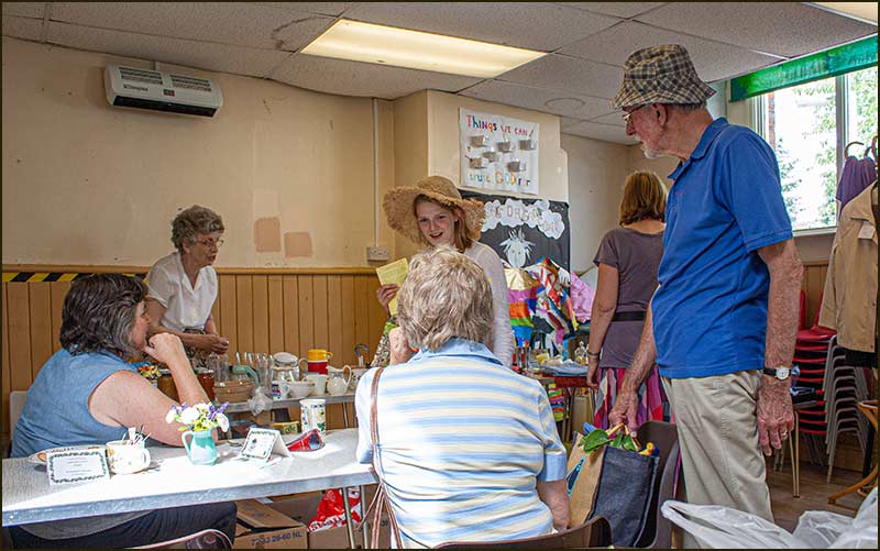
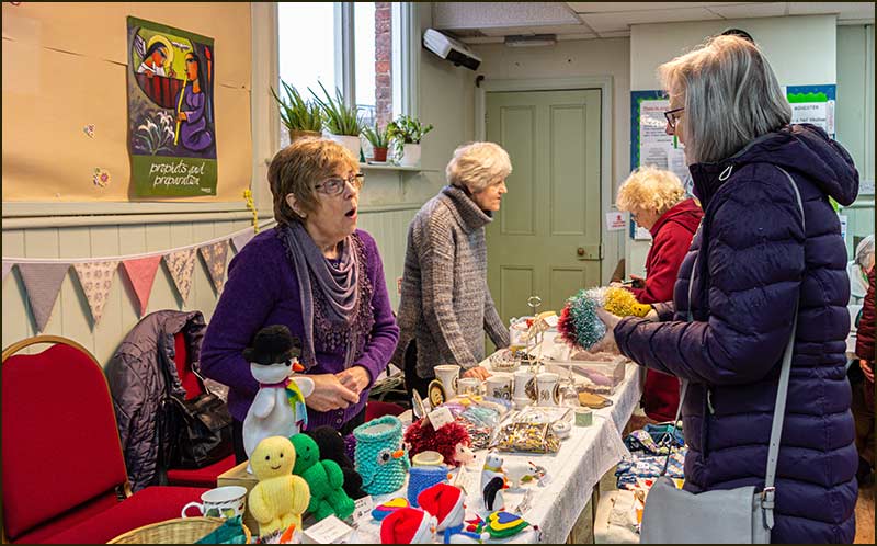
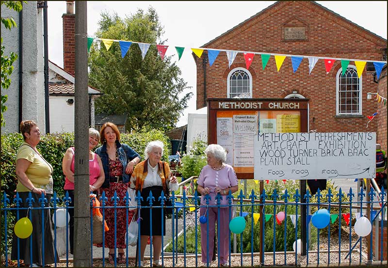
It remains a bright, spacious and attractive building which people enjoy visiting during Village Celebration Weekends. And the Schoolroom is a handy place for people to have a meeting, sell craft items, or just enjoy tea and cakes.
It will be interesting to see how the future pans out.
Thanks to Anne Terzza for help with this article.
Tony Jarrow
Cropwell Bishop Streets: – Nottingham Road - part 6 (25-7-21)
100 metres to The Turn
As we make our way down the final stretch of Nottingham Road, we are getting closer to St Giles Church and so the most ancient part of our village. Of course, the buildings that occupied the street a thousand years ago have long gone and left no trace - except, maybe, the gentle curve of the road. Why is it curved, I wonder.
For all we know, some of the stones in the walls of buildings or street walls, may have once been part of the home of a 14th century farmer or merchant.
If ever you see the road being dug up (it often is) look closely at the spoil heap and contemplate the cart wheels and feet that once trod those stones and dirt.
Other Street Stories have already covered some of the buildings ahead, including Yew Tree House, The Methodist Chapel, the Butchers shop and Mill Lane, but what of the others?
We will look first at the homes and then the businesses, before exploring the sites close to The Turn – the space in front of the church which earned its name from vehicles turning around there.
From Richards Close to The Turn – the homes
(2020)(2021)
(2020)(2021)
(2020)(2021)
(2020)(2021)
(2020)(2021)
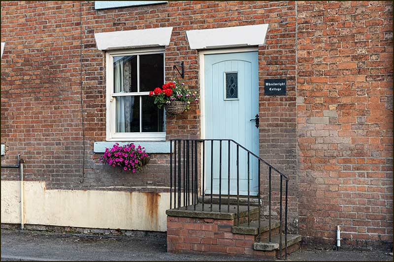
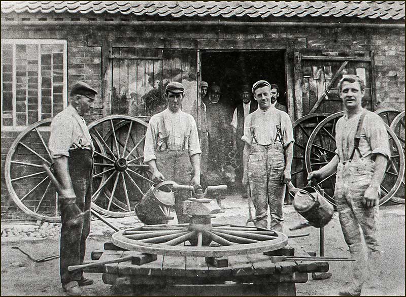
This is No.3, Nottingham Road. It is named, 'Wheelwrights Cottage' – and with good reason. Back in the early 1900s it was home to Henry Smith - a man who made cart wheels. (2021)The wheelwright's shop at the rear of No.3, Nottingham Road. On the left is Henry Smith with his two sons and, on the right, Charles Harper. It was Charles Harper who made the wrought iron gates at the entrance to the Church on Fern Road. And he was the father of Aubrey Harper, who wrote the book, "Chronicles of Cropwell Bishop". (1900s)
From Richards Close to The Turn – the businesses
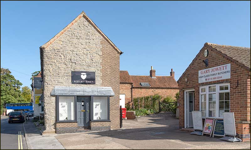
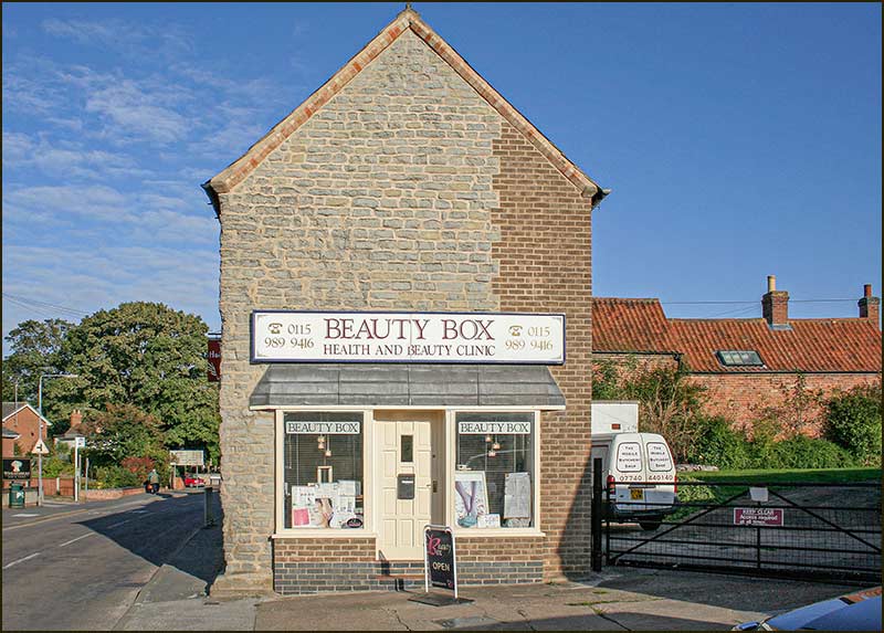
As we approach The Turn, the first business we come to is the Butchers: you will read more about it in the next section. Beside it, is the beauty salon, once called Beauty Box, but now called Heavenly Beauty. (2020)This is how Beauty Box looked in 2008.
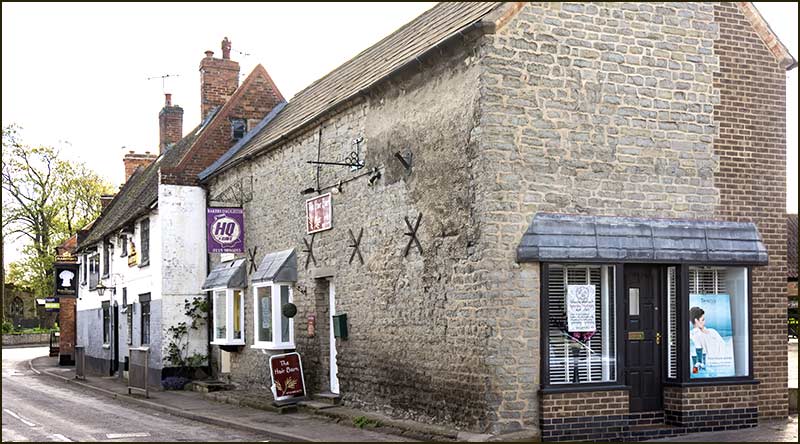
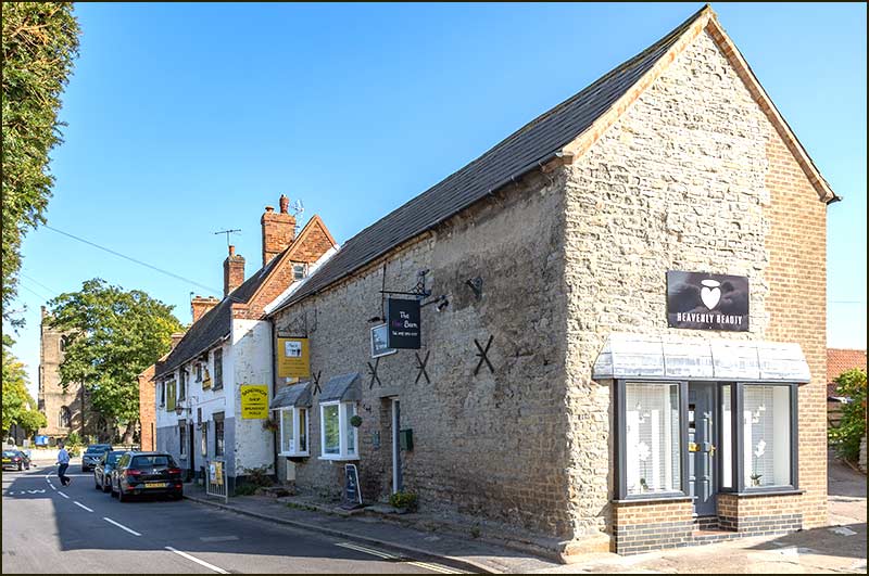
Beauty Box became Beauty Barn and now it is Heavenly Beauty. Whether Box, Barn or Heavenly, it has long been the place for Beauty on Nottingham Road. (2017)This ancient building, is now home to three modern businesses, but was once the family home of Harold Barlow, the village butcher. (2020)
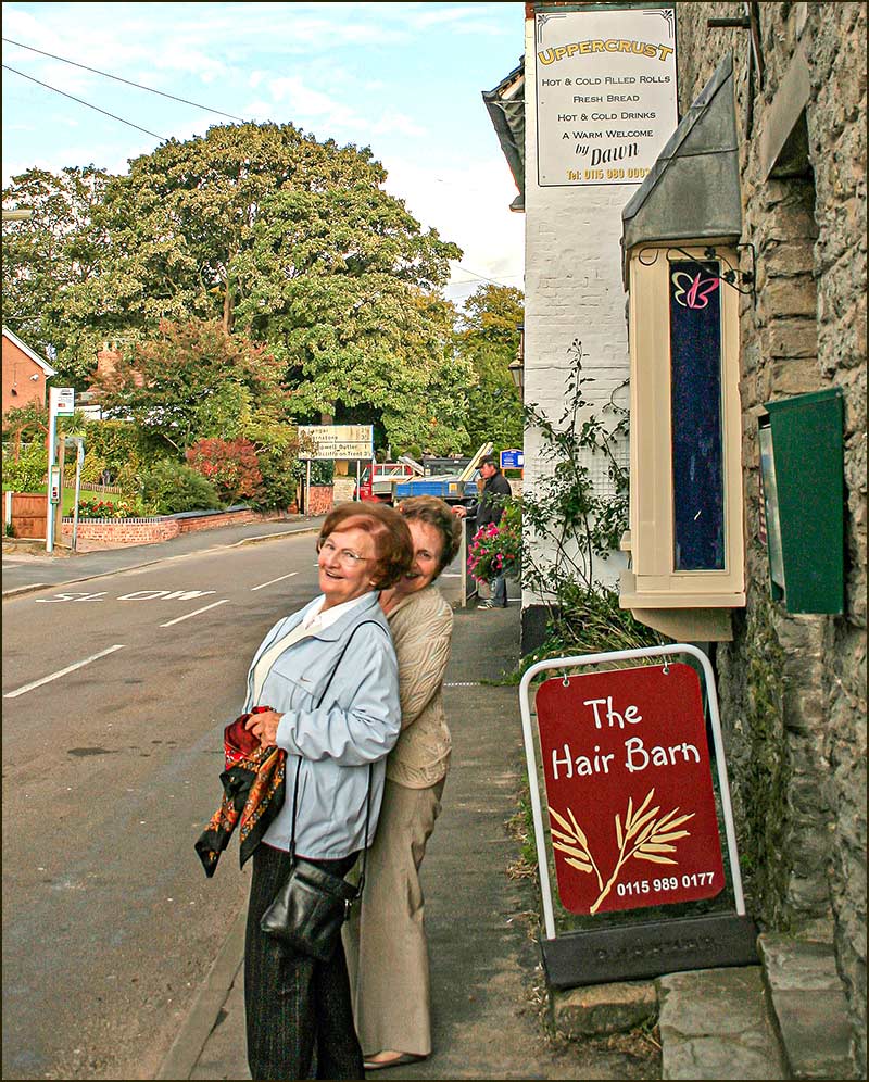
Get your hair done at The Hair Barn, (right), then treat yourself to food at Nyce, next door. (2020)The back of Harold Barlow's home in the 1970sThe staff at the Hair Barn have put a smile on the face of these two customers (2008)
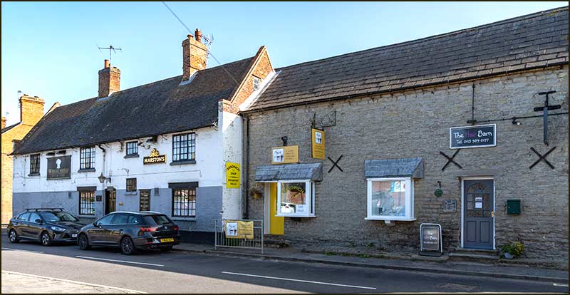
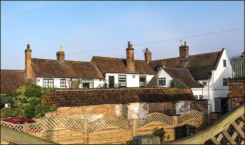
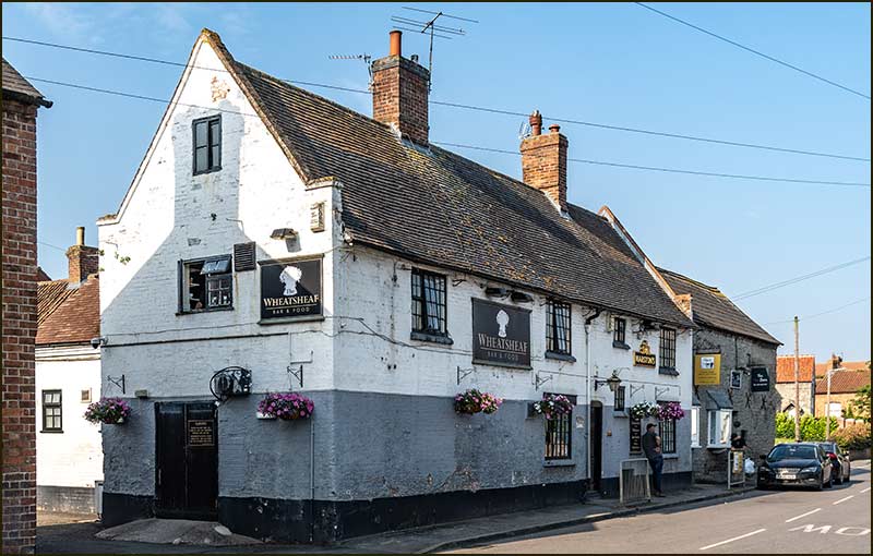
The Wheatsheaf and Nyce buildings are joined, but don't appear to have been built at the same time: can we tell which was built first? (2020)It looks like there was once a double window on The Wheatsheaf's gable end; the adjoining roof overlaps it. Also, The Wheatsheaf's gables were originally built for a thatched roof, whilst the gables on the other building were not. This all points to The Wheatsheaf being the older building. (2020)
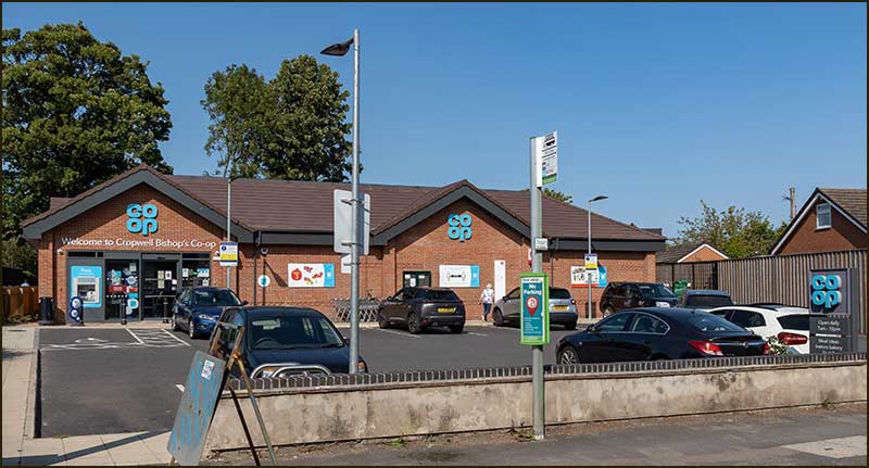
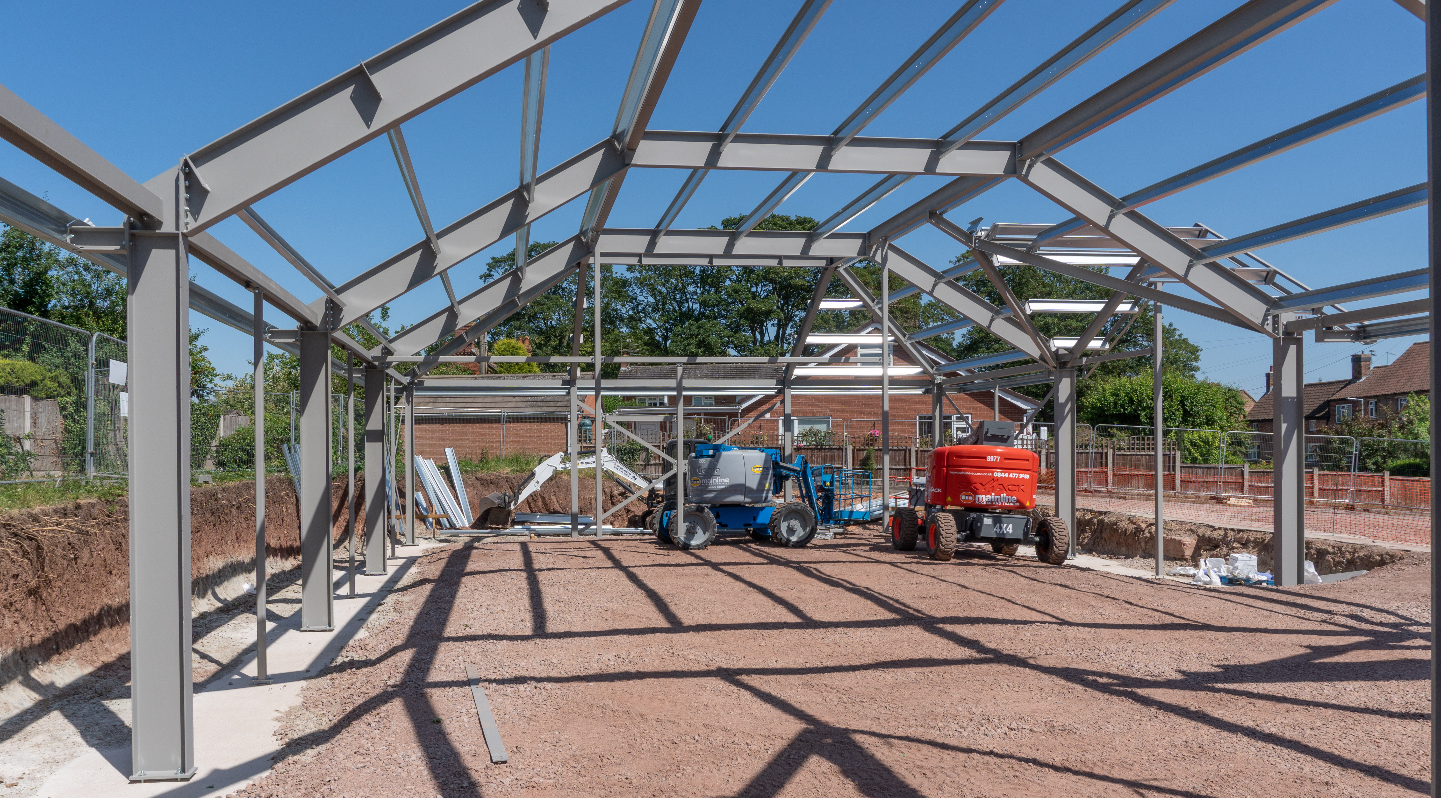
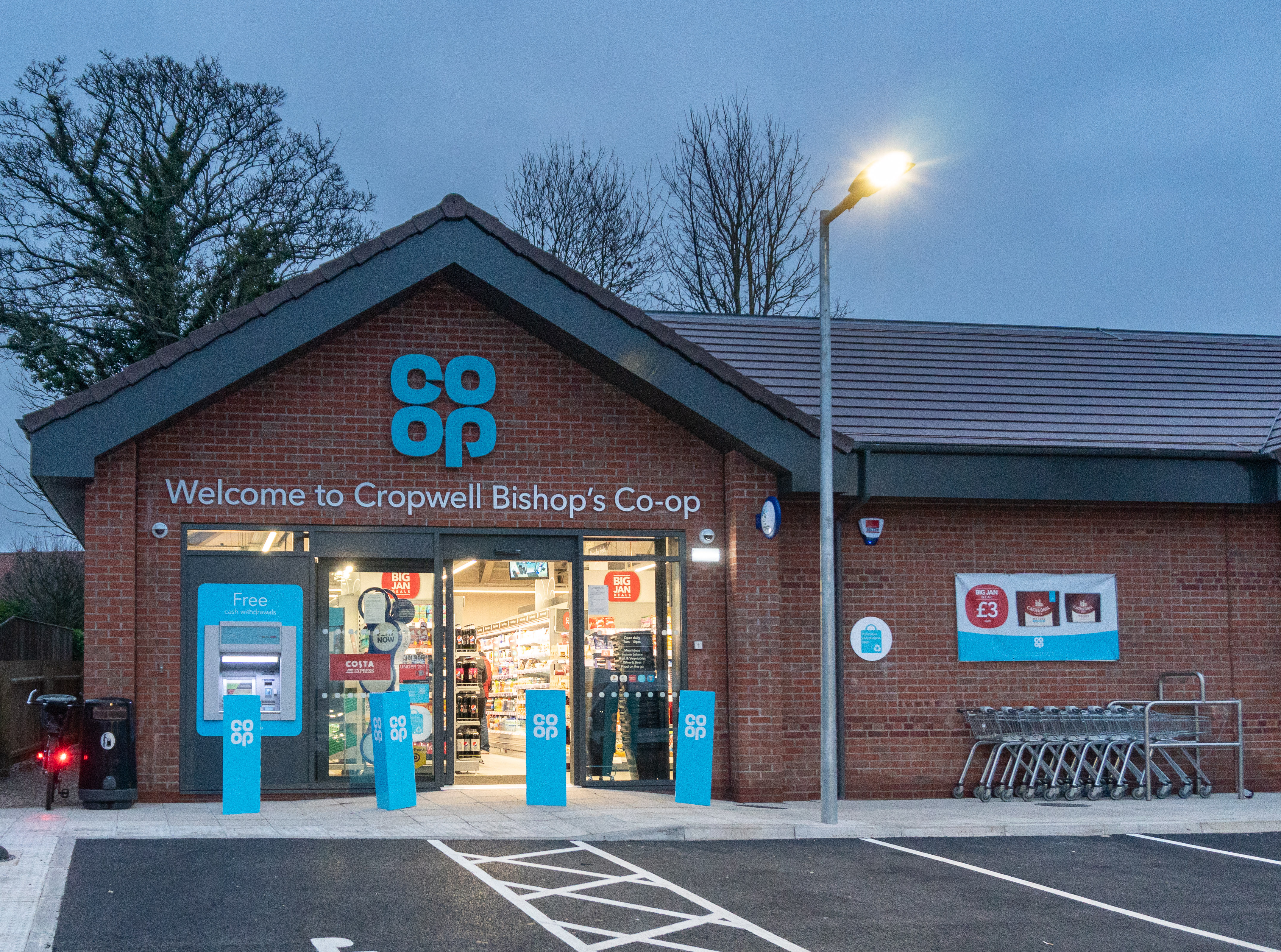
The Co-op shop moved to Nottingham Road from Church Street in early 2019. (2020)In June 2018, the frame of the building was erected: 6 months later the shop was ready for opening. (2020)
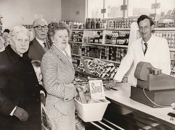
Opening Day: January 5th 2019 and the Co-op awaits its first customers.In 1960, a Co-op shop opened on this very same spot! Here is the first customer on its 'opening day'.
However, it wasn't there for long: 2 years later it moved to Church Street where it remained until 2018.
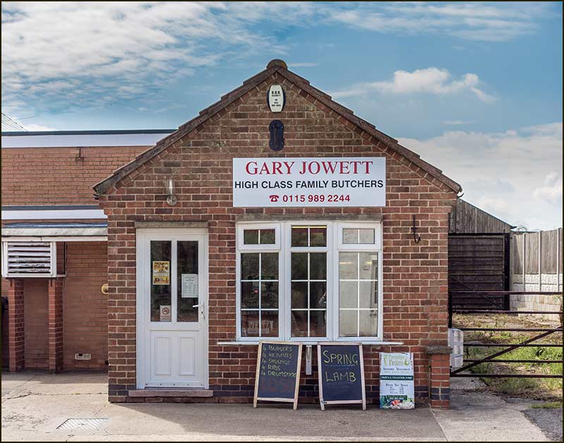
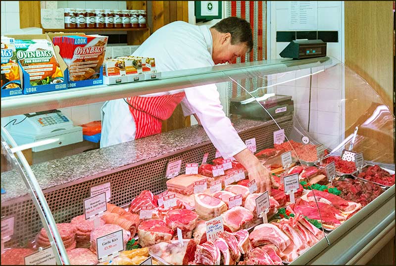
The Butchers
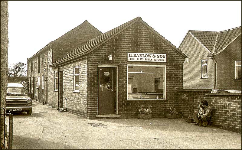
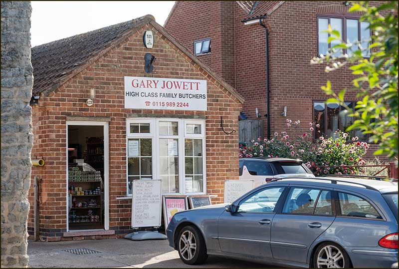
H. Barlow & Son Butchers in the 1970s. You can find out more about Harold Barlow and his son in the Barlows Close Street Story.In 2001, young Harold Barlow died and a few years later Gary Jowett took over the Shop. (2015)
Gary Jowett Butchers. (2020) Compare this photo with the 1970s photo above: notice that the earlier bungalow next door is now a house. Gary Jowett (2019)
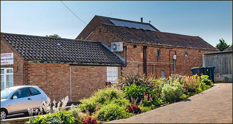
Until about 50 years ago, Harold Barlow made use of the slaughterhouse at the back of the shop, but then new regulations forced it to be closed. However, the building itself is still there. (2021)(1980s)
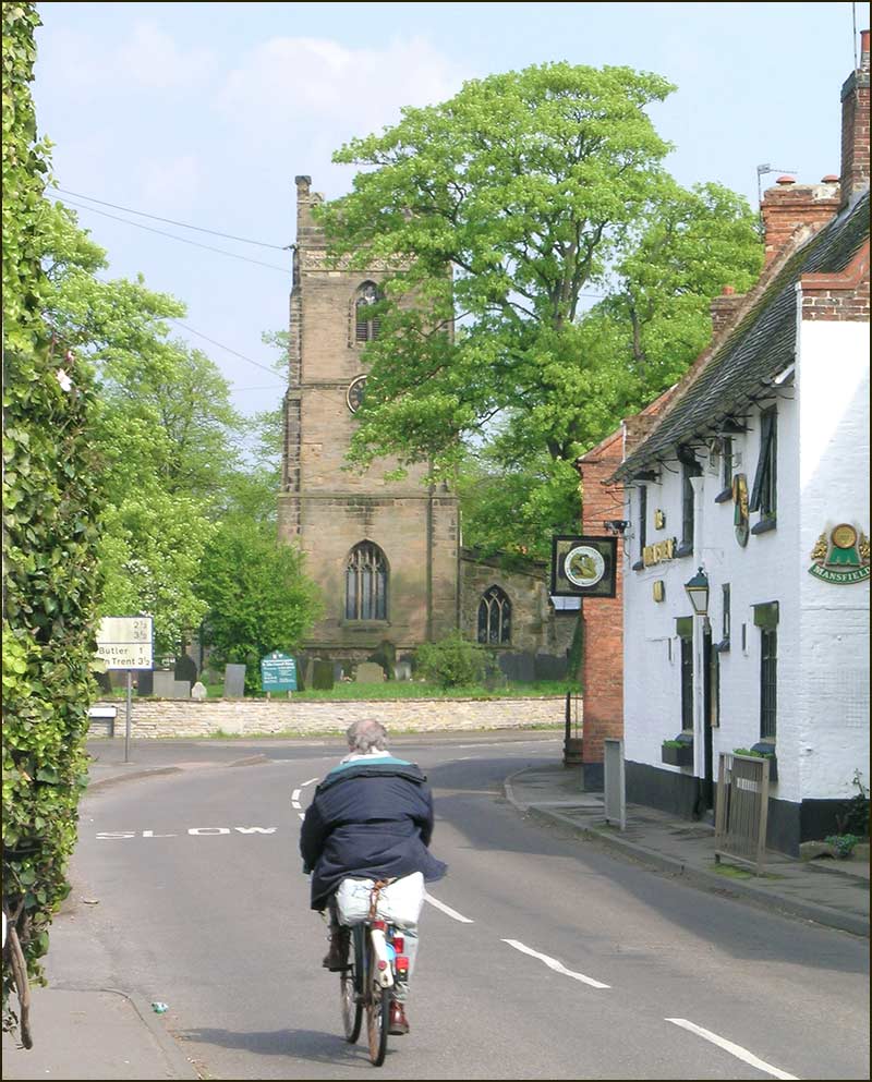
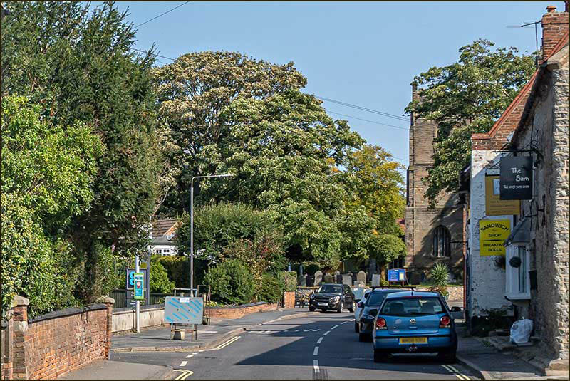
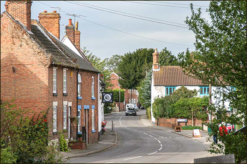
The Turn
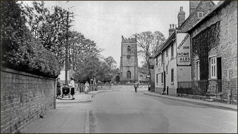
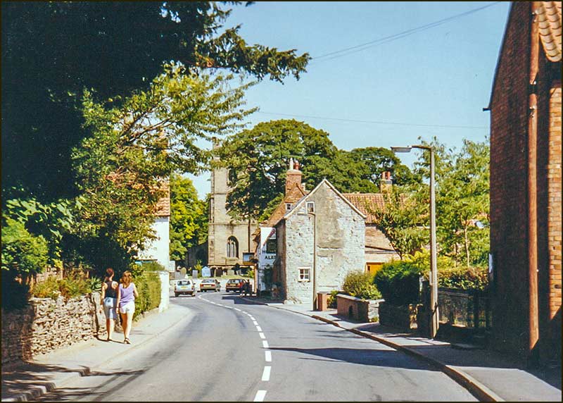
The Turn, that is the junction of Fern, Church and Nottingham Roads, has probably looked the same, more or less, for centuries.
Evidence for this comes from maps and documents.
The invention of photography, and its eventual use in Cropwell Bishop about 120 years ago, changed all that.
Now we are able to compare photos taken since that time, and search for changes ourselves. We don't have to rely upon the fallible memory of humans.
Nevertheless, the dating of old photos often relies on some detective work and can be an imprecise art.
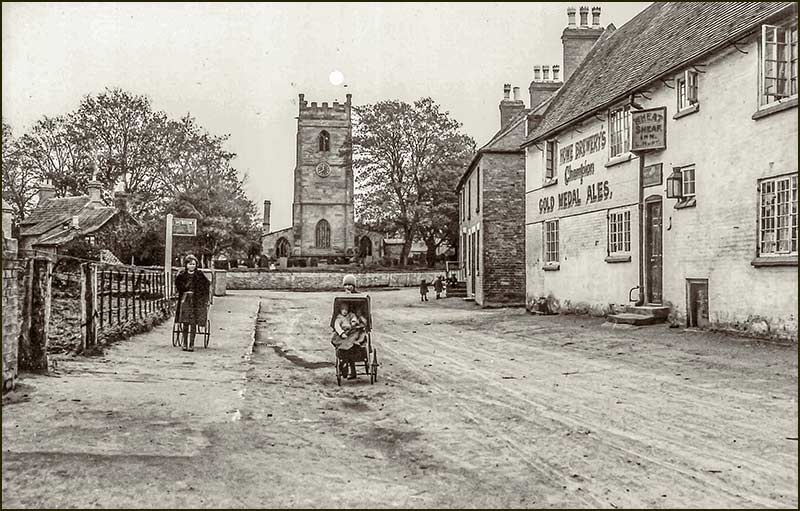
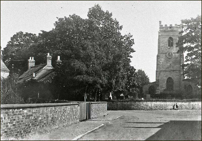
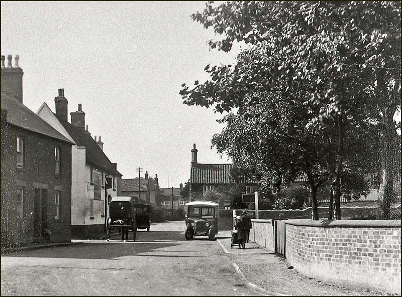
St Giles Church towers over the trees in the churchyard and, in the foreground, is a regular field: this is where the car park now is. (1910s)Girl with pram (1920s). The trees around the church are now much taller. Notice that the house on the left has had an extension built on the end. The church has a chimney, clearly visible to the left of the tower.
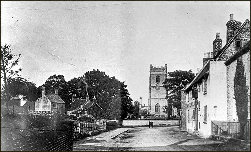
There is a wide pavement on the left, but none at all on the right. (1930s)People with a bicycle outside the Wheatsheaf. (1930s). There is scaffolding around the church chimney.
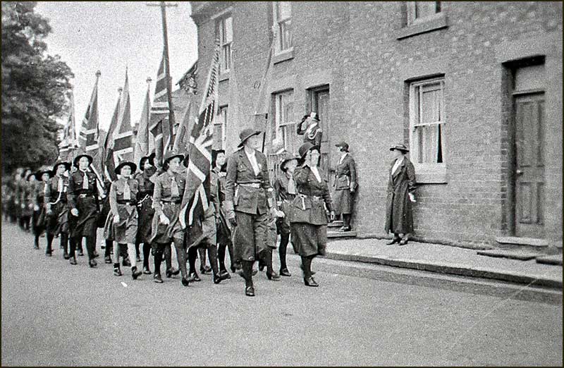
Girl Guides and Brownies parade on The Turn in the 1930s. Is the lady at the top of the steps saluting them? Are the two standing against the wall backing off from the fearsome guides? We shall never know.The very same spot today. (2021)
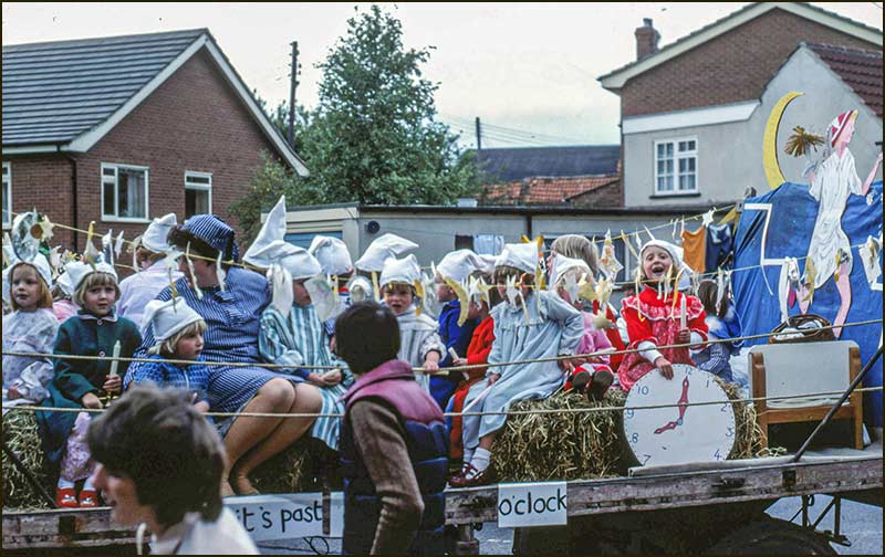
The bend round to Church Street at The Turn in the 1940s. The church no longer has a chimney but, if you walk around the church, you will find that there is still a chimney in the same location - it just doesn't have a high stack.The float, created by the Playgroup, rounds the same bend during the Village Parade in 1981.
Woman with a pram (1950s). Good pavements on both sides now and a telegraph pole has appeared on the left: it is still there today. The two daughters of Ann Mansell, who was a teacher at the Primary School, walk down Nottingham Road in 1989.
A peaceful scene in 2004.The Turn has always been a busy spot. (2008)
(2008)(2008)
(2020)(2020)
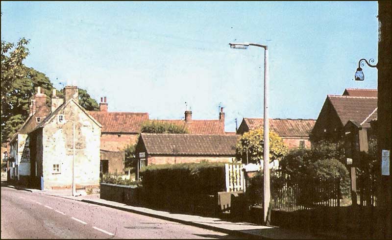
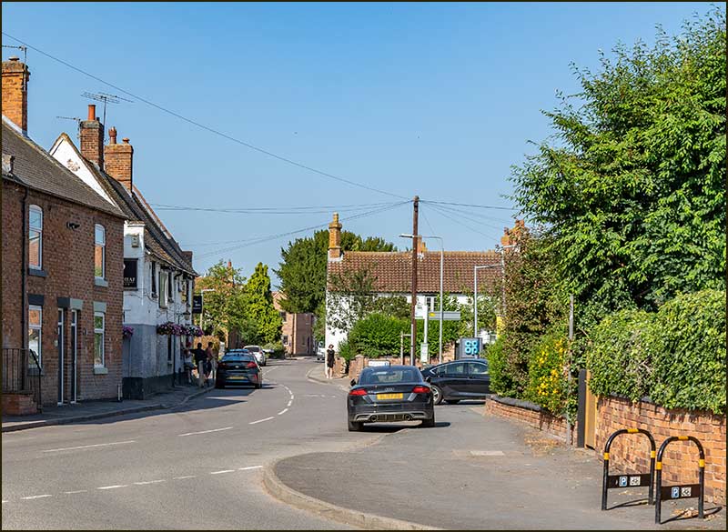
Looking up Nottingham Road from The Turn
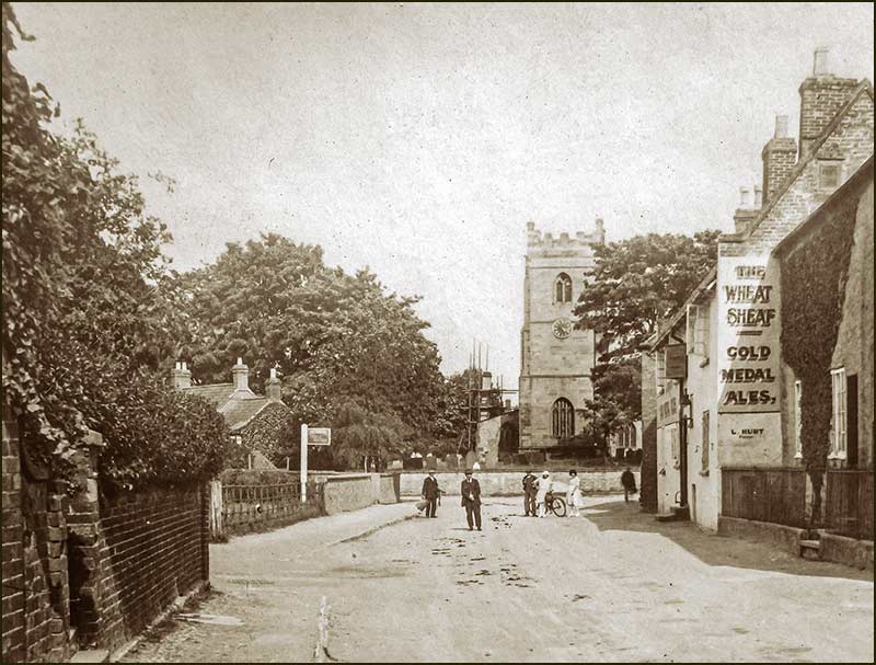
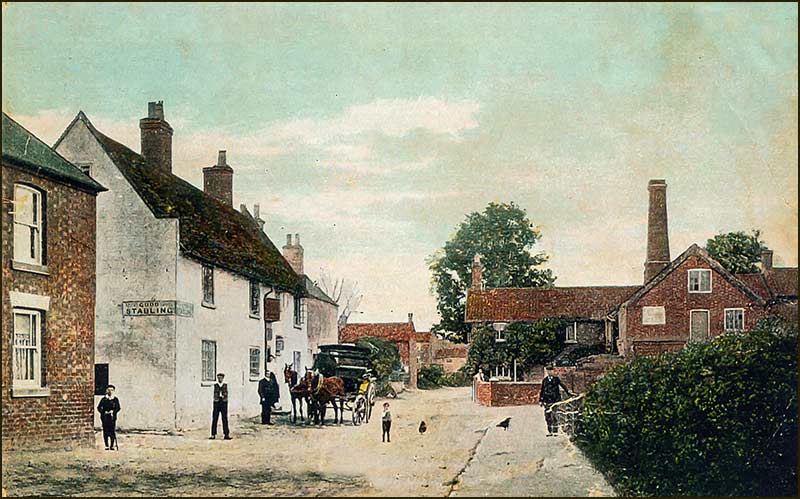
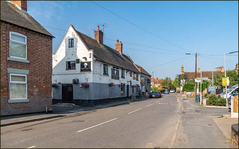
People gather outside the Wheatsheaf Inn in 1905. On the right, you can see the steam-powered mill on Mill Lane. Discover its history in the Mill Lane Street Story.Compare this photo with the previous one. Taken over a century later, the scene is still instantly recognisable. The vehicles on the road are the biggest difference. Nowadays, it is rare to see the road look like this: it is usually dominated by cars and vans, both parked and moving. (2021)
Bus waiting for passengers (1930s)(2021)
(1950s) (2006)
(1949)(1960s)
(1960s)(2019)
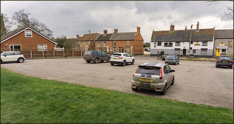
The Wheatsheaf Inn's Car Park
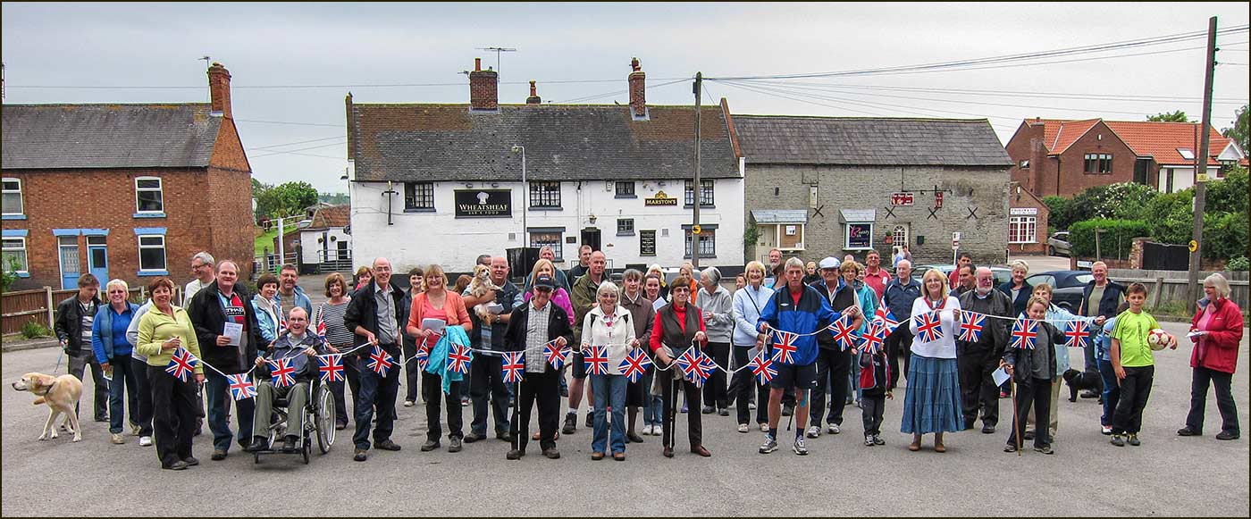
In June 2012, it was the Queen's Diamond Jubilee and there was a long weekend of events, both nationally and in Cropwell Bishop, to celebrate the occasion. First off, was a 3 mile walk to the top of Hoe Hill and then along the Grantham Canal. Here, in the Wheatsheaf's car park, villagers get in the mood before setting off.
These days, the car park is very busy 7-days a week and cannot be used for anything else. But that wasn't always the case, as can be seen by the Jubilee photo above. (2020)The Village Feast was held on the site of the car park in the 1950s. Viewed from The Wheatsheaf Inn Read all about The Feast in the Mill Lane Street Story.
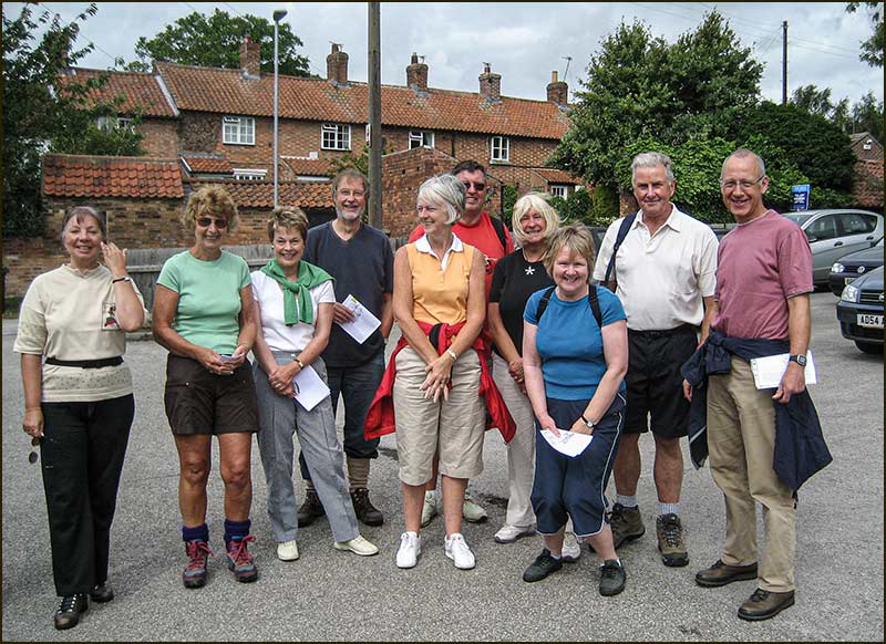
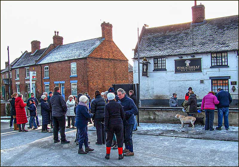
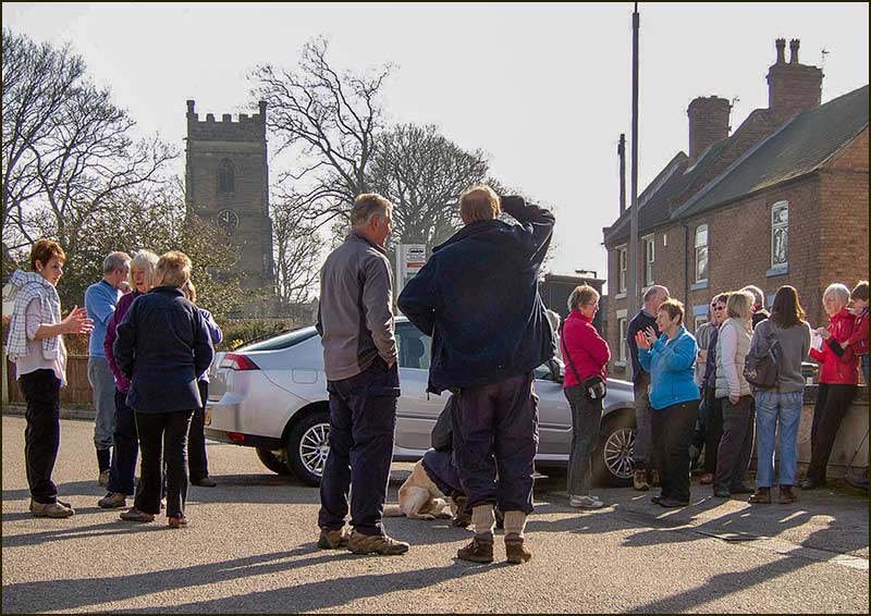
For years it was the starting point for walks with the Cropwell Bishop Walking Group. (2008)The Walking Group were not put off by a sprinkling of snow. (2010)
However, sunshine was preferred for those Sunday morning walks. (2012)A last look at the car park before the builders of the new Co-op arrive. (2016)
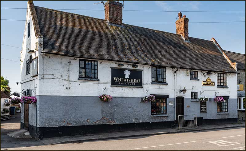
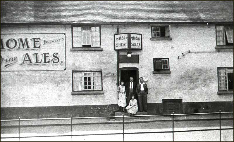
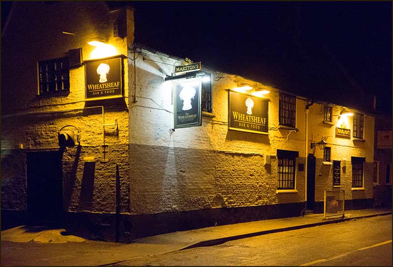
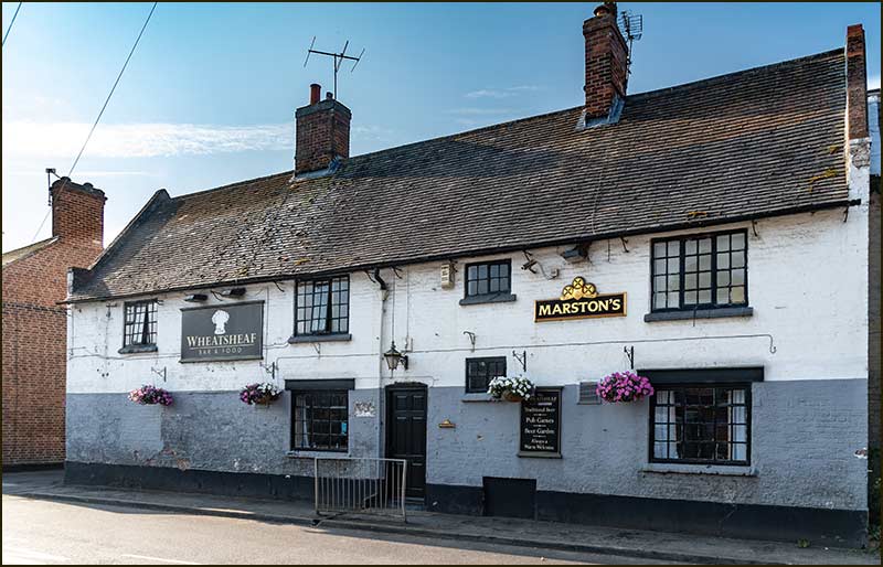
The Wheatsheaf Inn
At one time, there were five pubs in Cropwell Bishop and The Chequers Inn and The Wheatsheaf Inn are the oldest. The Wheatsheaf is many centuries old, and the present building was almost certainly built on the site of a previous one.
(2021)
Nowadays, we call it a pub, but before the days of motorised transport, it would have been a genuine inn – somewhere for you and your horse to rest overnight.
It would also have been an important meeting place for village folk. To appreciate why, you have to imagine what life was like for working families a hundred years ago.
You and your partner lived in a two-up, two-down house with as many as 8 children. Your cooking range was fired by wood, or maybe coal, and the only other heat in the house might come from a single open fire in the living room. Your toilet (in some form) and wash-house were out back, and you fetched fresh water from a spring or the canal.
Imagine a long, dark, cold evening in winter when your only lighting is from candles and the flames of a coal fire. Putting a fresh lump of coal on the fire could be distressing: it was like burning money. I recall my own grandfather putting a brick or two in the fire-grate to make the fire smaller and burn more slowly - and so save money. And he was an ex-coal miner who received a free coal allowance.
As for home entertainment, there would have been none, unless you made the effort to create it. But then, you were tired after 10 hours hoeing the fields, mining gypsum, or making bricks. Or tired from doing the housework, mending clothes, and cooking for everyone in the house.
For men, at least, the attraction of escaping to a pub with heating, lighting, drinks and the company of others must have been irresistible. For housewives, it was not an option.
The Wheatsheaf is a stones-throw from St Giles, and so the go-to place after church events, like funerals. And not just funerals. A newspaper report of a hundred years ago describes an inquest being held at The Wheatsheaf.
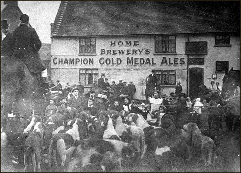
Then there were the Hunts, with horses, dogs, riders and followers who would gather in the field opposite (now a car park). All good trade for the landlord.
The Hunt, meeting outside The Wheatsheaf Inn. (1930s)
Indeed, being the landlord of a pub could be an attractive and profitable occupation. The photos we have from the 1930s when a Percy Brown was landlord, appear to support this idea.
Percy Brown watches horse and cart outside The Wheatsheaf Inn. (1930s)
Similarly, wealthy farmer Robert Smith had the Lime Kiln Inn built in 1840 and appears to have made it highly profitable.
More recently, successful footballers were also attracted to the idea of running a country pub after retirement. Tommy Lawton, a star international player with Notts County in the 1940s, took over the Magna Charta pub, in Lowdham, in the 1960s.
Pubs, everywhere, face a challenging time. Life has changed in every respect since their heyday, and it will need imagination, courage and investment to ensure their future. Our two surviving pubs are no exception.
The Wheatsheaf Inn – in the 1930s
Percy Brown (landlord) and wife at the front door of The Wheatsheaf. (1930s)Percy Brown looking out of the cellar trapdoor of The Wheatsheaf. (1930s)
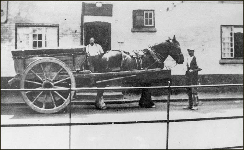
Percy Brown, Lucy Guy, Margaret Brown, Marjorie Knight and Barbara Hall with a water cart. The cart was used for carrying water from the canal before piped water came to the village in the early 1930s. Water from wells in the village was very hard because of the gypsum. The canal water was used for washing and also for brewing beer. The carts were hired for a copper (penny) or two. (1930s)Percy and daughter, Margaret Brown, outside The Wheatsheaf with a brewery lorry. (1930s)
Men drinking in the backyard of The Wheatsheaf. (1930s)In the backyard of The Wheatsheaf with landlord, Percy Brown, centre. (1930s)
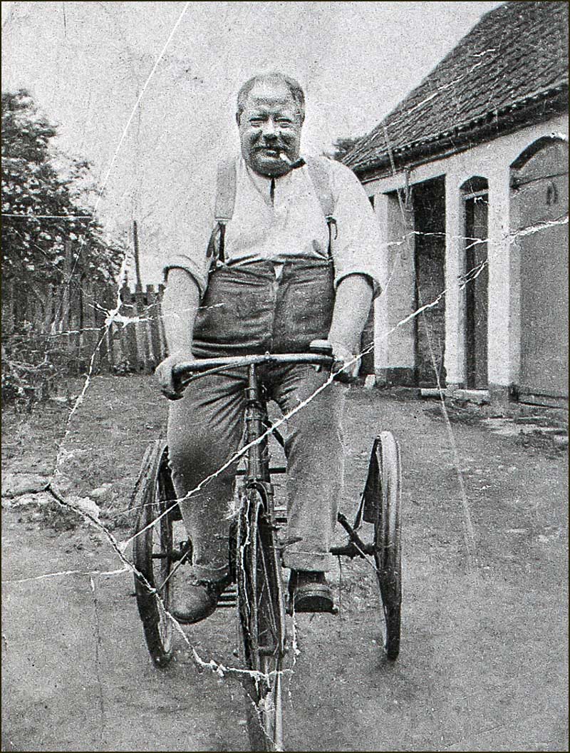
Percy Brown on a tricycle, although he doesn't look like he was a regular cyclist. (1930s)Percy Brown and Margaret with his pig. (1930s)
Mrs Brown and daughter Margaret. (1930s)Mrs Brown. (1930s)
Lucy Guy and Margaret Brown in Wheatsheaf backyard with motor car. (1930s)Mrs Brown with dogs in Wheatsheaf yard. (1930s)
Brewery delivery man at The Wheatsheaf. (1930s)Young lady in the backyard of The Wheatsheaf. (1930s)
The Wheatsheaf Inn – from 1960s to 2021
Backyard of The Wheatsheaf (1960s)The Wheatsheaf Inn (1978)
The Wheatsheaf Inn at night (2013)View of The Wheatsheaf from the fields behind. (2015)
(2021)(2021)
Thanks to Anne Terzza and Jane Jones for their help with this article.


-DSC07246.jpg)