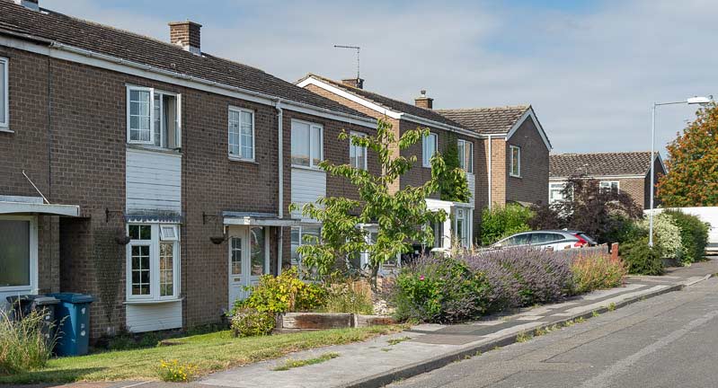
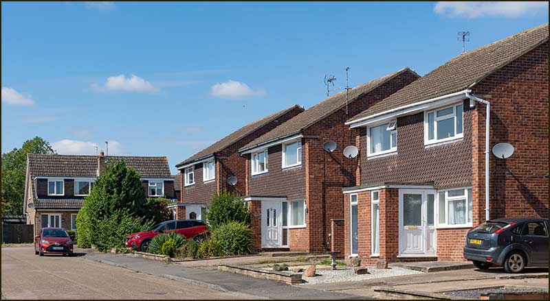
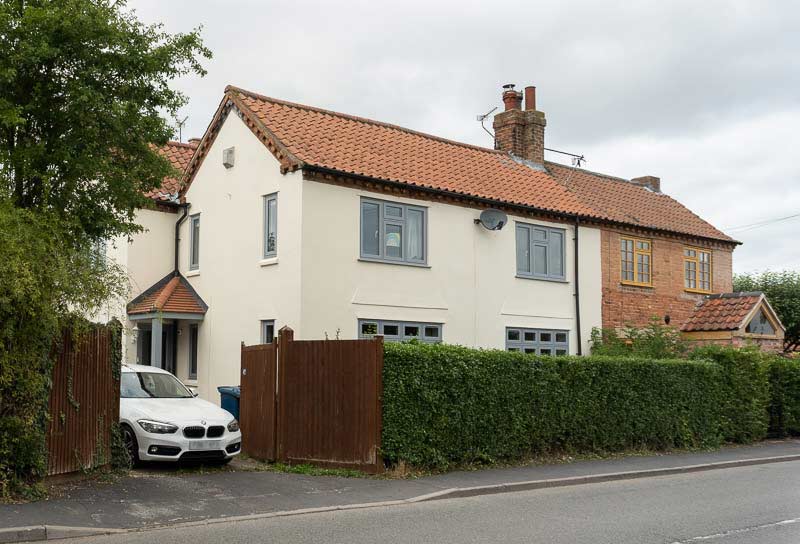
Have you ever wondered how the name of your street was chosen: No? Well, I have to agree that there are more pressing concerns in life but, never the less, I’m going to let you into the secrets of street naming.
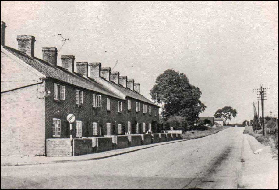
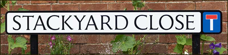
Last year Stackyard Close was opened and before that there was Kerrs Close, Shelton Gardens and Barlows Close. In the coming years dozens of new streets will have to be named, so what the process?
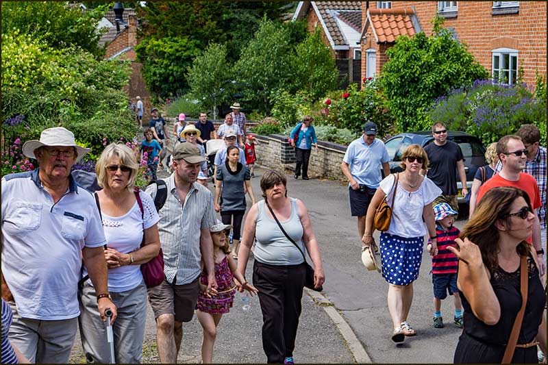
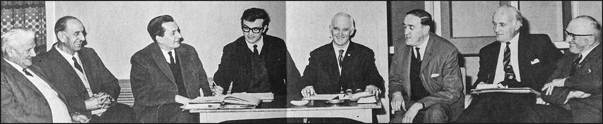
Our Parish Council is central to street naming. No doubt you have attended recent monthly meetings online using Zoom and recognise your councillors, and you have watched them discuss matters and reach decisions: No? Not to worry, you are not alone.
CBPC Meeting online - 7th July 2020
Back to street naming. The Parish Council put forward their suggestion for a street name to Rushcliffe Borough Council who, almost invariably, approve it but they may make modifications to ensure consistency within the Borough.
For example, they asked for “The Stackyard” to be named “Stackyard Close” and they would have alerted us if there was a similar name in the vicinity. Also, I believe, apostrophes are not allowed in names.
But how does the Parish Council choose a name? Well often they don’t; Cropwell Village residents do. They put forward their suggestions for consideration.
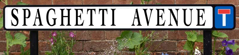
However, before you think of putting forward the name of your dog, favourite holiday resort or much-loved food, be aware that the Councillors will certainly exercise their own judgement.
Names like, Tinkerbell Way, Benidorm Close and Spaghetti Avenue are not likely to stand the test of time or be popular with some owners. Imagine selling your house and trying to attract viewers to 8 Spaghetti Avenue!
Would you like this street name?
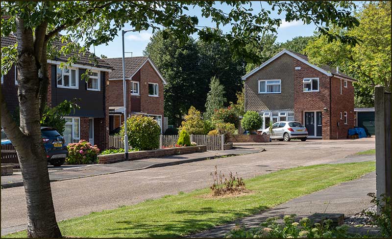
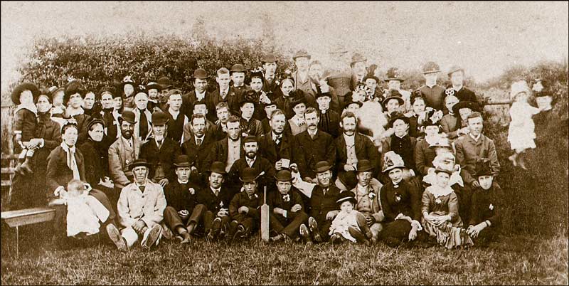
Let’s consider the history of street naming in Cropwell Bishop – there are patterns to be found.
Look at a map of Cropwell Bishop streets and one thing we discover is that many are named after people, although many of us do not recognise the names. Also, these people are all dead – another apparent restriction on street name choice.
The oldest streets follow a different pattern. Roads leading out of the Village were never chosen, they just evolved naturally; Nottingham Road, Cropwell Butler Road, Kinoulton Road and Colston Road all lead to a place (there is one outgoing road that does not). Some roads within the Village follow the same pattern, Mill Lane for example.
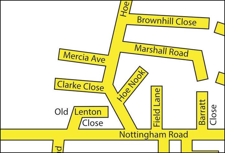
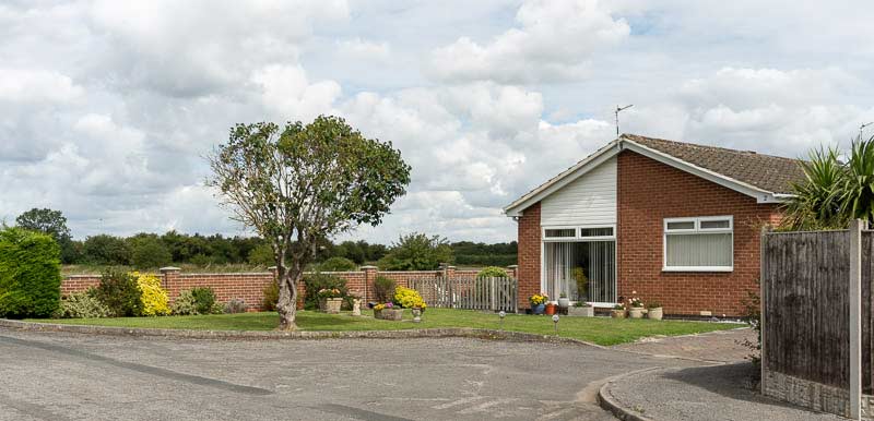
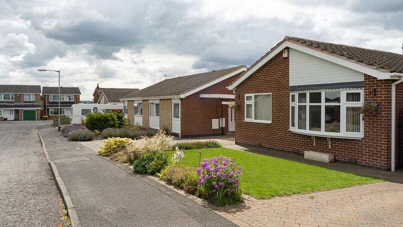
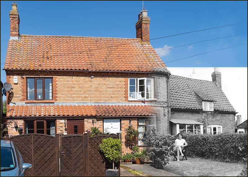
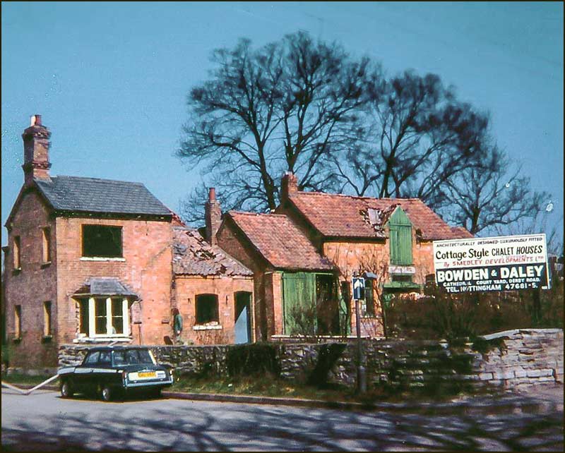
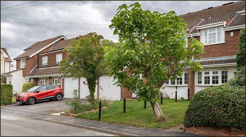
Let’s look at the streets at the southern end of Hoe View Road and also a map from 1804. These streets were named in the 1970s: can you see where the Parish Councillors got their inspiration from?
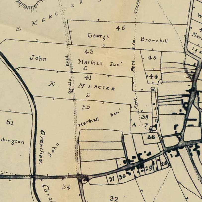
Present-day street map1804 map
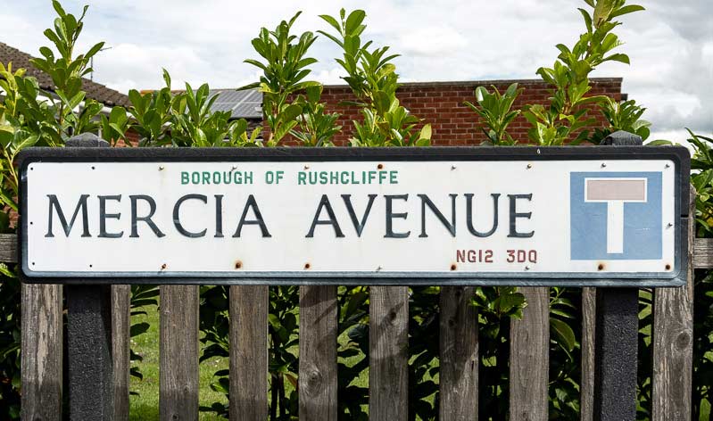
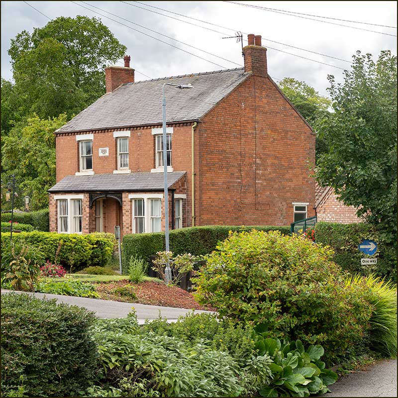
Marshall Road is on land that John Marshall Senior owned in 1804, Brownhill Close is (approximately) on land that George Brownhill owned, and Mercia Avenue is on land owned by …
Oh, there isn’t a landowner named ‘Mercia’ but there is one called ‘E. Mercier’. So Mercia Avenue was named after E. Mercier.
The councillors who named these roads are no longer here, but I think it is safe to assume that there was a good reason for the change - or maybe somebody made a mistake; we shall never know.
All the other landowners on the map were local people but Mercier was different. E. Mercier was a woman and an extremely wealthy one but she never lived in Cropwell Bishop.
She was born as Everilda Wordsworth in 1739 to rich parents in Hemsworth, Yorkshire.
By the time she was 5 years old, she had 3 sisters and a brother but then her father suddenly died when he was just 35 years old.
Her mother quickly remarried and had 3 more children with Thomas Sunderland but then in August 1749 she and her husband died just 2 days apart. She was 38 and he was 32. Everilda was only 10 years old and had already lost 3 parents.
By the time she was 30, she was married to William Stainforth in Yorkshire. Records show they were a wealthy couple but they had no children. In 1784, when Everilda was 45, William died.
In 1790 she married wealthy Frenchman, Francois Mercier, and they lived in Southwell. In 1803 Francois died.
Everilda held in trust substantial land, Leasehold and Freehold in Cropwell Bishop which, after her death, would go to other members of the family.
Everilda eventually went to live in Soissons, France where she inherited her late husband’s real and personal estate and she died there in 1815 at the age of 76.
It is ironic to think that a woman as rich as Everilda Mercier is remembered in name by one of the smallest streets in Cropwell Bishop – and even then, her name is spelt wrongly.
Her wealth may have bought her comforts, but she seems to have experienced more than her fair share of sorrow.
Tony Jarrow
Note:
Particular thanks to Anne Terzza and Pam Barlow for their help with this article.
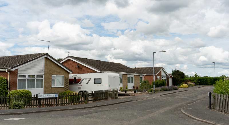
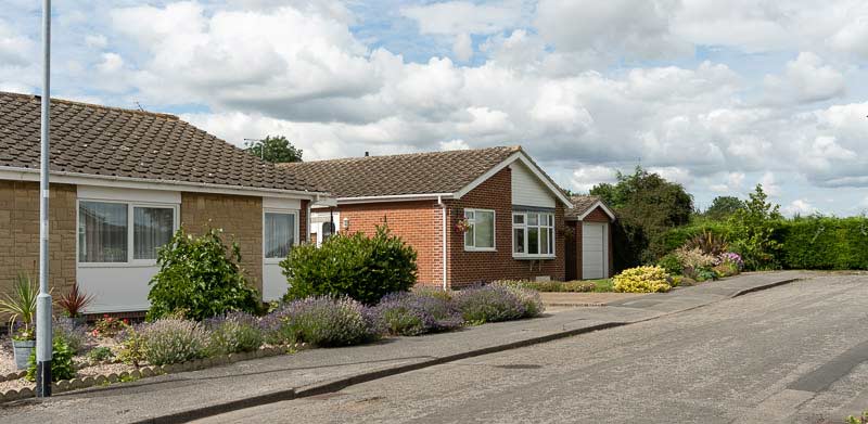
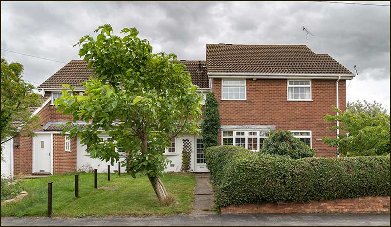
Here is Mercia Avenue today. I wonder if current residents would prefer the more accurate, French sounding name, Mercier Avenue.
Turning into Mercia AvenueOn the way up Mercia AvenueTop end of Mercia AvenueLooking back down Mercia AvenueView from the top of Mercia AvenueClear view of Hoe Hill
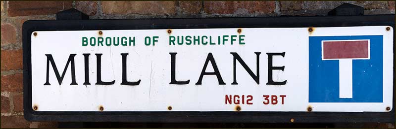
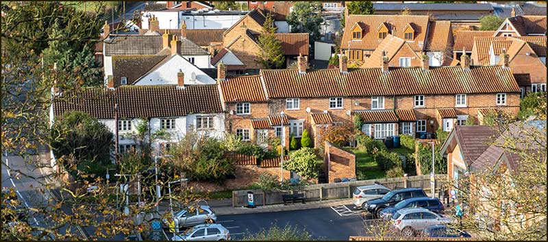
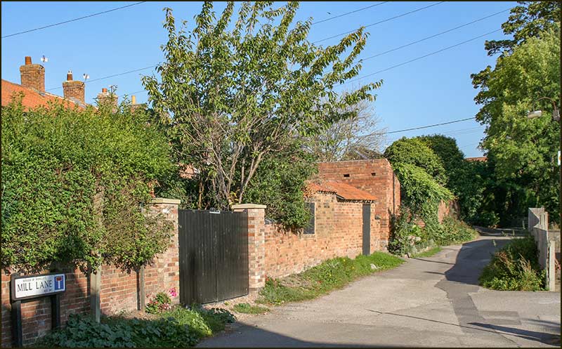
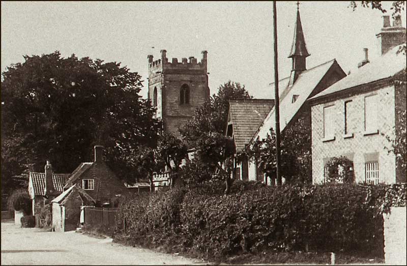
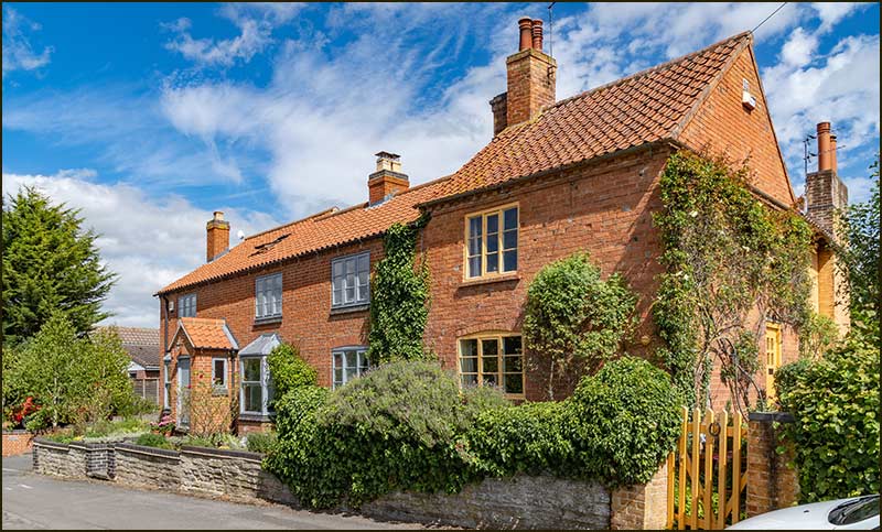
Cropwell Bishop Streets: — Mill Lane (4-12-20)
Mill Lane is one of the old streets of Cropwell Bishop and like all the old streets, it didn’t need anyone to decide on its name, it just evolved.
Nottingham Road leads to Nottingham, Kinoulton Road to Kinoulton, so you would assume that Mill Lane once led to the village windmill – if only it was that simple.
The Mill
Cropwell Bishop did once have a windmill but it was built on a windy hill-top rather than lowly Mill Lane, but more about that in another street story.
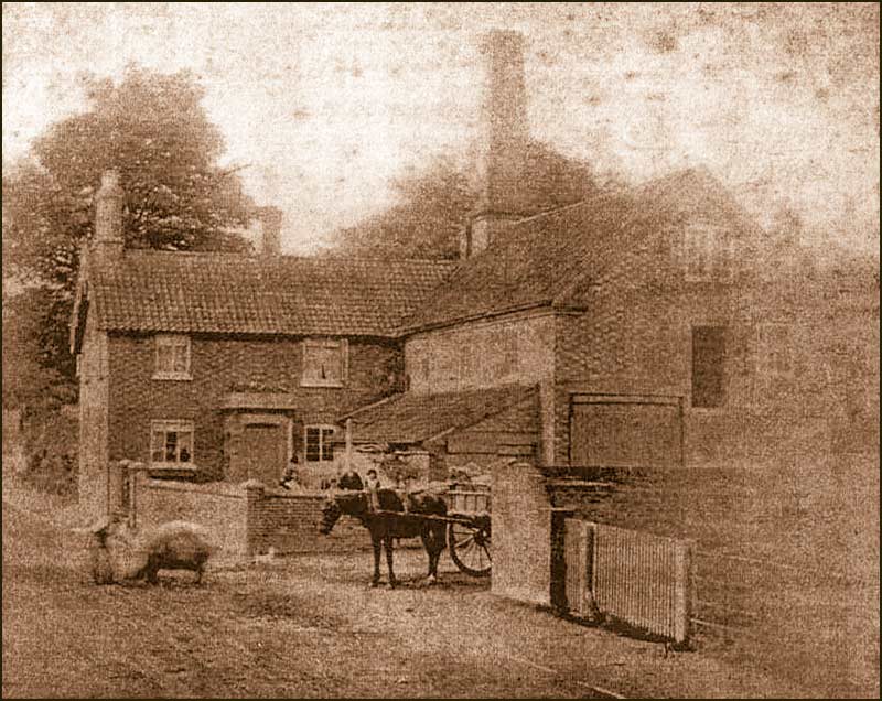
Nevertheless, there was once a mill on Mill Lane, but it was powered by steam rather than wind.
The steam-powered mill was built in 1860 by a man named William Saxton. He was a wheelwright and had move to the village ten years earlier.
He lived at a house that already existed (number 6 Nottingham Road) and built the mill onto the side of it. He even included a bake house in the building.
Inevitably, the house became known as Mill House and the cottages as Mill Cottages.
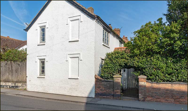
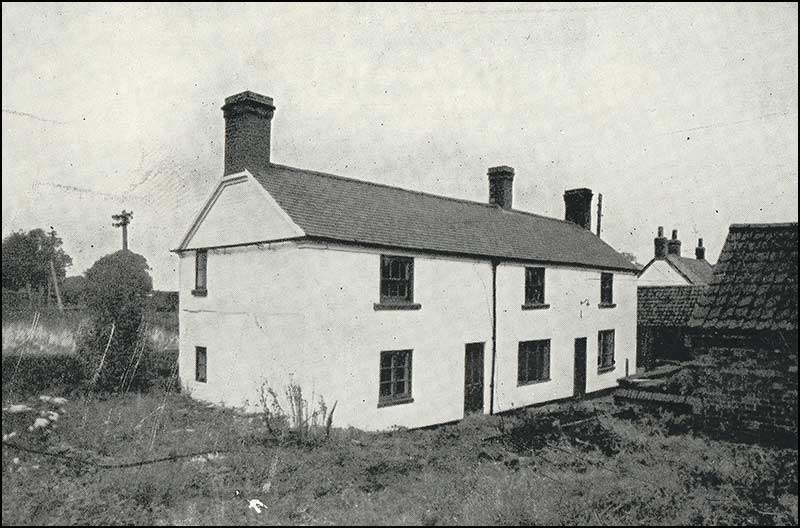
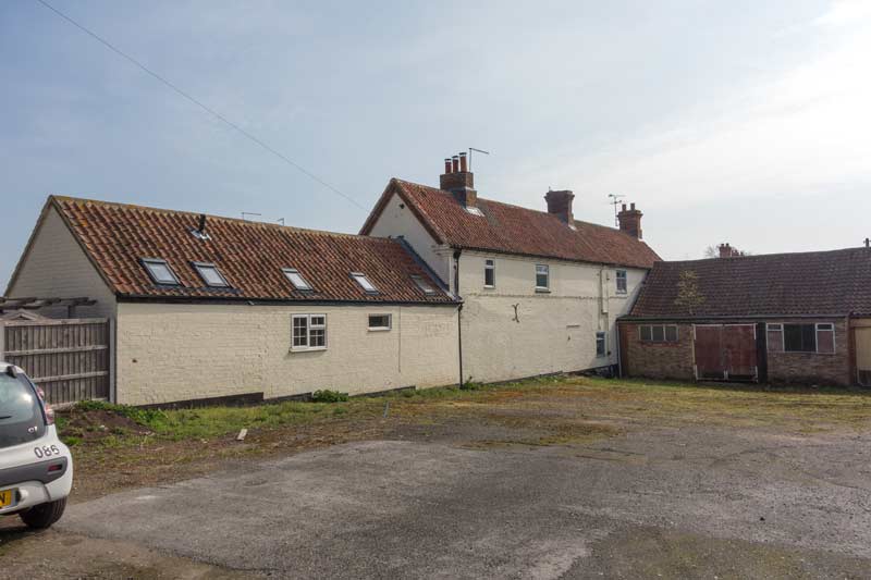
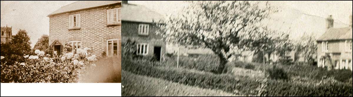
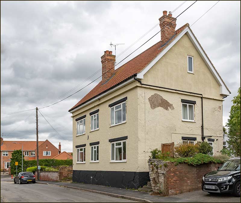
This old photograph shows the corn-mill butting out from the house with its chimney at the rear. The house is easily recognisable as being, essentially, the same building that stands there today. Since being painted, it it has been called, The White House.
The steam powered corn mill in the late 1800s
Saxton was described as a ‘maker of agricultural implements’ in the 1861 census, but this venture shows that he was far more skilled and daring than the average maker of cart-wheels. At the time, his steam mill was the only one within 10 miles of the village.
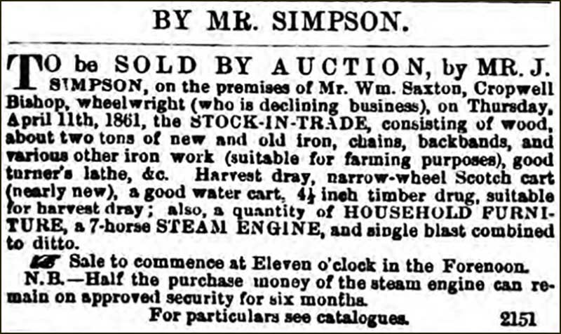
Nevertheless, in April 1861 we find him selling by auction, all of his wheelwright business.
Advert for auction of Saxton's wheelwright business and a steam engine in 1861.
This is puzzling. However, I notice that the auction does not include the house or the corn mill. I wonder if he was selling his earlier wheelwright busines to enable him to concentrate on corn milling. He was selling a steam engine, but maybe this was a prototype than he no longer needed.
What we do know, is that 10 years later the mill was taken over by an Edward Wileman who came from Long Clawson.
Some 30 years after this, in the late 1890s, the mill was again taken over, this time by John Billings. He was assisted in the mill by his nephews, George Johnson and Ernest Johnson.
By 1904, the steam-mill had been working for over 40 years and the technology had proved itself safe – or so it seemed.
On Tuesday 2nd February 1904 its boiler exploded. This is how the event was described in the Grantham Journal:
“On Tuesday morning, about half-past ten, a serious accident occurred at the Steam Mill, occupied by Mr Billings. The boiler of the engine burst and wrecked the engine-house and premises.
Mr Billings and his nephew, Ernest Johnson, were in the mill at the time, and both were scalded and hurt by the debris.
Mr William Harrison, however, received the most serious injury. He was in front of the boiler, and was badly hurt by the falling bricks and scalded by the steam. How he escaped death is miraculous.
Bricks and tiles were hurled great distances, but, fortunately, fell without doing further damage.”
It is thought that the explosion was the result of a 'weak boiler plate'. All three men eventually recovered from their injuries.
For a time, John Billings and his wife, Ellen, lived at a crook cottage (details, later) further up Mill Lane.
In the 1911 census, when he was 76 years old, he classed himself as an 'old age pensioner' and was living with his wife and nephew, George, at Ivy Cottage near the canal bridge on Nottingham Road.
Following the explosion, the mill was never repaired. In 1918 a Mr Thompson took over the house. He was a newcomer to the village – an officer returning from the First World War – and had the mill’s ruins cleared away.
He also had the bake house and rear part of the mill repaired with a new façade, and incorporated into Mill House.
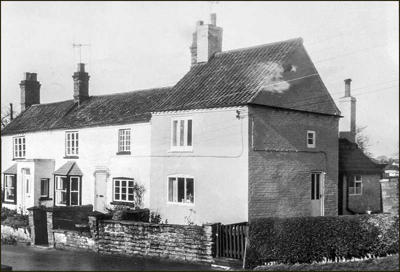
The old Mill House, now called The White House (2020)1804 map showing Mill LaneThe loft of The White House today. The lower gable suggests that the original house was much older than the adjoining terrace. In the front garden there is still an underground cistern which would have held about 4000 gallons of rainwater for the steam engine.
A past resident of The White House that many people will recall the sight of, if not the name, was Noelle Gullick.
She and her husband bought the house in the 1950s when he started work as a mining engineer at the newly opened Cotgrave Coal Mine.
Decades later, when an elderly widow, she would be regularly seen driving in or out of Mill Lane in her low-down, Triumph Spitfire sports car.
The brick garage, at the end of Laurel Cottages, was small, but big enough for her pride and joy. The garage is still there, but not the car – or Noelle.
Name Changes
Now that you know about the corn-mill, you might think it only natural to call the street, Mill Lane. But events in villages are not always natural: the influence of people is much stronger than that of steam-engines.
In oldest known name of the street is Hallams Lane. We can trace Hallams back to 1751 and they have lived here ever since then – plus Hallems and Hallums, which were probably misspellings.
It think it is safe to assume that members of the Hallam family lived on the street and so it became known as the, ‘lane where the Hallams live’, or simply, Hallams Lane.
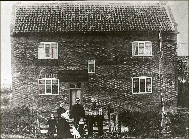
By the late 1890s, Hallams were no longer living on the street but John Billings was operating the corn-mill. Just a few years later, in the 1901 census, the row of terrace cottages adjoining the corn-mill were referred to as, 'Billings Row', but far end of the street was called Mill Lane.
Ten years later in the 1911 census, Billings Row is still mentioned, but now the far end of the street is called Billings Lane.
This demonstrates how, in olden days, street names were often the result of local-knowledge and preferences, and could easily change.
Today, we all know it as Mill Lane, a name that began to be used after the Second World War. I can't see this name going out of fashion, in spite of there being no mill in sight,
Postal workers, sign makers, map makers, TomTom and Google can all sleep easy.
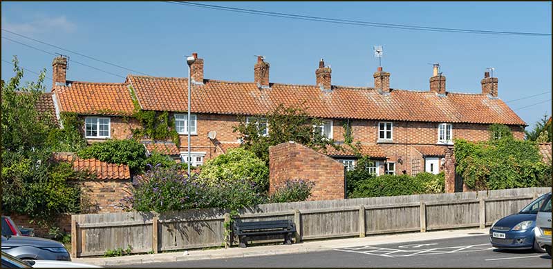
As for the terrace cottages, well, if they are referred to by a name at all, it tends to be Laurel Cottages.
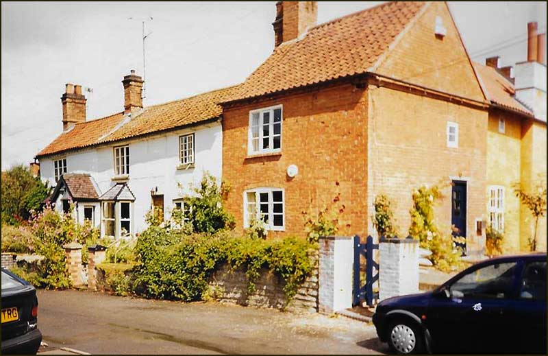
Mill Lane (2020)
An interesting fact about Laurel Cottages is their numbers. At one time they were numbered from 1 to 7 but then, as more homes were built on Mill Lane, they were given the odd numbers from 1 to 13.
The owner of 13 thought it an unlucky number, so simply changed it to 15. The home beyond accepted the change and became 17. This leaves everyone happy as long as there are no parcels for number 13 – that would be unlucky, or would it.
The photograph below shows Mill Lane and its cottages in 1949; not so different to today really.
A view of Mill Lane from the church tower in 1949. Looking beyond, you can see the chimney of the Cotton Brickworks that lay beyond Kinoulton Road1970s photo of cottages 9 and 11
View from the church tower in 2019
Laurel Cottages (2020)Mill Lane (2020)
One resident of Billings Row in 1911 was a nine-year-old boy named Aubrey Harper. I am not sure which house he lived in but the 1911 census shows that he was there with his parents and older brother and sister.
He is known to many local people as the author, along with his wife Ethel, of the booklet, 'Chronicles of Cropwell Bishop'. It is a book I regularly refer to when preparing these street stories.
Beyond the Cottages
At the top of Mill Lane are two old cottages.
The two adjoining cottages, numbers 8 and 6, were once three. Until the 1960s there was another one on the right, described as a crook cottage.
The crook cottage, on the right of number 6, was demolished around 1960. (in this image, a photo of the crook cottage is merged with the present-day cottages)
The crook house can be seen on the right, at back of this photo taken from Nottingham Road in the 1950s.
It was called a 'crook' cottage because its roof was supported by pairs of curved timbers, plus a cross beam to hold them together. The word, crooked, is derived from crook. So too, is hook.
The top-end of Mill Lane in the 1970s. On the right-hand side, note the long, black, wooden bungalow that once stood where the end of Smiths Close is now.
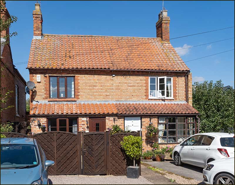
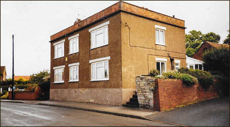
At the top end of Mill Lane stands a house that now has the name, Orchard Farm.
Number 10, Orchard Farm house
Before the 1970s, the view beyond here was of open fields and Hoe Hill.
View from the church tower in 1949. In the middle distance, on the left, are the out-buildings at the bottom of the garden of number 6 Mill Lane1930 map of the centre of Cropwell BishopThe top end of Mill Lane in 1960s. Photo taken from where Barratt Close is now.
Cropwell Bishop Feast
Where the Co-Op and its car park now stand, was once a large patch of flat grassy land. It was useful for staging the odd village event – such as the annual Village Feast.
In Medieval times, it was custom for the parishioners to commemorate the founding of their parish church each year by having a feast or festival.
This custom lapsed for many years but was then revived in the 20th Century and took place on the first Sunday after the 12th September.
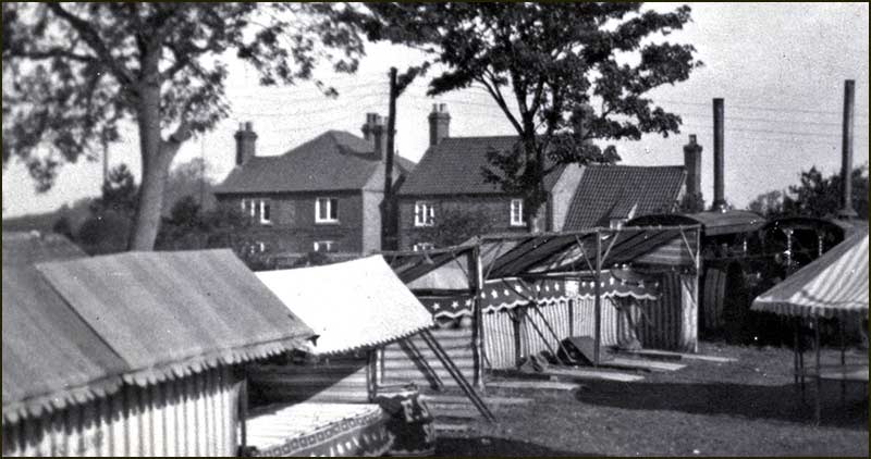
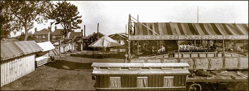
View of the Feast fairground from the Wheatsheaf (1950s)
Festivities would begin on the Saturday and continue over Sunday, Monday and Tuesday.
Feast in the early 20th Century
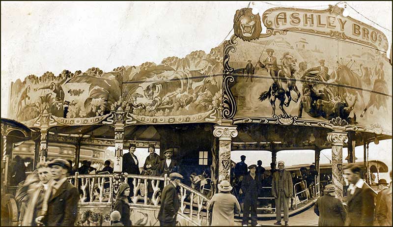
Visiting showmen brought roundabouts, swing-boats, coconut shies, cakewalk and hoopla.
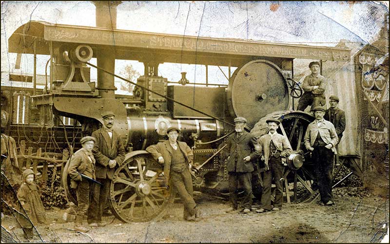
Magnificent traction engines set up in the paddock opposite the Wheatsheaf and also on the paddock near the Chequers.
The roundabout was illuminated by electricity from a dynamo driven by a traction engine, and a small engine provided the power for turning the roundabout and the organ blaring music. Paraffin flare lamps lit the side shows.
Cropwell Feast was brought to the village by the Ashley family in the latter years.
Feast in the 20th Century
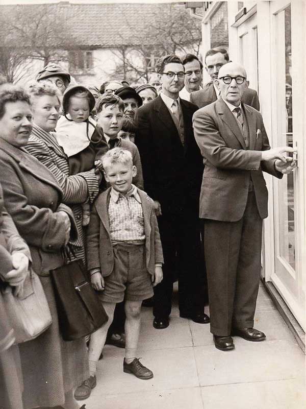
The Feast moved from this site to the Memorial Hall field in the late 1958. The reason for this was that a Co-Op shop was to be built on the land.
If you are new to the village, that last sentence has probably confused you: let me explain.
The current Co-Op store was opened two years ago. But in 1960, the same thing happened, a new Co-Op was opened on the same spot. It was there for only a couple of years before moving to Church Street where it stayed until 2018 when the present Co-Op was opened.
The 'new' Co-Op being opened in 1960. In the background are the Laurel cottages on Mill Lane.
During the 1960s, mass entertainment, TV, foreign travel and cars had a profound effect on everyone's life and traditional village entertainment struggled to survive. By the early 1970s the traditional Cropwell Feast was no more.
In spite of being a short lane with only a handful of homes, Mill Lane has enjoyed a colourful history. It remains at the centre of the village and always will do.
Anyone living there hardly needs to remove their slippers if they want to pop out for food, drink, prayer, snack, hair-cut, or beauty treatment. Can't be bad.
Tony Jarrow
Note:
Thanks to Anne Terzza, Pam Barlow, Jonathan Good and Jane Jones for their help with this article.
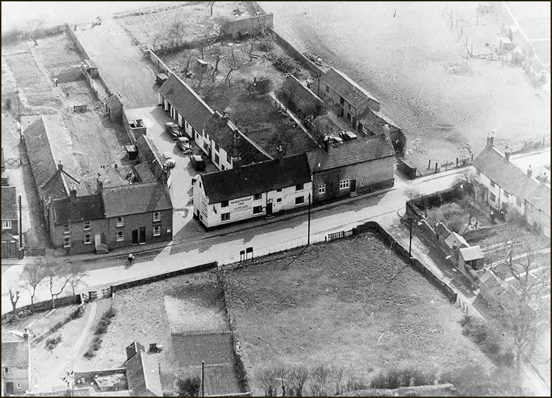
The Wheatsheaf and the field used for the Feast (1958)
More photos of Mill Lane
Mill Lane from above (2016)
Looking down Mill Lane (2020)Laurel Cottages (2020)Laurel Cottages (2020)Little Lane, which connects Mill Lane with Church Street (2020)17 Mill Lane (2020)2 Mill Lane (2020)19 Mill Lane (2020)4 Mill Lane (2020)
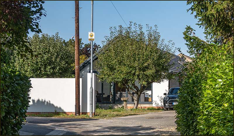
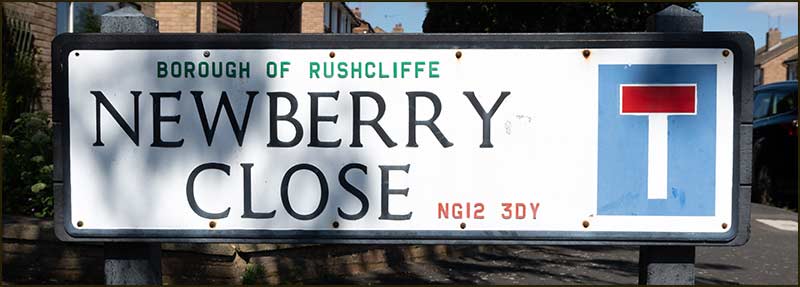
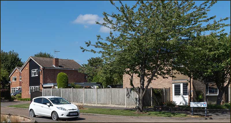
Cropwell Bishop Streets: — Newberry Close (2-9-20)
Whenever I see the street name, Newberry Close, I imagine a small, sunny, Close with mountain ash trees clothed in red berries. I had always assumed this was what the people who named the street had in mind too. How wrong I was.
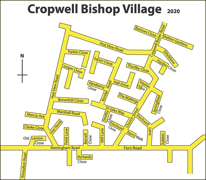
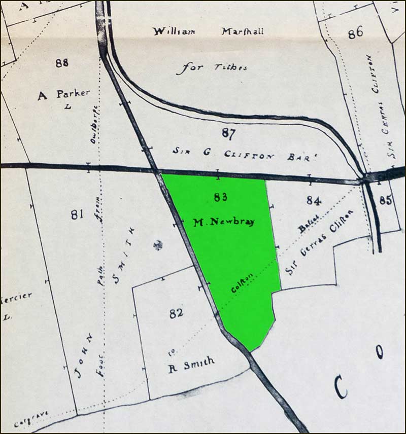
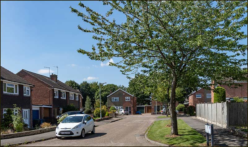
Look at a map of the village and you will see that, more or less, Newberry Close is at the centre of Cropwell Bishop. All the other streets around it were named at the same time and they are named after people or places.
When you think about it, it stands to reason that, in all likelihood, Newberry Close was also named after someone. But if you don’t think about it – then it was named after trees with berries.
2020 street map of Cropwell Bishop
Where does the name Newberry come from?
Many of the street names can, with a bit of research, be quite easily associated with at least a family if not a person.
They were people who lived in Cropwell Bishop – often for many generations. They worked here, they owned land or ran businesses here: they had history and it was written down – somewhere.
All, it seemed, except Mr/Mrs/Miss Newberry.
Ask the Parish Councillors who made the decision, you are probably thinking. I thought the same, but none are living in this village – or, in all probability, 'in this world'. The decision was made nearly 50 years ago.
Ask other people who might know – but none did.
Parish Councillors would very likely have referred to the names of past landowners in Cropwell Bishop.
Did the councillors get the names from a map?
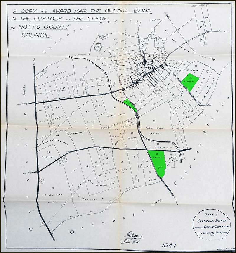
I have a digital copy of an 1804 map that shows the landowners in Cropwell Bishop at that time. I have often looked at it in recent months but not, it seems, closely enough.
Here is the map:
1804 Landowners Map
You may not be able to read the names but you can see the outlines of many fields in the parish. All but the smallest contain the name of the person who owned or farmed it.
Many names are associated with street names but the name of Newberry is not there. But 3 fields do contain the name ‘Newbray’ – I have coloured them in.
Here is the biggest of the 3:
Field owned by M. Newbray
But ‘Newbray’ is not ‘Newberry’: more research was needed.
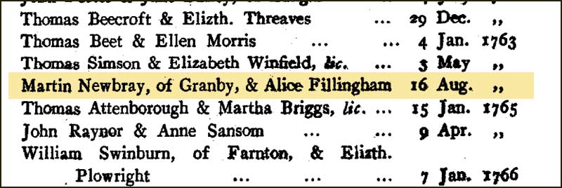
Online searches did reveal a man named Martin Newbray who lived near Granby 300 years ago but he appeared to have no link with Cropwell Bishop.
Other searches listed a Martin Newberry being married at Tythby at this time but the listing was not backed up with evidence.
After a great deal of searching, ultimately on a 17-year-old CD of Church records, the original listing of the marriage at Tythby was found.
Record of Martin Newbray's marriage to Alice Fillingham in 1763
It proved the man's surname in the online listing had been copied in error: it was not 'Newberry' but 'Newbray'. This fitted in with our 1804 map if not our street name.
Martin Newbray may never have lived in Cropwell Bishop, but he did travel to Tythby to marry Alice Fillingham, a girl from Cropwell Butler.
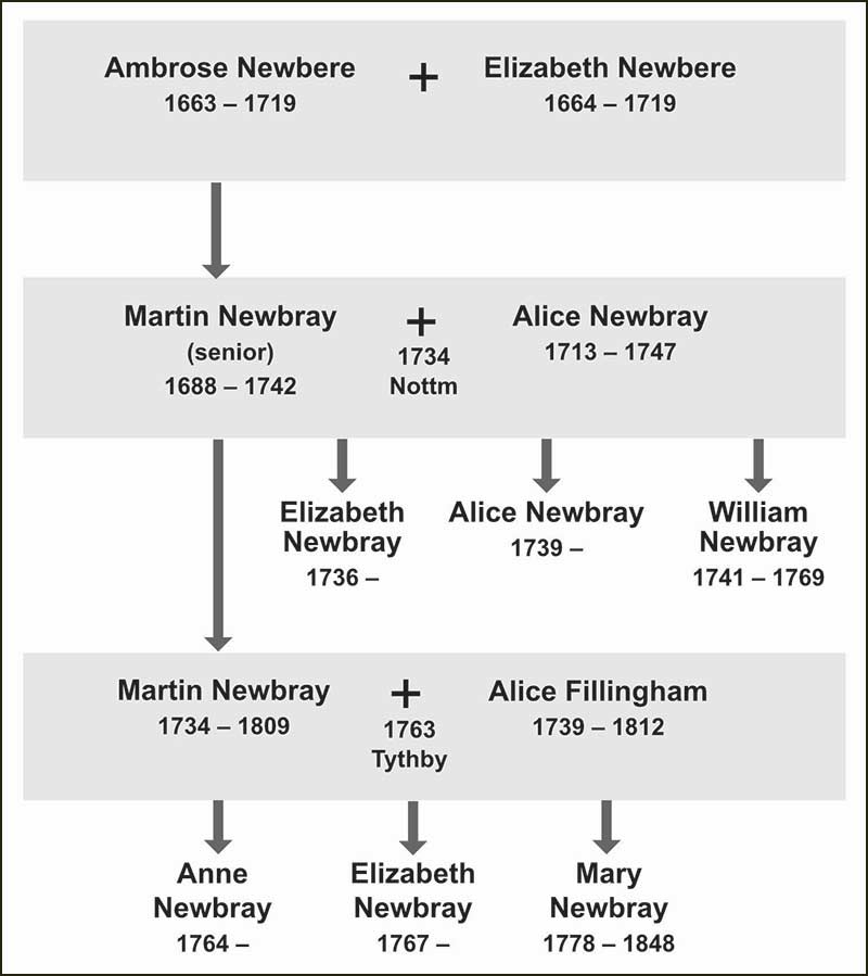
Newbray Family Tree
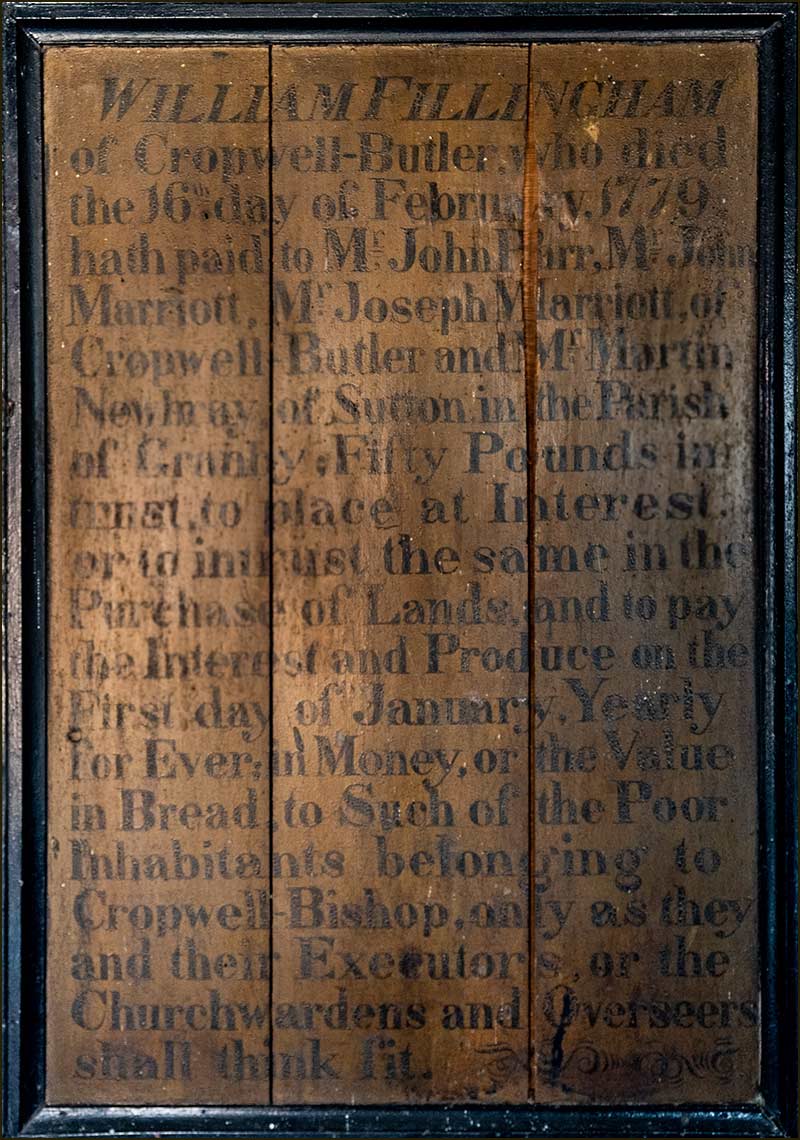
The name of Fillingham crops up in our village history.
In the Parish School Room on Church Street there hangs an original wooden plaque that is 240 years old and once hung in the church. It reads:
“William Fillingham of Cropwell Butler who died the 16th day of
February 1779 hath paid to Mr John Parr, Mr John Marriott, Mr
Joseph Marriott of Cropwell Butler, and Mr Martin Newbray in
Sutton in the Parish of Granby; Fifty Pounds in trust to place at
interest, or to intrust the same in the purchase of Lands, and to pay the Interest and Produce on the First day of January, Yearly for Ever; in Money or the Value in Bread to such of the Poor Inhabitants belonging to Cropwell Bishop, only as they and their Executors or the Church wardens and Overseers shall think fit”.
1779 Wooden Plaque mentions M. Newbray
This plaque proves a link between the Fillingham family to M. Newbray on the map.
In Tythby church there are two, almost identical, plaques to the one pictured above, but for the Poor of Cropwell Butler instead. One is in the name of William Fillingham and the other is on behalf of his daughter, Mary, who died 2 years before William.
William's wife had already died so, as he approached his 80th year, with his unmarried daughter dead, maybe he saw this as a useful way of distributing his wealth.
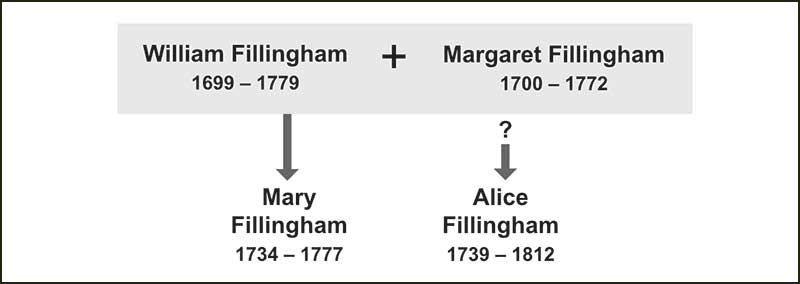
This leaves one question unanswered: was Alice Fillingham the daughter of William Fillingham? I think they must have been related and, in all likelihood, Alice was his daughter.
Census records did not begin until the 1800s but gravestones go back much further.
William Fillingham has closer links to Cropwell Bishop than even the plaque suggests: he and his wife were buried here: so was his daughter.
Fillingham Family Tree
So, we have identified the M. Newbray on the 1804 map as Martin Newbray who married Alice Fillingham from Cropwell Butler.
Although he doesn't appear to have been a 'big name' in Cropwell Bishop, his association with the Fillingham family, who did support 'the poor' here, does raise his status. High enough to be remembered by a street name?
But we don't have a 'Newbray' Close, we have a 'Newberry' Close!
Did the Parish Councillors in 1970 make a mistake with the spelling or did they choose to use a different spelling?
Could such a thing have happened: we know it could.
The Street Story for Mercia Avenue revealed a similar happening. Mercia Avenue was named after another landowner on the 1804 map, E. Mercier (sounds the same, but different spelling).
Maybe the Councillors wanted to simplify/update the spelling of names.
To sum up, we can confidently say that Newberry Close is named after Martin Newbray who was born in 1734 and died in 1809 at the age of 75.
He lived his whole life in the tiny village of Sutton which is near Granby.
He owned three small fields in Cropwell Bishop as the result of a gift to the 'Poor of Cropwell Bishop' by William Fillingham. William was from Cropwell Butler but lived his final years in Cropwell Bishop.
You could argue that Fillingham Close might have been a more fitting name for Newberry Close but then you wouldn't have visualised ‘trees with berries’ as you walked down it!
Tony Jarrow
Note:
Thanks to Anne Terzza, Pam Barlow, Rachel Mitchell (Rev), John Spence and Hilary Jarrow for their help with this article.
Newberry Close in 1999
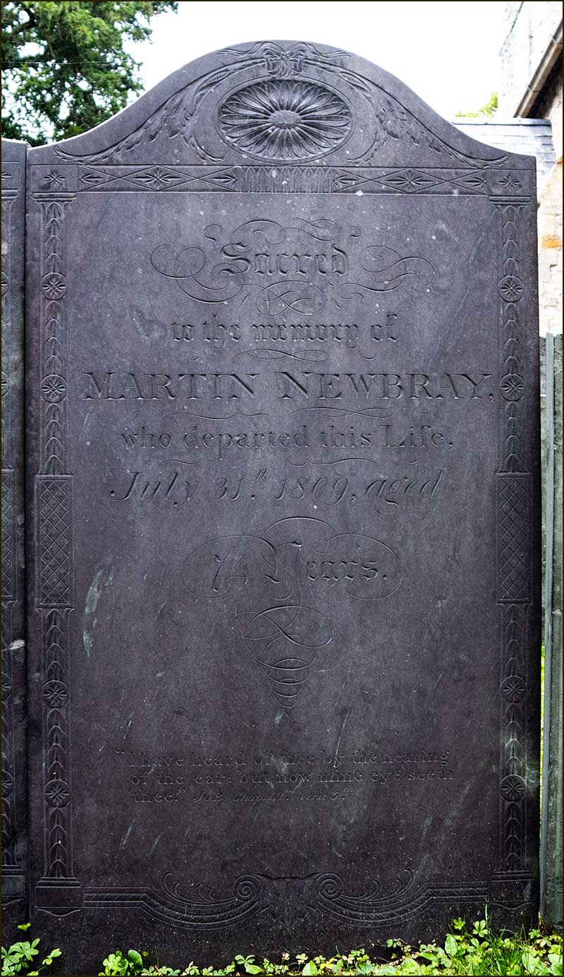
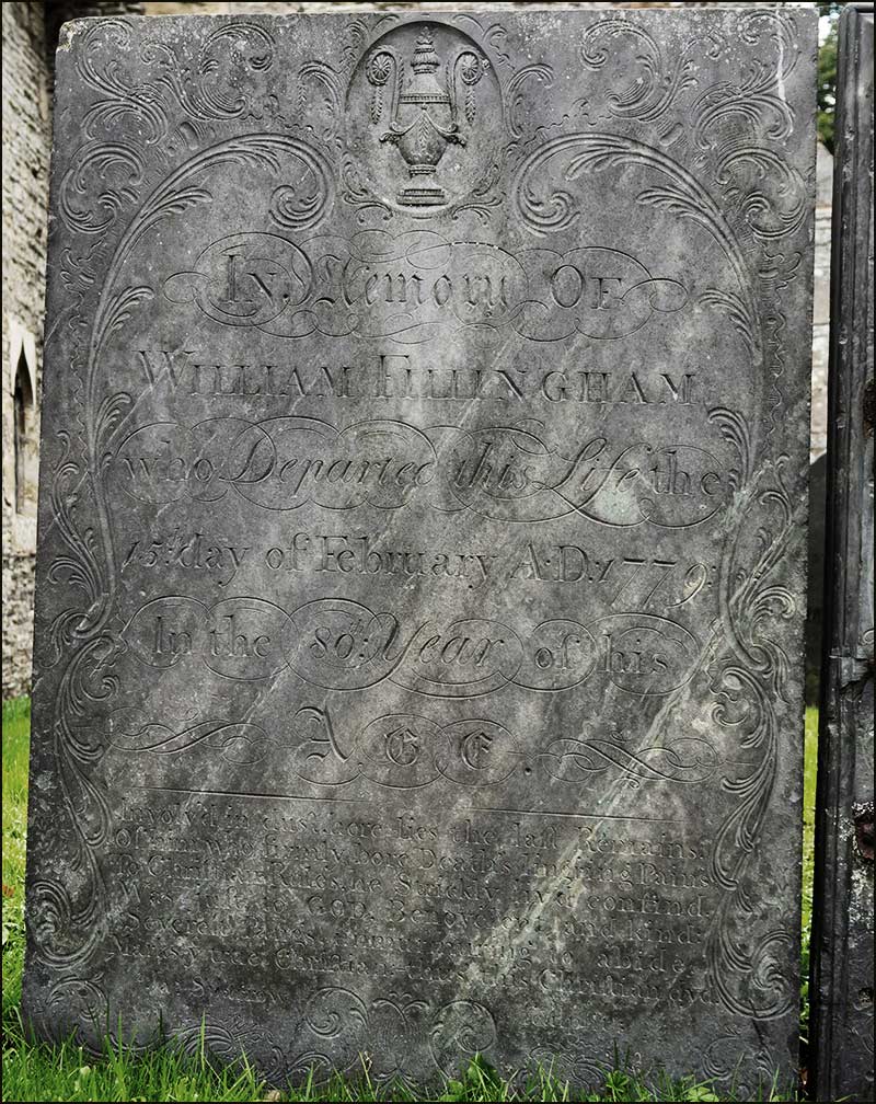
Headstone of Martin Newbray, 1809, in GranbyHeadstone of William Fillingham, 1779, in Cropwell Bishop
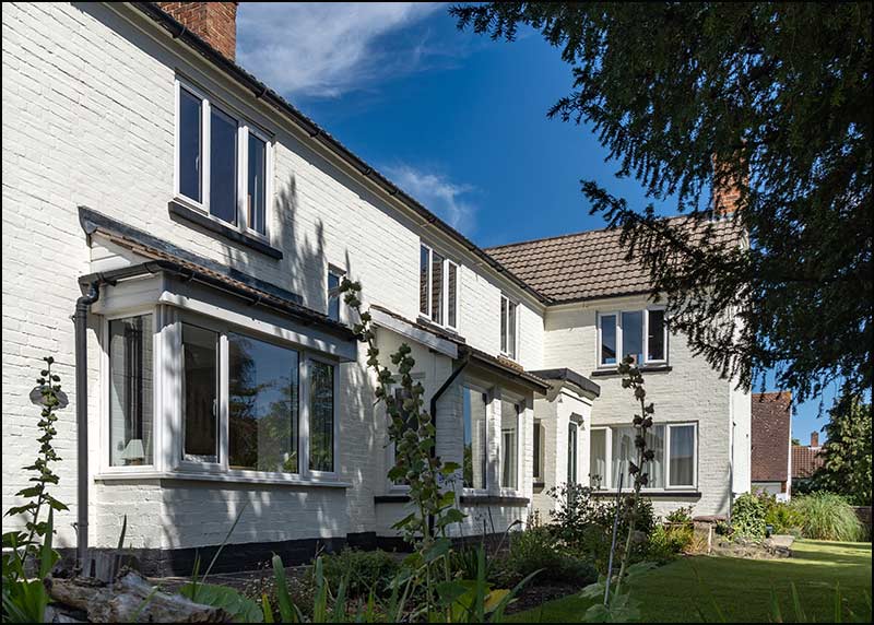
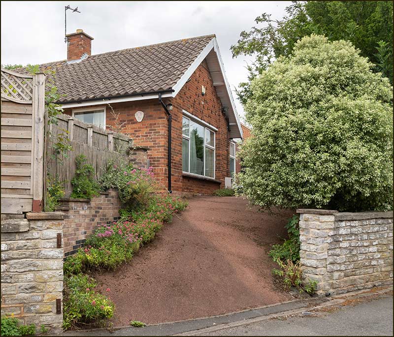
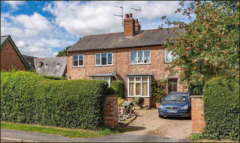
This is Newberry Close today (August 2020).
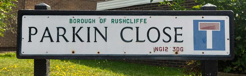
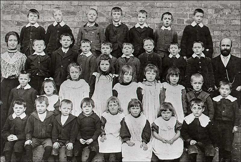
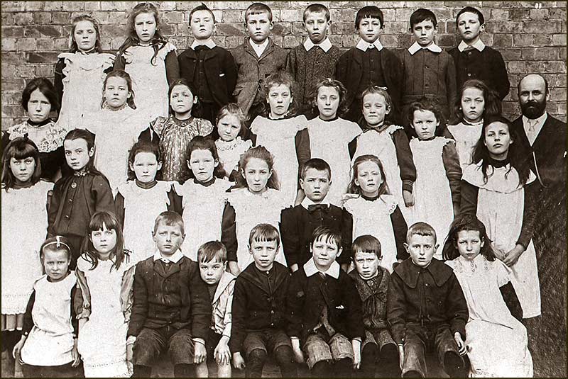
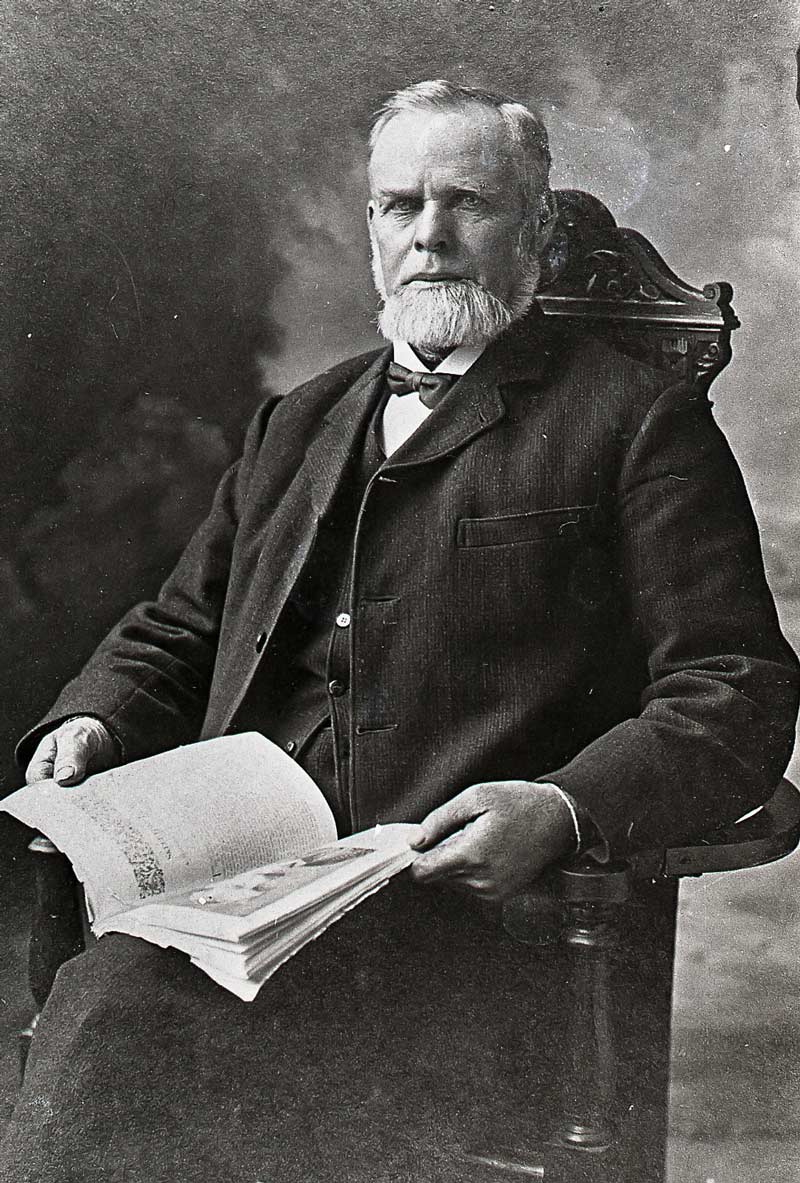
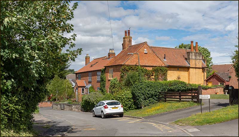
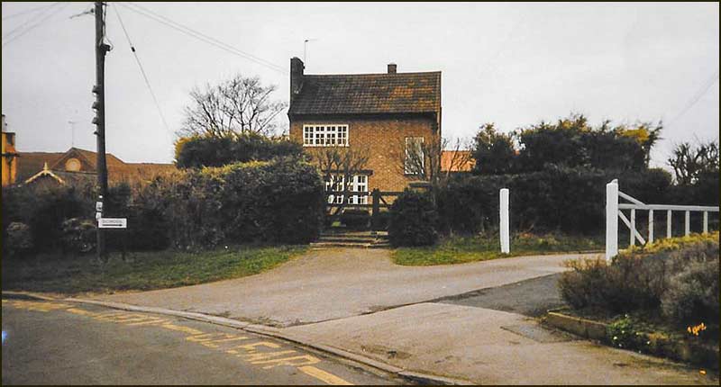
Cropwell Bishop Streets: — Parkin Close (14-8-20)
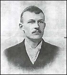
Parkin Close was a named after William Parkin; no argument, no discussion. To paraphrase the chants from football terraces, “there is only one William Parkin”.
William didn’t inherit lots of land or money from his parents, nor did he make loads of money by farming hundreds of acres. He didn’t own a big house; he didn’t have a grand title and he wasn’t the leader of an army or a hunt. And yet, William Parkin had a bigger, positive effect on the lives of more people in Cropwell Bishop than anyone else in its history.
William Parkin was the School Master at the village School on Fern Road from 1878. This was not a time when a School’s leader sat in an office doing endless paperwork punctuated by morning assembly and the odd cover lesson. He was very much the hands-on teacher. He would have had one or two assistant teachers but, never-the-less, he would have known every child and probably every other member of his or her family.
The catchment area was “walking distance” for a child of 5 and upwards. That would have included Owthorpe, Colston Bassett, Cropwell Butler together with the Bishop kids. They would have been taught at the School until they were 10 years old (11 from 1893) and then have left. Not to go to the “big School” in a nearby town, but to go to work – or to go to war.
As we grow older, we look back and recognise that of all the people we cross paths with in life, only a small number leave a lasting impression. We are inspired by those who show us how to think, teach us practical skills or open a window on places and people way beyond family and local life.
Then there are people who inspire us by their actions, the way they live their life and the things they achieve. I think William Parkin inspired the people of Cropwell Bishop a century ago in all these ways.
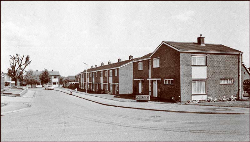
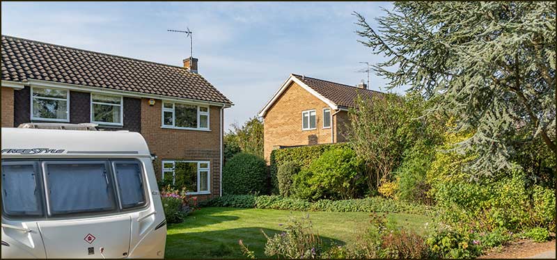
Parkin Close was named before the fashion of naming streets after people was the habit of Parish councillors. It was built in 1968 – about 14 years after the building of the northern end of Hoe View Road – and the homes were built for a different purpose.
Parkin Close in early 1970s
The late 1960s and early 1970s heralded a great expansion in Cropwell Bishop’s population. This growth was worrying for some of the resident population who were apprehensive about the changes ahead.
Providing access roads to the new homes necessitated the demolition of a number of old cottages and houses in the village. At the same time, there were other old houses that were in need of replacement.
The homes on Parkin Close, together with other homes on Hoe View Road near its entrance, were built by Bingham Rural District Council in 1968 to house those village families in need of a new home. Most are now privately owned and one is still being lived in by the same family that moved in from new.
So, what of the man who gave his name to the street?
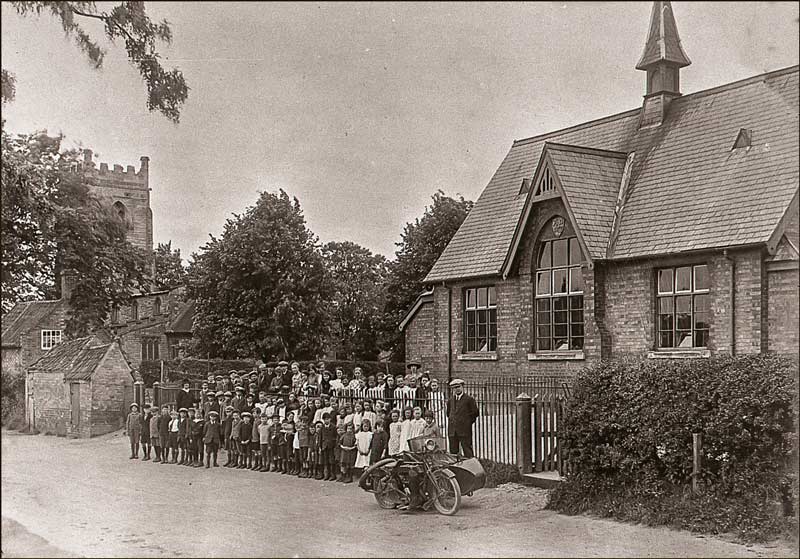
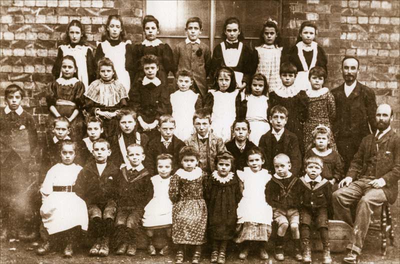
William Parkin was born in Attercliffe, Yorkshire in 1855. He became School Master at Cropwell Bishop Elementary School (the building we now call ‘The Old School’) on Fern Road in 1878 when he was 23 years old. He remained in the village up to his death in 1944 when he was 89.
The School (1920s)
During his 67 years in Cropwell Bishop, his influence on villagers was immense. No other person has had such a massive, beneficial effect on the lives of the people of Cropwell Bishop. He was so much more than a dedicated teacher: he became the leader of life in the village.
Before his arrival, Cropwell Bishop had the National School (the small building we now call the Parish School Room) on Church Street. That was built in 1850 when education was not compulsory. School attendance was poor.
Even after 1870, when education became compulsory, attendance declined. It didn’t help that the vicar ‘kept an eye on the curriculum’ which particularly annoyed Methodists who had a strong following in the village. Eventually, in 1875, because so few children were turning up, the School closed.
In 1877, a tender from local builder David Salvin, for a School and School House for £774 was accepted by the Board of Education.
In 1878 the School was completed and the post of ‘Master’ was advertised. The School Board, which comprised of Cropwell Bishop men, chose 23-year-old William Parkin and he began teaching in September 1878. He was an ardent Methodist.
We know that in 1881, when he was 26, he was still boarding at one of the cottages at The Turn (the junction of Nottingham Road and Church Street). Maybe the School House was still being built.
Living nearby was the large Wright family and the eldest daughter, 19-year-old Elizabeth, was a school teacher. She probably taught alongside William: she certainly made an impression on him.
William (behind bat) after a cricket match on the field where the Health Centre now stands (1880s)
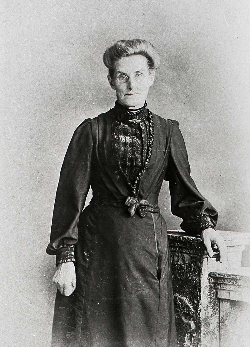
A few years later, the whole of the Wright family emigrated to New Zealand. However, it wasn't long before Elizabeth returned and in 1889 she and William were married at St Giles Church and moved into their home - the School House.
School and School House in the 1920s
In 1882, William’s older brother George who was also a qualified teacher, moved to Cropwell Bishop and taught alongside William at the School. He boarded with William and Elizabeth at the School House and worked at the School for at least 10 years. In 1901 he was no longer boarding at the house and no longer appears in School photos.
Elizabeth taught needlework to the older girls on Tuesday and Friday afternoons and continued doing so for the next 35 years. William and Elizabeth had no children.
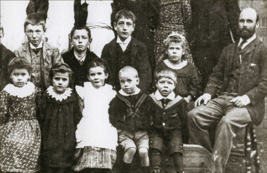
School Photo 1893. William Parkin with George standing
To quote Aubrey Harper, author of Chronicles of Cropwell Bishop, who knew the Parkins,
“William’s advice was sought on the making of wills, on how to deal with official letters and on all domestic issues. He took a very active part in the life of the village and was greatly respected.”
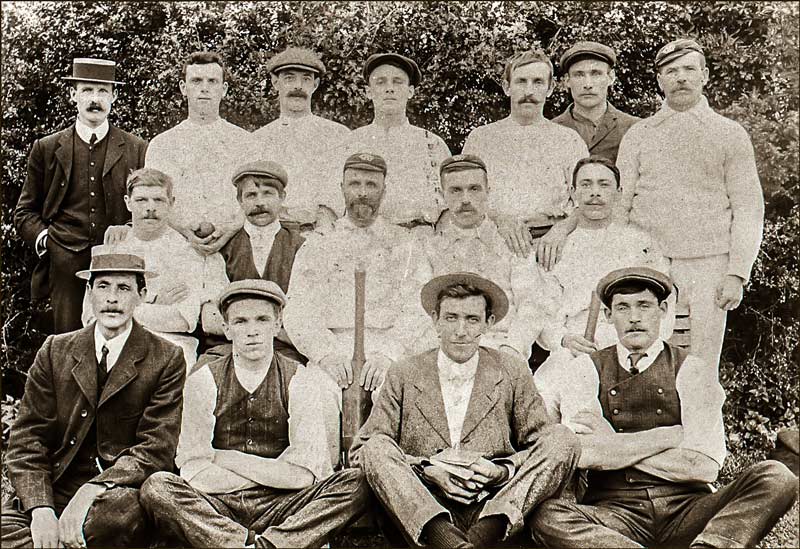
He was a keen supporter of the Cropwell Cricket Club and secretary of both the Angling Club and Cropwell Sick Club.
Cropwell Bishop Cricket Team (1910). William Parkin holding the bat.
He filled many positions in the village including; Chapel Steward, Superintendent of the Sunday School, Local Preacher, occasional organist and Parish Overseer.
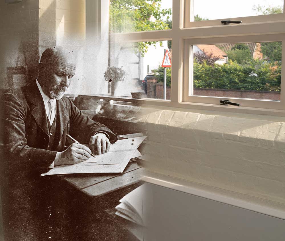
William Parkin sat here, in the School , in the 1910s
When the very first Parish Council was elected in 1894, he received the most votes. Brother George became Clerk. Later, William also became a Bingham Rural Councillor.
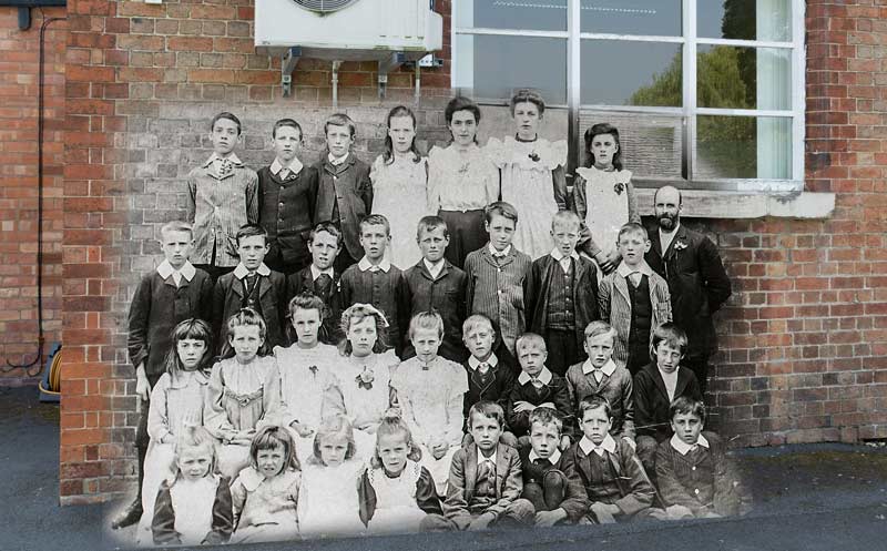
William Parkin with a class in 1900sClass photo in 1910 - merged with same wall today
When he retired from teaching in 1920, he had been Head Teacher at the School since its beginning 42 years earlier. And yet, a project for which he is most remembered by many, did not begin until 4 years later.
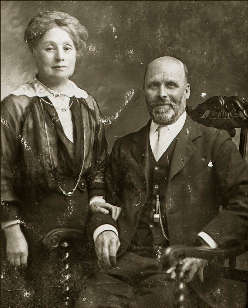
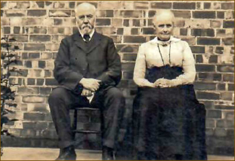
William and Elizabeth Parkin (1910s)
Both William and Elizabeth had devoted themselves to the people of the village. Maybe, because they had no children of their own, they looked upon the village children as their extended family. Imagine their feelings during the 4 long years of the World War from 1914 to 1918 when children they had taught were enduring horrific experiences, injuries and even death on the other side of the English Channel. Eleven Cropwell Bishop men died in that War.
Following the War, villagers were determined to establish a lasting memorial for those who had died. The biggest idea was for a village Memorial Hall.
Encouraged by the moral and financial support of Mr J. N. Derbyshire, owner of the Gotham Company that mined gypsum in the village, a building committee was formed in 1924 – and William Parkin was its secretary.
The Hall would cost £1220 and over half was raised by the people of Cropwell Bishop. Villagers also helped keep costs down by doing a lot of the hard work themselves. Men, wives and children devoted their spare evenings to getting the job done.
The final go-ahead to build the Hall came in 1928 and by the summer of 1929 it was finished.
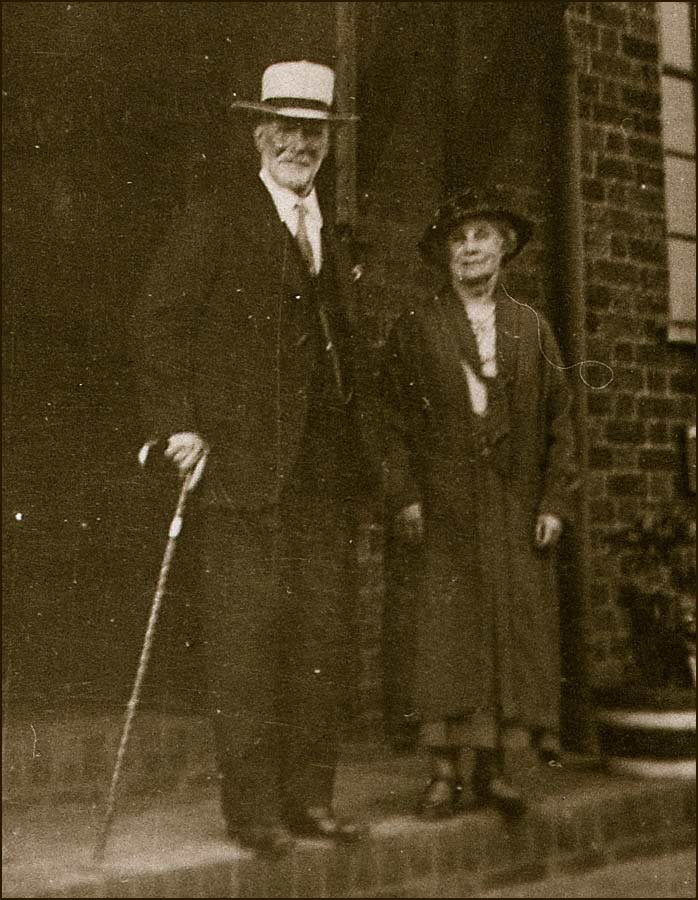
On the 3rd August 1929, Mrs J.N. Derbyshire officially opened the Hall alongside William and Elizabeth Parkin.
Awaiting the official opening of the Memorial Hall by Mrs J. N. Derbyshire (3rd August 1929)
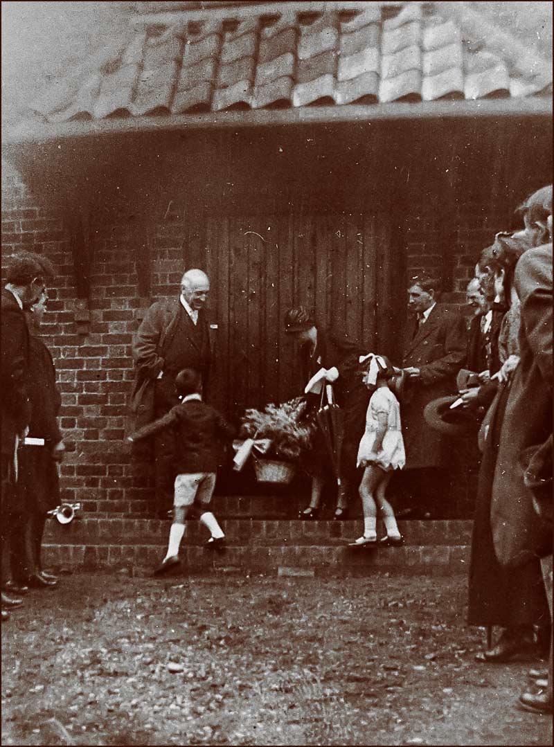
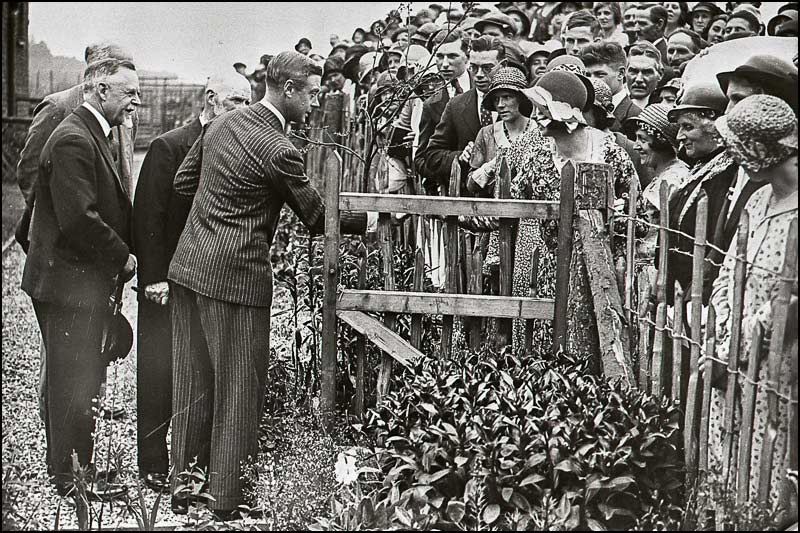
However, 3 years later there was an even bigger event in the history of the Memorial Hall and the village: Royalty paid a visit.
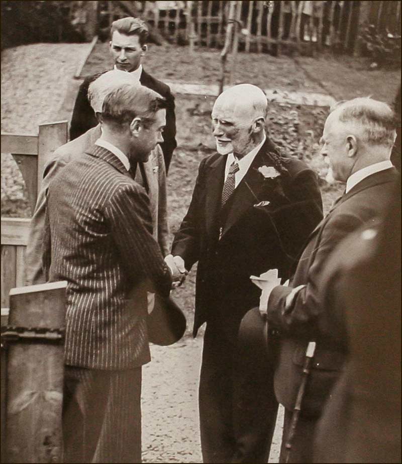
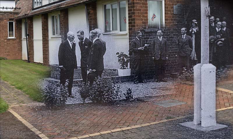
On the 29th June 1932, the Prince of Wales (later Edward VIII) visited Cropwell Bishop as part of his ‘Social Services Tour’ of the country. Fittingly, it was William Parkin who welcomed him and accompanied him on his whistle-stop tour of the Memorial Hall. He flew into Tollerton airfield and arrived at the Hall at 2.20pm.
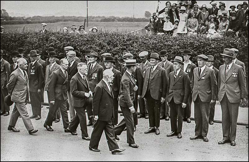
William and Elizabeth await the arrival of Prince Edward on the steps of the Memorial Hall (29th June 1932)Edward, Prince of Wales, is greeted by William Parkin and Alderman Derbyshire (29th June 1932) The past merged with the present: Prince Edward and William leaving the Memorial Hall.Prince Edward inspects Ex-Service Men The people of Cropwell Bishop meet the Prince
He was there for only 15 minutes but photographs suggest that villagers saw the occasion as being equivalent to a wedding, and dressed accordingly. I imagine they also spent that evening as they might after a wedding: good business for the pubs!
Since his retirement, William and Elizabeth had occupied a house on Church Street - number 59 which, at that time, was called ‘The Croft’. Behind it was, ‘The Croft Bungalow’, where his brother George lived.
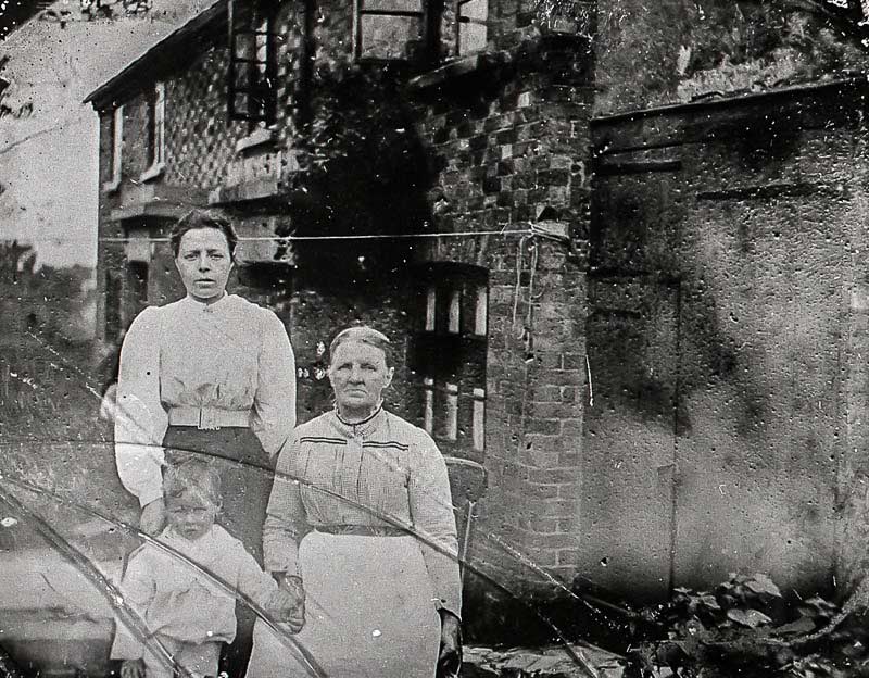
Two children stand outside The Croft on Church Street
William died in 1944 at the age of 87 and Elizabeth in 1949 at the age of 89. A humble man with big ideas and the resolve to see them fulfilled for the good of ordinary people.
If he were living in Cropwell Bishop today, would he be respected and admired as much as he was a century ago? I think so, don’t you?
Tony Jarrow
Note:
Particular thanks to Anne Terzza, Pam Barlow, Jane Jones and Alan Wilson for their help with this article.
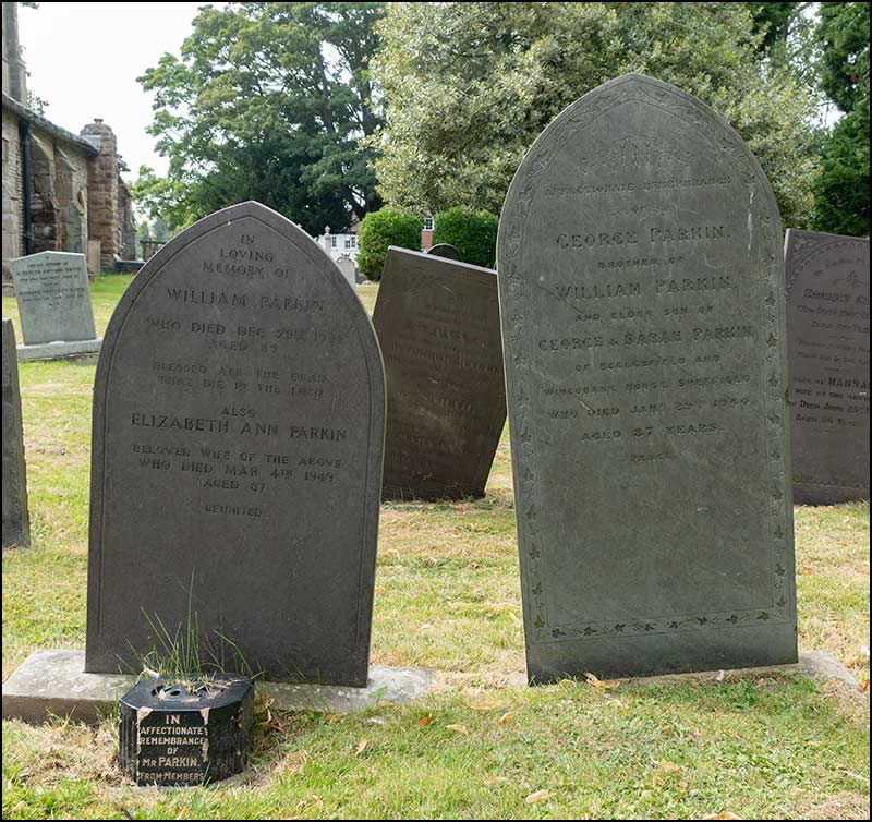
William, Elizabeth and George Parkin are all buried in Cropwell Bishop Churchyard.
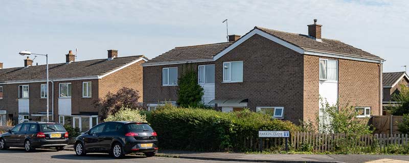
This is how Parkin Close looks today (August 2020), 165 years after the birth of William Parkin.
Top of Parkin Close today (2020)On the right going down
Further down on the right Right-hand corner
Near the bottom on the right Bottom of Parkin Close
At the bottom on the leftBungalows near the bottom
Bungalows on the left Left-hand corner
Top of left-hand corner Top of Parkin Close on the left
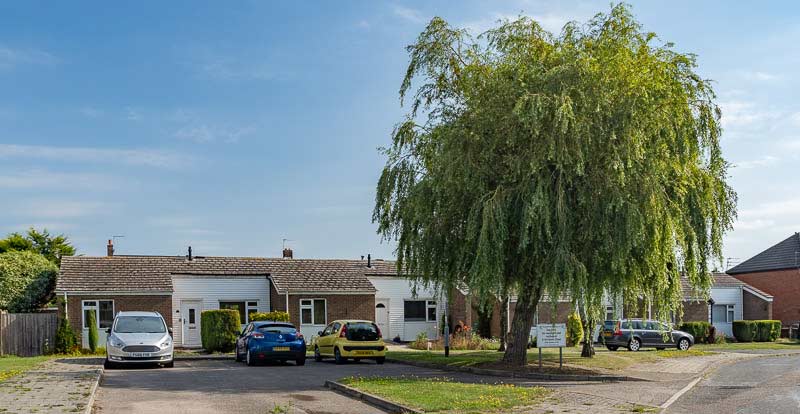
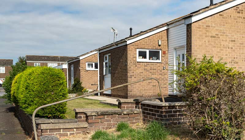
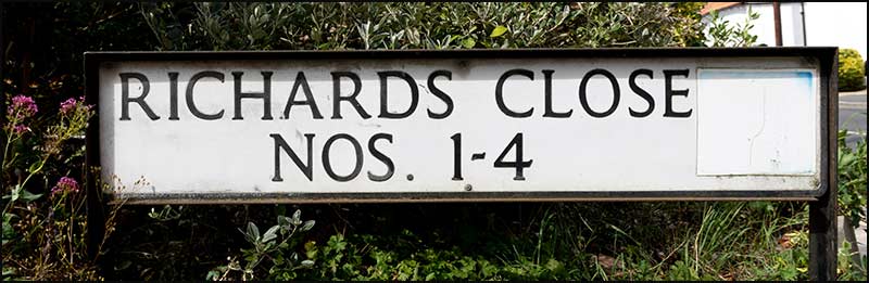
Cropwell Bishop Streets: — Richards Close (21-8-20)
Designing the layout of houses and roads for a new housing development must be a dream job. To look upon open land and imagine the route of roads that are both safe and offer glimpses of beautiful views. To have pedestrian twitchells that provide safe but exciting short-cuts to play areas, parks and allotments.
The reality for most builders is very different.
A parcel of land squeezed between existing buildings, a right of way through it and narrow openings and slopes that make it difficult to even get the builders on site.
The builder certainly needs imagination, but not to plot sweeping roads, rather to make homes fit in the most efficient way that leaves house-buyers happy and the builder with enough profit to build another day.
That brings us to Richards Close.
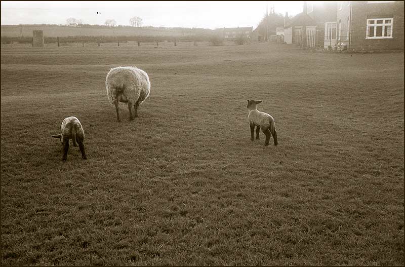
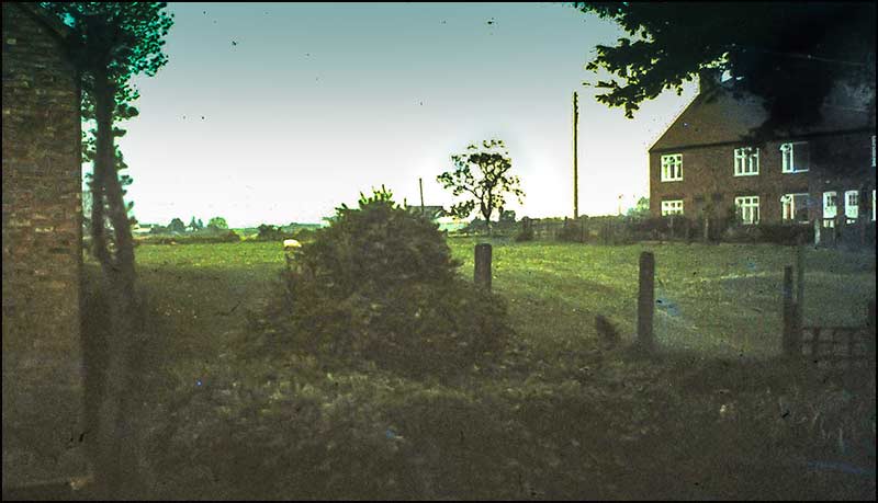
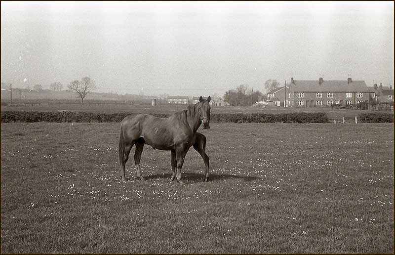
Until 40 years ago, the space it occupies opposite Barratt Close on Nottingham Road was a small, sloping field occupied by the occasional wandering sheep.
Wandering sheep. On the right is the end of Jubilee Drive Houses (1960s)
On the left was the Methodist Chapel and its Sunday School, and on the right were joined-up houses known as Jubilee Drive Houses. These homes were built in 1935, the Silver Jubilee year of King George V and Queen Mary. The field was known as Jubilee Field.
Jubilee Field – the site of Richards Close. Jubilee Drive Houses on the right – Sunday School Room on the left. (1960s)Jubilee Drive Houses on the right (1960s)
The field was owned by Harold Barlow (young Harold, the Butcher) and he sold it to Hamilton Knight, the Cropwell Bishop building company. The slope up from Nottingham Road and the Public Footpath across it would provide a challenge for the architect.
1960s map showing a public footpath through the gap between the Chapel (right) and Jubilee Drive (left)
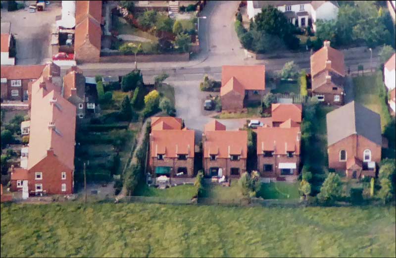
Richards Close is the smallest street in Cropwell Bishop: it has just 4 homes. Given the size of the plot, this is no surprise.
How local Buzzards and Swifts view Richards Close
When the Parish Council had the task of giving it a name, they decided it would be appropriate to recognise the impact that the Richards family had had on Cropwell Bishop. It chairman at that time, David Barlow, contacted Edward Matthews to ask for his permission to use the name. He happily agreed.
So, which member is the Close named after, or does it refer to the family name?
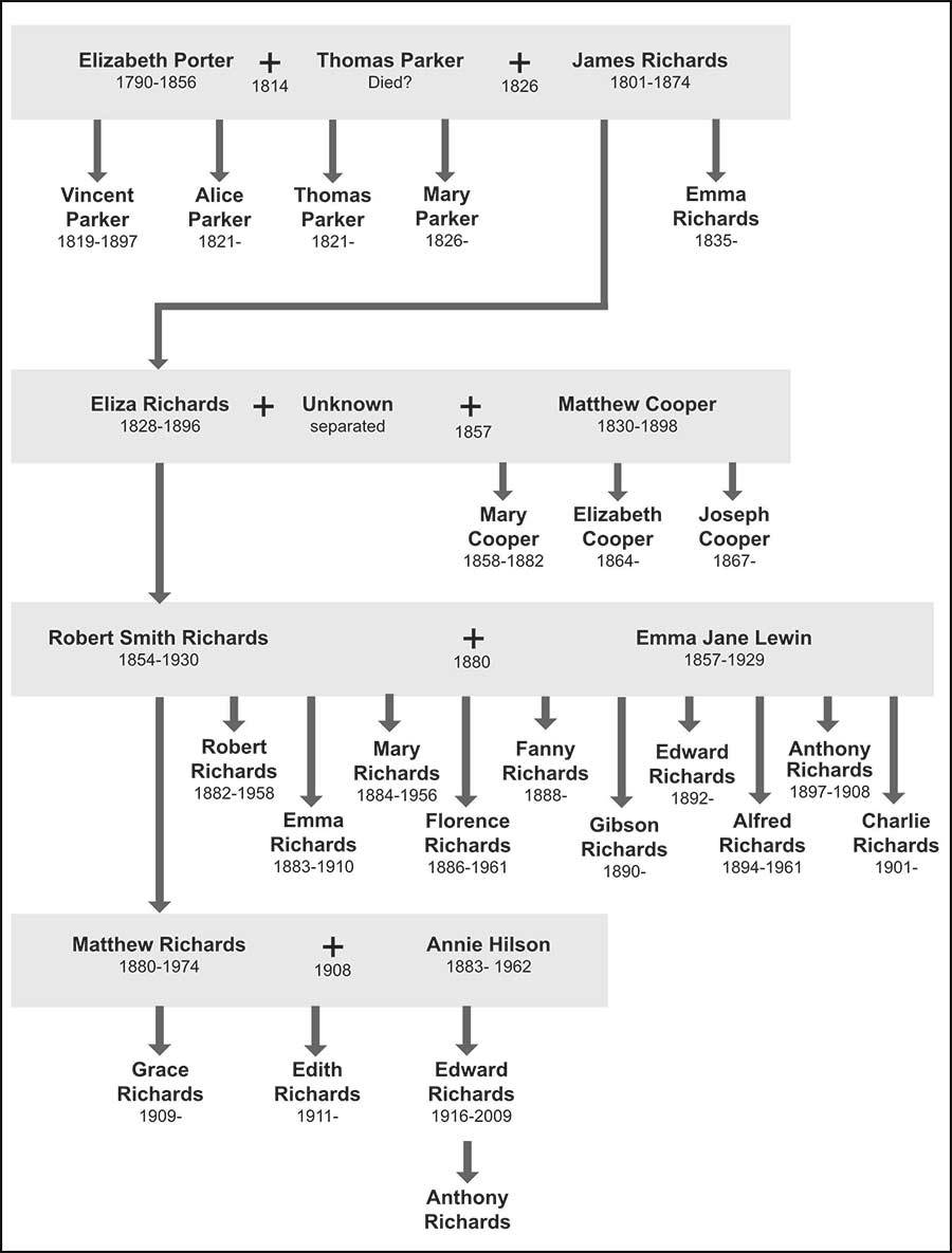
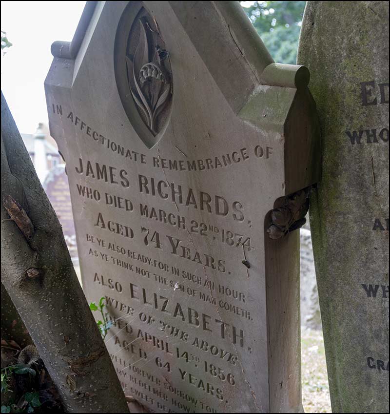
Let’s start in the early 1800s with James Richards.
He was born in Granby in 1801 to father Anthony Richards and mother Elizabeth and was the first of their four children. To follow were; Anthony (1803), Mary (1805) and brother Gibson (1809).
In 1826, when 25, James married Elizabeth Parker at Granby Church. Elizabeth was 11 years older than James and had already been married: she also had four young children. Her maiden name was Porter and she was born in 1790 at Tythby.
She had married Thomas Parker of Cropwell Butler in 1814.
They had their first child, Vincent, in 1820 and the following year they had both Alice and Thomas – maybe they were twins, we don’t know.
The fourth child, Mary was born in 1825 (or 1826, records conflict).
Oddly, in less than a year of giving birth to Mary, she was marrying James Richards.
I cannot discover the reason for this sudden change in Elizabeth’s circumstances but it could be explained by Thomas Parker, suddenly dying.
Shortly after James and Elizabeth married, they moved to Cropwell Bishop where James became Innkeeper at the Wheatsheaf on Nottingham Road and Elizabeth gave birth to their child Eliza in 1828. A second child, Emma, would follow in 1835.
Richards Family Tree for selected members
James and Elizabeth had a long and stable marriage together and two children went on to establish important families of their own in Cropwell Bishop: Vincent (the eldest child from Elizabeth’s her first marriage) and Eliza (the eldest child from her second marriage).
Vincent Parker
Vincent Parker became a farmer and he eventually owned 119 acres in Cropwell Bishop. He also followed the path of his step-father and became a Publican at the Canal House Pub next to the Canal Bridge on Nottingham Road.
He was also involved with the mining of Gypsum in Cropwell Bishop and went on to own 10 houses just a 100m from his home: they became known as Parkers Row.
Parkers Row (also known as Top Row) 1950s
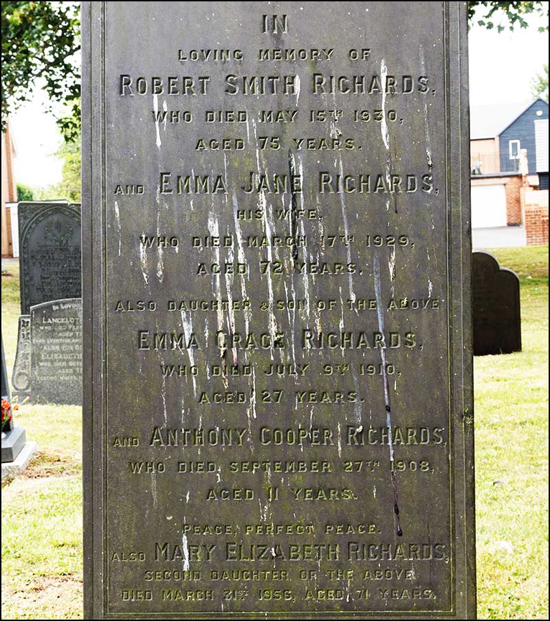
Meanwhile, Eliza Richards had a son in 1854 but the father remains a mystery. She named the boy, Robert Smith Richards.
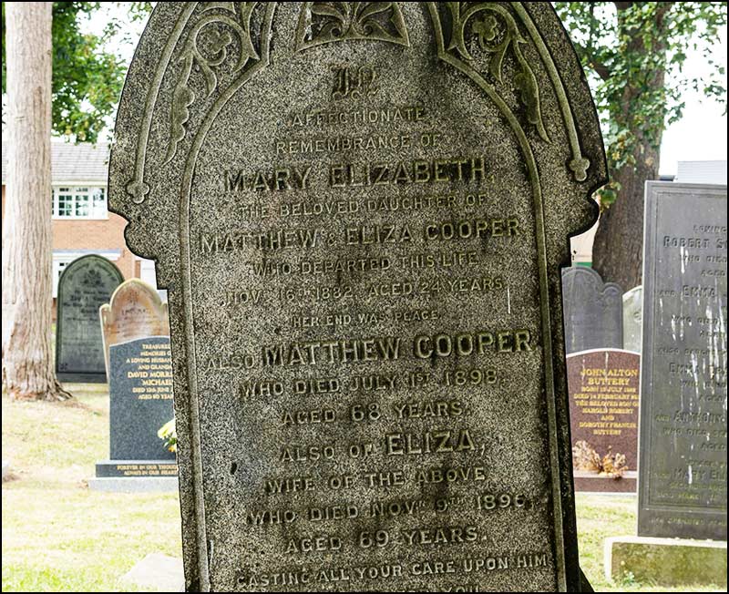
Within two years, in 1857, she married farmer Matthew Cooper of Screveton and they had three children of their own; Mary, Elizabeth and Joseph.
Matthew appears to have been the “business brains” of the family and over the next 40 years built up his farm by acquiring land as it became available. It is interesting to note that in 1885 he advertised himself as a brickmaker as well as a farmer.
The family lived at 49 Nottingham Road in the early years and when Matthew was 60 they moved to The Yews (100m down the road). They were there until his death in 1898 when he was 68.
He had given his step-son, Robert Smith, increasingly more responsibility for the running of the farm and it was he who took the business forward for the next generation.
49 Nottingham Road in 1968 (back of house)
Robert Smith married Emma Jane Lewin, from Cotgrave, in 1880 and they moved to Barton-in-Fabis where he farmed 115 acres. Their first two children, Matthew and Robert were born there.
After 3 years the family moved to Owthorpe Village where he farmed for the next 17 years. Robert Smith and Emma had 8 more children while living there. (Note to modern parents: they had 3 servants!)
Owthorpe children could easily walk the road to Cropwell Bishop School. Here is a School Class Photo showing the two eldest boys, Matthew and Robert, in 1893.
Cropwell Bishop School Photo 1893. Matthew Richards (aged 13) is top left, and right of him is his brother, Robert Richards (aged 12). Head Teacher William Parkin is seated right. The full class photo is shown in the Parkin Close article.Cropwell Bishop School Photo 1898 approx. Florence (Florrie) Richards is on the 2nd row down from the back. At left end is a teacher; Florence is next to her.
Once again, it was the oldest child who took forward the family farming business. I suppose that was the normal pattern in those days.
As a schoolboy, Matthew had been close to his grandparents, Matthew and Eliza Cooper. For a time, he even lived with them.
Surrounded by a growing number of brothers and sisters at home, finding a quite corner to do his homework each evening must have been a challenge (OK, I don’t suppose they had homework in those days).
Anyway, his grandparents lived at The Yews in Cropwell Bishop so he could avoid the morning, lunchtime, and afternoon walks to and from Owthorpe (school dinners didn’t exist, I am sure).
When Matthew Cooper died in 1898 (his wife, Eliza, had died 2 years earlier), Robert Smith, and his ever-growing family, moved into The Yews on Nottingham Road. He was still there in 1902 when Emma gave birth to their 11th child, Charlie. He was their final child: time for a rest Emma!
Robert Smith Richards and Emma Jane Richards (1920s)
Matthew Cooper had left the bulk of his estate to stepson Robert Smith but he also left part to his grandson, Matthew Richards. This included 49 Nottingham Road, a farmhouse. The will stipulated that until Matthew reached the age of 26, the house must be held by his father.
In 1908 he reached the age of 26 and he married Annie Hilson (of Bottesford). I can’t confirm if they did indeed move into number 49, but I do know that in 1911 they were living at The Yews (just across the road from where Richards Close is today).
This was where his father and family had been living but in 1911 they were all living at Sutton, a tiny hamlet near Granby. Robert Smith always had been one for regularly moving house.
Matthew and Annie already had a daughter, Grace, and before the year was out, they had a second, Edith. A son, Edward, joined them in 1916.
Matthew Richards and family: Edith, Annie and Matthew with Edward and Grace kneeling (1926)The Yews on Nottingham Road (1926)
In his later years, Edward recalled his growing up in Cropwell Bishop. Shortly after the above photograph was taken, he was awarded an Art Scholarship to attend Trent Bridge Central School for Boys in Nottingham from 1928 to 1931. Every day he cycled there from Cropwell Bishop. But when he was 14, he had to leave school to work full-time on his father’s farm.
The Yews Today (2020)
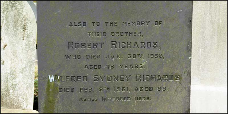
In 1930 Robert Smith Richards died: he was 75. His wife, Emma had died the year before. In his will he requested that all his assets be sold and divided equally between his children except for two who were already provided for.
It was just after this that Mathew decided he wanted to buy a farm of his own. In 1932 he moved his family to Rempstone and stayed there for the rest of his life. He still owned land in Cropwell Bishop and let it out to local farmers.
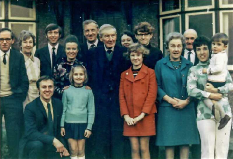
Here is a photo of him and his family at his 90th birthday in 1970. He died at the age of 93.
Matthew Richards' 90th Birthday with children, grand children and great-grand children. His son Edward is immediate left of him, daughter Grace is 4th from right-hand side, and daughter Edith is 2nd from left-hand side. (1970)
Matthew’s son Edward must have inherited his father’s long-life genes because he too lived to the age of 93. He died in 2009.
His son, Anthony provided details, insights and photographs for the writing of this article.
The colourful history of the Richards family in Cropwell Bishop is enough to fill Richards Close. With just 4 houses you could allocate a key character to each one of the houses.
But there is no need for that. Now we can all look upon Richards Close differently: a place linked to a large energetic family spanning two centuries.
Do you think the Postman, Amazon man, and other delivery people ever wonder at the history of its name? No, I don’t think so either.
But now, should they ever ask, you can enlighten them.
Tony Jarrow
Note:
Particular thanks to Anthony Richards for insights and photographs. Also, thanks to Anne Terzza, Pam Barlow, Tony Carter, John Bradley, John Greenwood and Lesley Shuttlewood for their help with this article.
This is Richards Close now (August 2020).
Up the slopeAt the top
The view aheadAlongside the Public Footpath
View of top corner from the ChapelClose up
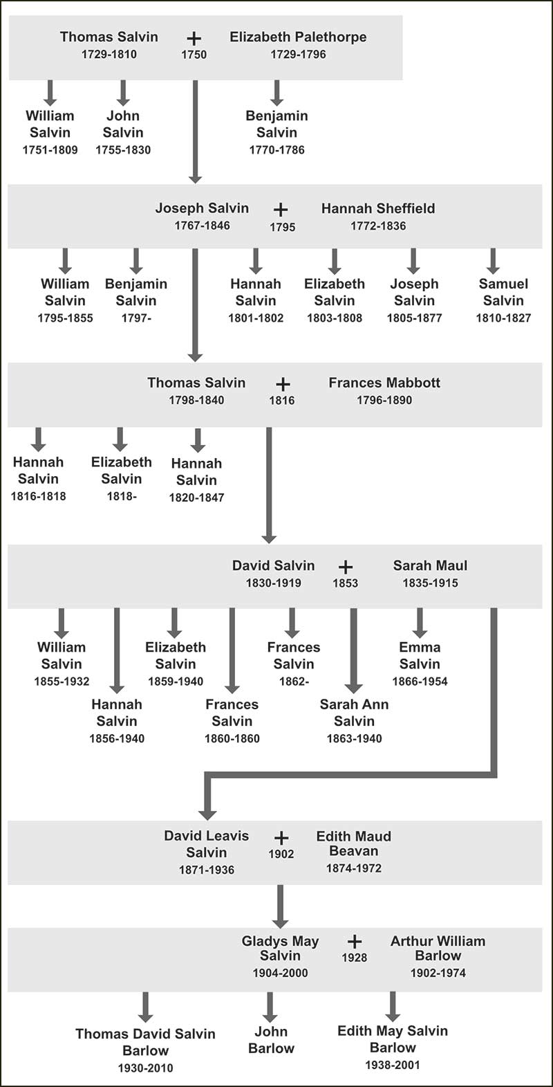
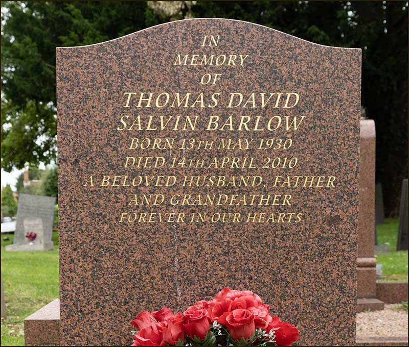
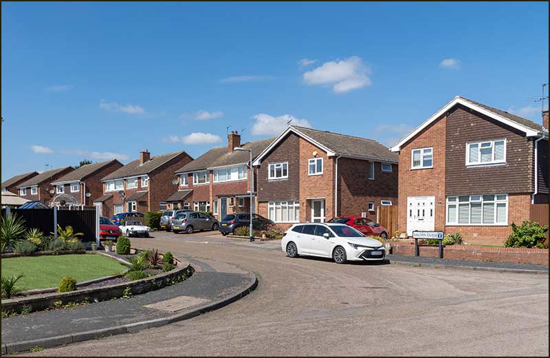
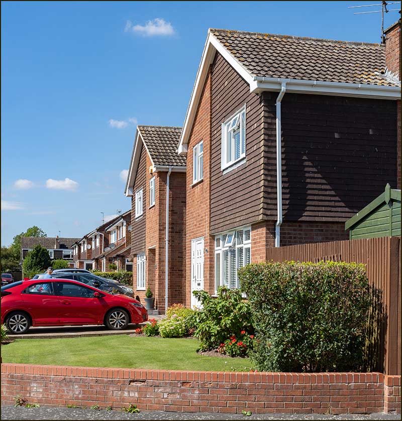
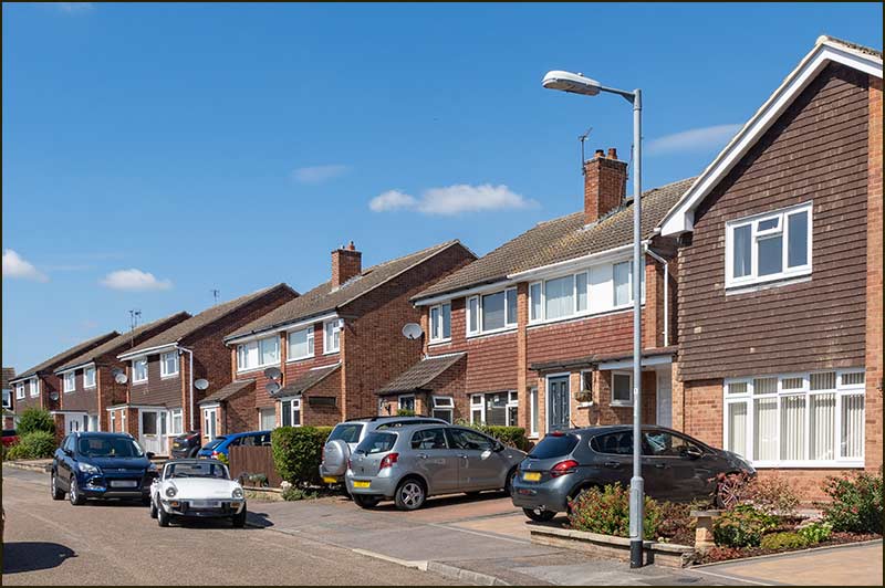
Cropwell Bishop Streets: — Salvin Close (28-8-20)
Some people boast that generations of their family can be traced back centuries.
The ability to trace family roots a long way back is quite rare. Ancestors would have had to record their activities on paper but most families did not possess paper and pens – and probably couldn’t read or write anyway.
Most of us have a fascinating family history but we don’t know it because it was never written down.
Being able to trace ancestors is much easier if you follow the male line. Men don’t lose their surname on being married.
Wealth and power can be inherited and having a shared surname helps to prove your claim.
This story is about the Salvin family that lived in Cropwell Bishop.
Salvin Close is named after David Leavis Salvin. He lived in Cropwell Bishop at the end of the 1800s and early 1900s. However, he was not the only Salvin to live in Cropwell Bishop and the story of how the Salvin family came to the village is an interesting one: so is the virtual disappearance of its name.
The Salvin family has a long history – it was written down. That means they were a rich.
We can go back a long way – to 1066.
Joceous le Flamangh came over with William the Conqueror and was rewarded with “one third of a knight’s fee” in Cuckney in north Nottinghamshire. What he had done to deserve this payment and who got the other two thirds is not recorded.
In those days, north Notts would not have been regarded as a lush part of a conquered country. It didn’t even need to be fought for: it became vacant when the previous Saxon owner died without heirs.
So Joceous was no leading-light in William’s government, but he was here and he owned land. Once established he made his influence felt locally.
His sons married into the aristocracy and a grandson became Sheriff of Nottinghamshire and Derbyshire (before Robin Hood’s arrival). His second grandson was named as ‘Ralph of Sylvan’ and became heir to the ‘Manor of Woodhouse’.
Within three generations, the family had marriage links with the Earl of Derby and ownership of property that would eventually become Welbeck Abbey.
The family name mutated into Salvin and extended its links in north Nottinghamshire and even into Yorkshire to an area that exists today as the village of Thorpe Salvin. By the 15th Century, family members had even become part of the aristocracy of County Durham.
The Salvin family had established itself but not become a high-profile one – and this would prove a distinct advantage. Their relative anonymity during some turbulent times, enabled them to keep their heads at a time when many fellow Roman Catholics were losing theirs to the executioner.
By the early 1700s, the Salvins had settled as far south as Gedling and Stoke Bardolph. In 1729 in Stoke Bardolph, Thomas Salvin was born. He married a local girl, Elizabeth Palethorpe at Gedling Church in 1750. They were both 21 at the time.
In later years Thomas would be known as ‘The Farmer of Stoke Bardolph’. A grand title but if you have ever visited Stoke Bardolph (or much more likely, ‘passed through’) the you will be forgiven for wondering if there is enough land for more than one farm.
The young love of Tom and Lizzie brought forth children, the first arriving the following year. They had four children, all boys. Their third son, Joseph, was 28 when he married 23 year old Hannah Sheffield in 1795.
Salvin Family Tree
Hannah was born in Castle Donnington but the wedding was at Gedling Church. We know nothing of her parents and can only presume that they moved with her to Gedling or she was working away from home. We don’t know but it doesn’t matter.
Joe and Hannah were in love – and they had 7 children. There were 5 boys and 2 girls.
There was heartache though: Hannah died when 1 year old, Elizabeth when 5 years old and Samuel when 17.
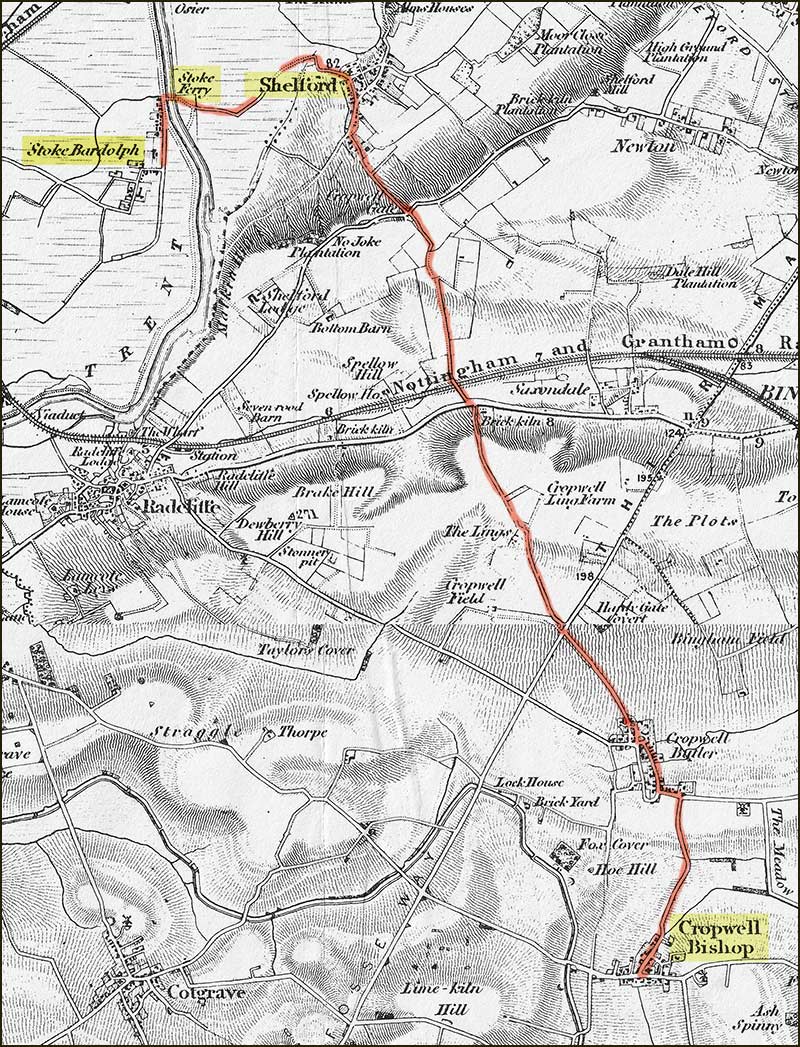
Their 3rd son, Thomas Salvin, is the one of interest to us. He was born in Stoke Bardolph and married Frances Mabbott of Cropwell Bishop in 1816.
Even today, Stoke Bardolph to Cropwell Bishop would be quite a long bicycle ride to discover your true love – and in 1816 there wasn’t a bridge at Gunthorpe, nor were there any bicycles (they were not invented until the following year). However, there was a ferry over the River Trent at Stoke Bardolph.
Once on the other side of the Trent, a brisk walk and you are soon in Shelford. After climbing the hill out of Shelford, it would have been a straight road to Cropwell Butler and then on to Cropwell Bishop.
You could follow the same route today, with a detour over the new A46, but you will need a towel for your swim across the Trent.
The route from Stoke Bardolph to Cropwell Bishop in 1816
I am not suggesting that Tom and Frances met at a local sing-song in the Wheatsheaf, just that the two villages and its occupants were not so far apart as it first seems.
Tom was 18 years old and Frances was 20 when they married in April 1st 1816 and Cropwell Bishop was where they would live their life.
Their home was a house at The Turn, that is the area in front of St Giles Church where carts could turn around. We can't identify the actual building from historical records.
Three months later, on the 21st July 1816 their first child, Hannah, was born. (Maybe they did meet at a sing-song of sorts at the Wheatsheaf)
Sadly, Hannah died when just 2 years old in 1818, the same year their second girl, Elizabeth, was born.
A third girl was born to them 2 years later and they decided to name her Hannah too. Sadly, this second Hannah also had a short life: she died when just 27 years old.
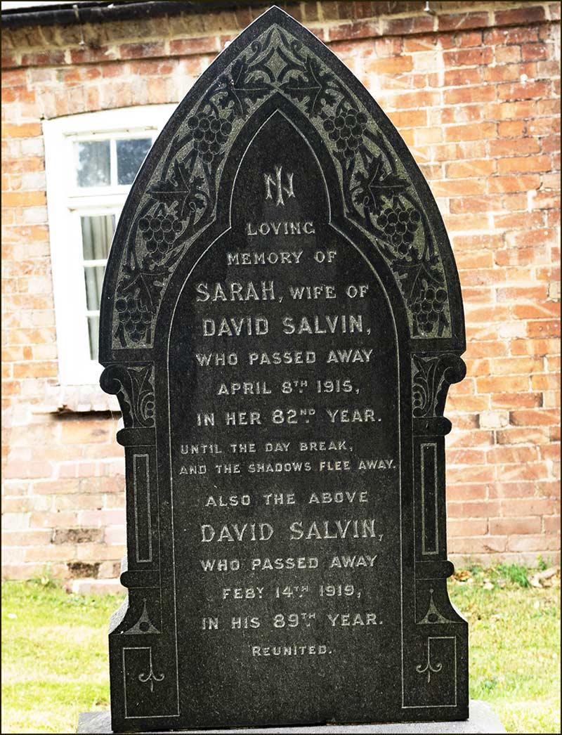
There was then a 10-year gap before their next child, this time a boy, David Salvin. They had no more children afterwards and in 1840, at the age of 42, Thomas Salvin died.
Frances worked as a housekeeper so she could support 10 year old David.
When David was 23, he married and Frances lived with him and his family until her death at the age of 94.
David started his working life as a bricklayer’s apprentice and became a very proficient builder in Cropwell Bishop. The Old School on Fern Road is an example of his work; so is the ‘cart shed’ at the entrance to Stackyard Close (on the right).
David married Sarah Maul in 1853. Sarah was born and bred in Orston but, on marrying David, moved to Cropwell Bishop.
They had 8 children. The first was William and the last was David Leavis. In between were 6 girls.
Their youngest, David Leavis Salvin, was an ambitious and hard-working man from an early age.
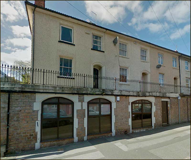
By the time he was 20, in 1891, he had left his home in Cropwell Bishop and was lodging with his sister, Elizabeth, and her husband Thomas Clarke and their family at 191 Sherwood Street in Nottingham. Thomas was “provisions merchant manager”.
191 Sherwood Street in 2020
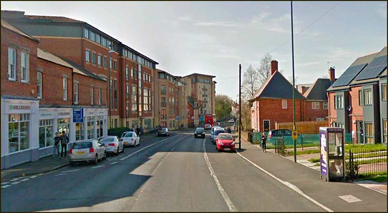
Just 3 years later, in 1894, David Leavis was advertising himself as a grocer at 312 Ilkeston Road. He continued with this shop for at least 10 years.
312 Ikeston Road was once on right hand side where the new homes are today
Five years after this, in 1899, he also listed himself as, “beer retailer and shopkeeper”, at 191A Sherwood Street. Look at the photograph of 191 Sherwood Street. It is easy to imagine the ground floor windows as shop fronts, number 191 for groceries and 191A for beer.
This shop appears to have been a short-lived venture because he did not advertise it again.
Life was not all work for David Leavis. In 1902 he married Edith Maud Beavan. In 1904 their daughter, Gladys May Salvin was born: she was to be their only child.
It was at this time that he was advertising his second grocery shop on Ilkeston Road, number 284. Maybe he was in the process of moving to a bigger shop because after this time he no longer advertised the ‘312 shop’ but continued to trade from the ‘284 shop’ until at least 1925.
By that time, he had been a grocer for over 30 years.
David Leavis was an entrepreneur and his business ventures had proved profitable. He was looking to invest his capital beyond his Nottingham shops – into the Cropwell Bishop area of his childhood.
He bought a farm on the north side of Cropwell Butler and also land around Cropwell Bishop. By 1912 he was already referred to in directories as “a principal land owner and farmer” in Cropwell Bishop.
In 1911, he and his family were living at 31 Albert Grove, Nottingham, but maybe he felt that now was the time to look for something better.
31 Albert Road (2020)
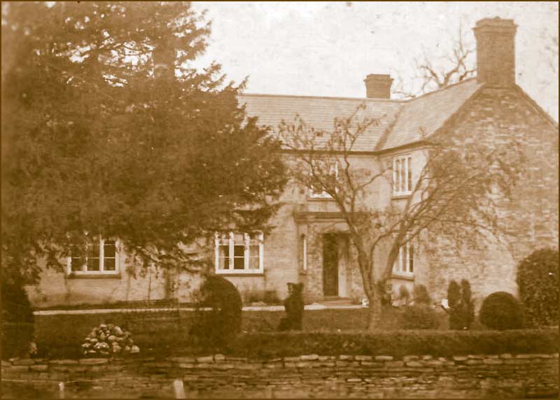
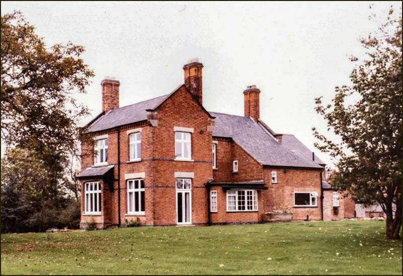
He bought the Manor on Fern Road in Cropwell Bishop and not long after he and his family were living there.
The Manor on Fern Road
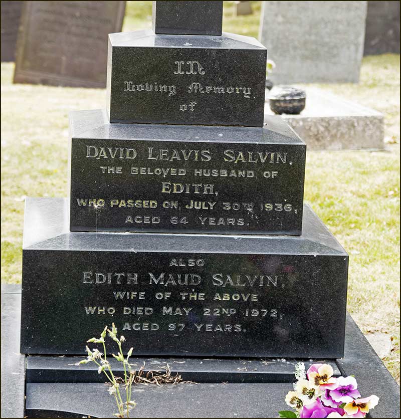
In spite of all his energy, David Leavis Salvin did not enjoy a long life. He died in 1936 at the age of 64.
In the five generations of Salvins we have looked at, the swing from being a family with mainly male children to one of females is interesting. For anyone keen to maintain the family name, it was worrying.
David Leavis and Edith Maud failed to have a son, it meant that the Salvin surname had come to an end in this branch of its family tree.
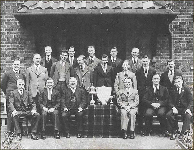
The Men's Institute, 1932. David Leavis Salvin (front row, 3rd from left) and Arthur Barlow (front row, 2nd from right)
In times past, the end in line of a family name would have been a great disappointment to some fathers, usually the ones with great wealth to pass on. I don’t think this is the case so much nowadays.
Science has revealed the existence of DNA. We understand how parts of our DNA are passed on to the next generation. Precise parts of it can be identified and they can be screened for: they can even be replaced!
We can identify parents or find long-lost relatives by spitting some saliva into a test tube and posting it for DNA analysis. Within weeks we are sent names of others who have similar DNA.
With all this knowledge, the importance of family names on pieces of paper seems trivial.
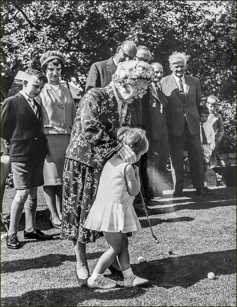
Edith Maud Salvin at 90. With great-grandaughter, Jane, at opening of Village Fete in 1965
As for David Leavis Salvin and Edith, the most important thing was that their child, Gladys, was healthy. A very healthy one it would seem. She certainly inherited her mother’s long-life genes.
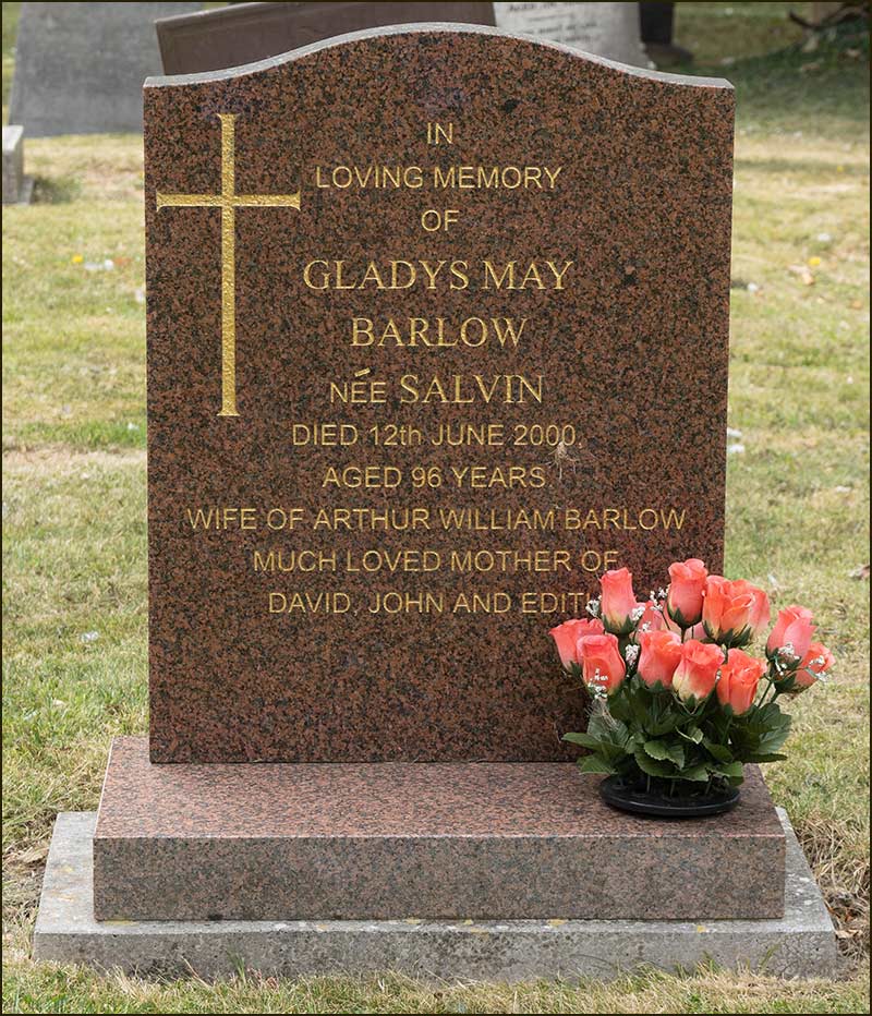
Edith Maud lived to be 97 and died in 1972. Her daughter, Gladys May died in 2000 at the age of 96.
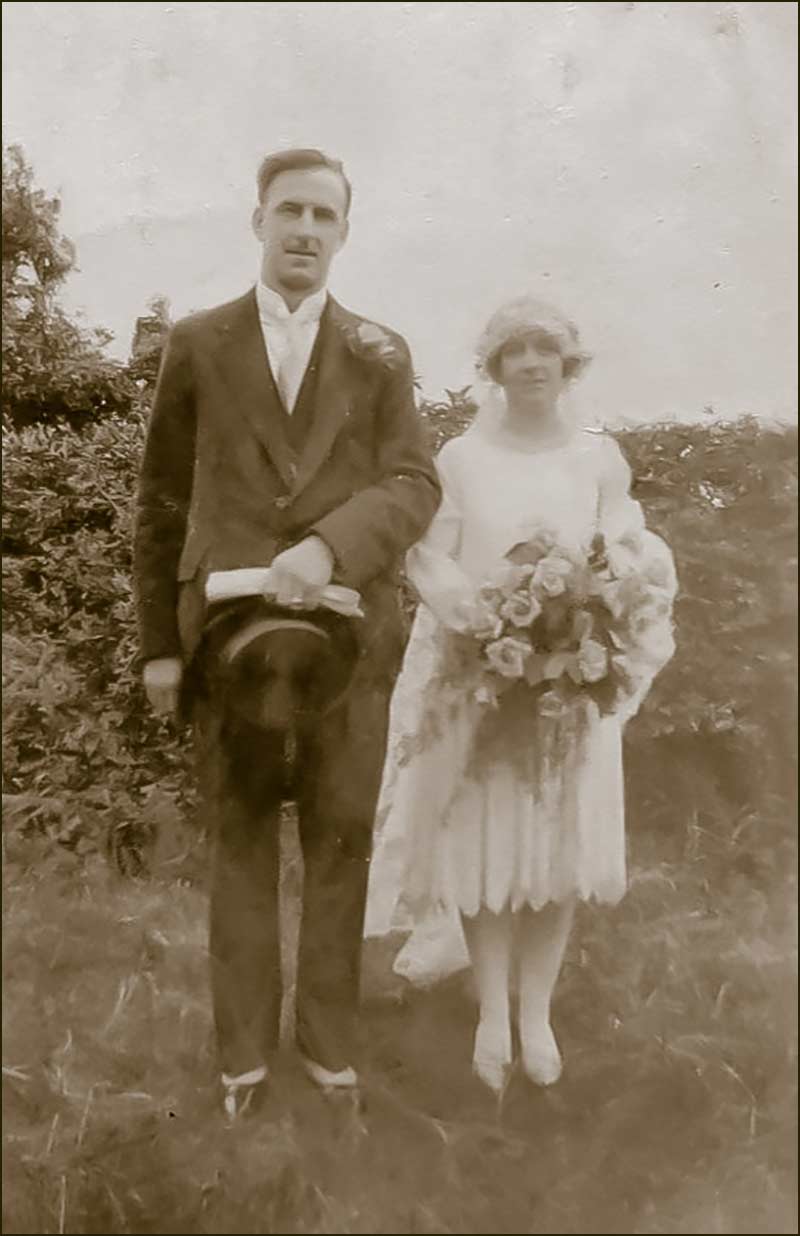
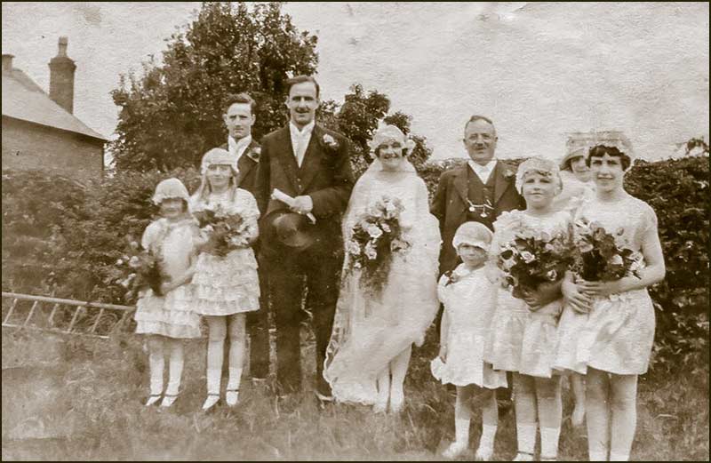
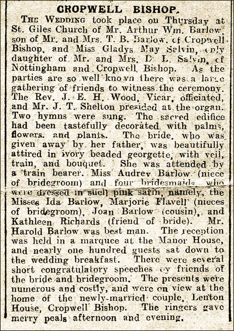
Gladys May Salvin married Arthur William Barlow in 1928.
Arthur Barlow and Gladys May Salvin on their wedding day in 1928On the right of Gladys is her father, David Leavis Salvin. 1928Newspaper report of the wedding. 1928
Glady and Arthur had 3 children; David Barlow, John Barlow and Edith Barlow. So, the name of Salvin had disappeared? Not quite.
When you want to keep an earlier surname alive you can either create a double-barrelled surname (e.g. Barlow-Salvin) or keep it as an extra forename. The full names of two of Gladys and Arthur's children were: Thomas David Salvin Barlow and Edith May Salvin Barlow.
So, as you can see, the Salvin family has history in Cropwell Bishop: that is why we have a street named after it.
Tony Jarrow
Note:
Thanks to Anne Terzza, Pam Barlow, Malcolm Dabell and Jane Jones for their help with this article.
This is Salvin Close now (August 2020).
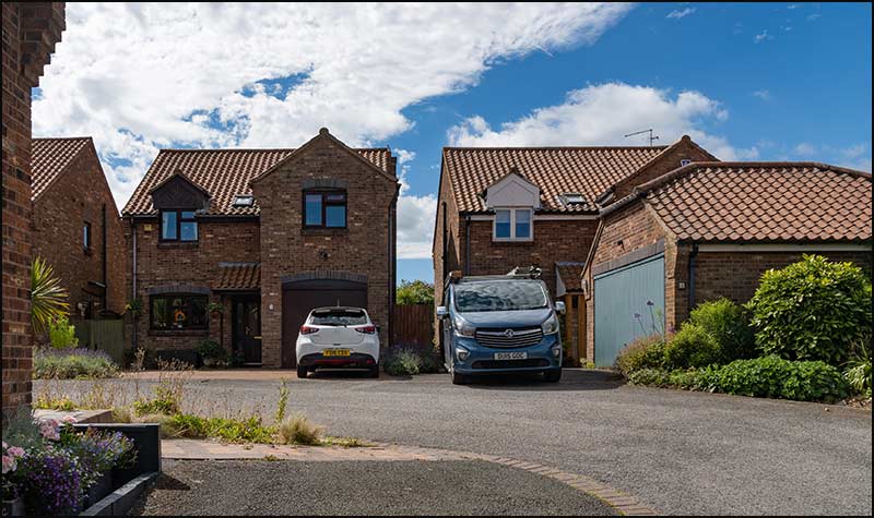
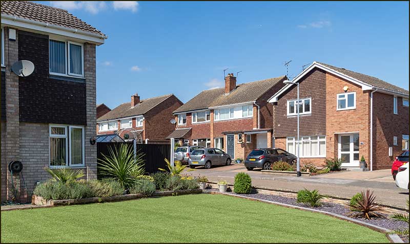
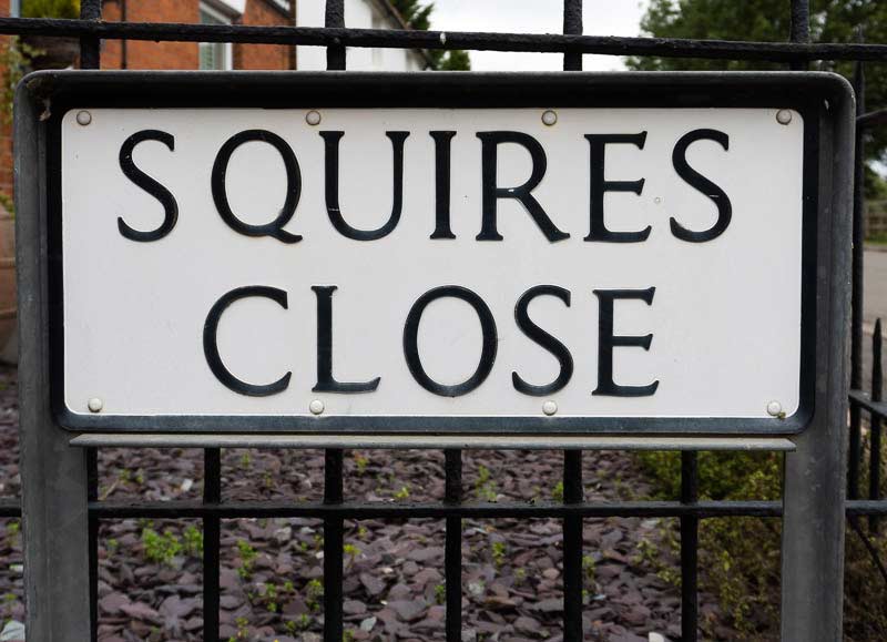
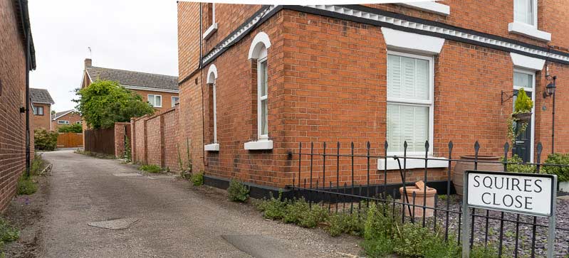
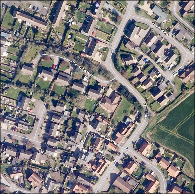
Cropwell Bishop Streets: — Squires Close (19-7-20)
Squires Close; named after the lord-of-the-manor or a local knight of old? I used to think so - but I was wrong.
The houses in Squires Close were built in the mid 1970s, not long after the completion of the Wimpey housing estate which included, “just over the fence”, Hall Drive.
At the bottom of Hall Drive, the gap between house numbers 30 and 32 is about 2m wider than normal. When Wimpey built the houses in 1974 there was every intention of having a public footpath between these houses and onwards to Church Street. For a time, people did indeed use this route as a short-cut to the Coop which was on Church Street at that time.
1977
However, planners overlooked the fact that the route was through land not owned by them but by Cropwell Bishop builder, Dennis Smith - and he had every intention of building houses on it. That was the end of the footpath idea but the beginning of Squires Close.
The area was quite small; not surprising really because it was effectively the back garden of a house on Church Street. It was only big enough for 5 detached houses - just two other streets in the village have a smaller number.
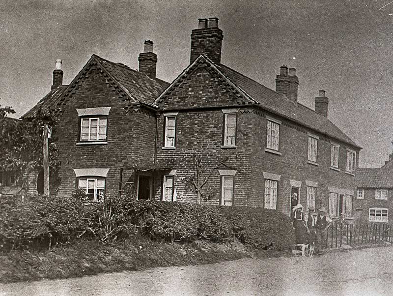
Here is a photo of the house from Church Street taken in the 1930s.
Squires House 1930s
That is almost a hundred years ago and, not surprisingly, it has been much modernised since then but, even so, its unusual shape makes it easy to recognise: here is what 47 Church Street looks like today.
47 Church Street: 2020
So, how did Squires Close get its name?
Well, we do know that 47 Church Street was for a long time owned by a family named Squires: it was even referred to as Squires House.
But surely, that is not enough to justify naming a street after the owner: not everyone gets a street named after them when houses are built in their old back garden – there must be more to it than that.
The Squires family have 12 graves in St Giles Churchyard, ranging from 1839 to 1925. We do know that for over a century, family members involved themselves in a wide range of activities in Cropwell Bishop.
It all began in about 1800 when James Squires, an agricultural labourer in Flintham, married Cropwell girl Mary Mabbot. Although they decided to live in Flintham, two of their sons, John and George (no record of a Paul or Ringo!), went on to also marry Cropwell girls (what was it about our village girls?) and decided to make their homes in Cropwell Bishop.
The older one, John, married Sarah Allcock at St Giles Church in 1832 and they went on to have 8 children, but 4 died in infancy. John was a stone mason and bricklayer, and was also an active Methodist Preacher locally. The family lived at 47 Church Street – the house referred to above which, over the years, became known as Squires House.
So, we know that John Squires lived with his family at Squires House and we know that 140 years later, Squires Close was built in the back garden – so presumably, the Close was named after John Squires.
Hold on, it’s not that simple: lots of other Squires characters appeared during those 140 years, might not one of them be the one commemorated?
One of John and Sarah’s sons, Samuel, grew up to be a farmer and owner of 120 acres: he sounds promising. However, he did not live in Squires House, but down the road in the cottages known then, as Salvins Row. Also, by the time he was 40, he was farming with his wife and 4 children at Frisby-on-the-Wreake near Melton Mowbray. So, not the person you would name a Cropwell Bishop street after.
Meanwhile, George (the younger son of James and Mary), had married Sarah Thraves and they lived at Mill Hill Cottages on Fern Road (Fern Road was called Mill Hill in those days). George was also a bricklayer and, later on, a ‘letter cutter’, probably of gravestones.
George and Sarah had at least 10 children (no television in those days).
Their son, George, started as a Baker & Grocer and lived with his wife, Miriam, at the Co-operative Store in the village. Within a few years though, he became a Builder and Bricklayer and they lived with their 7 children at Mill Hill, maybe at his late father's house.
Here are photographs of George and Miriam in 1910.
George Squires: Baker then Builder. 1910Miriam Squires 1910
Another son of George and Sarah, Stephen, lived with his wife and 6 children on Fern Road (then called Mill Hill). Like his father, he was a gravestone mason: his name, “Squires”, is engraved on the base of many local gravestones – including some in St Giles Churchyard.
Now, the question is, which of the many members of the Squires family is Squires Close named after? To be honest, I have no idea!
Here are some pictures of family members: any thoughts?
Squires women in front of house: 1930sSquires family in boat: 1910Three Squires men front of house: 1920s
I think the best answer is that Squires Close was named to celebrate all members of the Squires family. Some will have lived in Squires House and have worked and played on the land now occupied by Squires Close so, linking them all to the street, would have been a great decision.
Tony Jarrow
Note:
The extended Squires family were involved in many aspects of Cropwell Bishop life and one descendent still is. Malcolm Dabell lives in the village and was the provider of much family history for this article. A thank you to him.
Thanks also to Anne Terzza and Pam Barlow for their help.
I suspect that most people in the village have never walked down Squires Close, tucked away as it is off Church Street. Here is your chance to see what you are missing ....
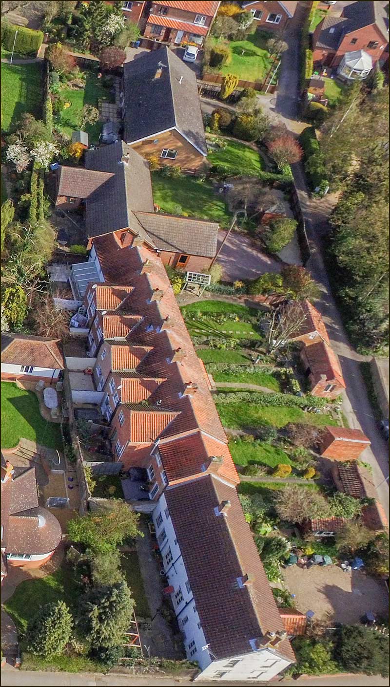
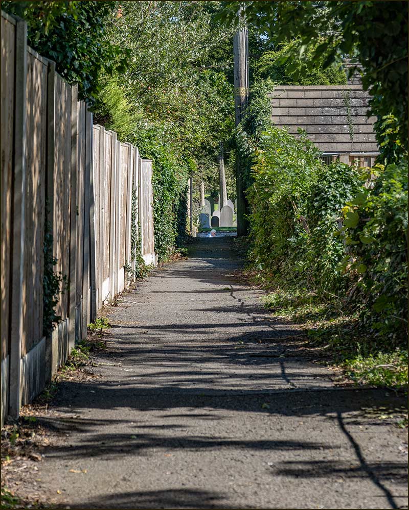
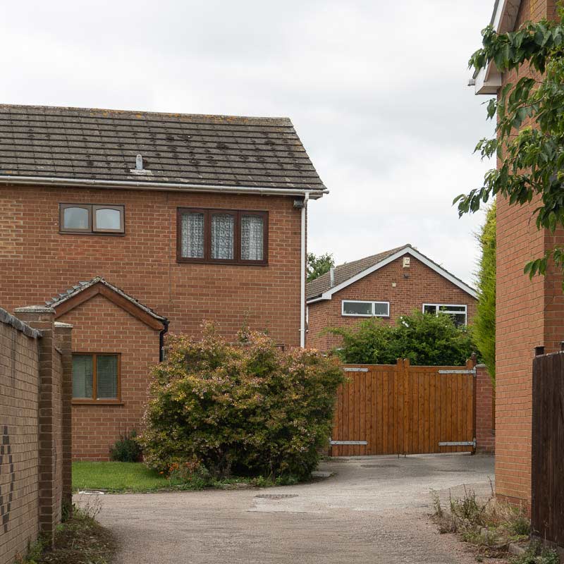
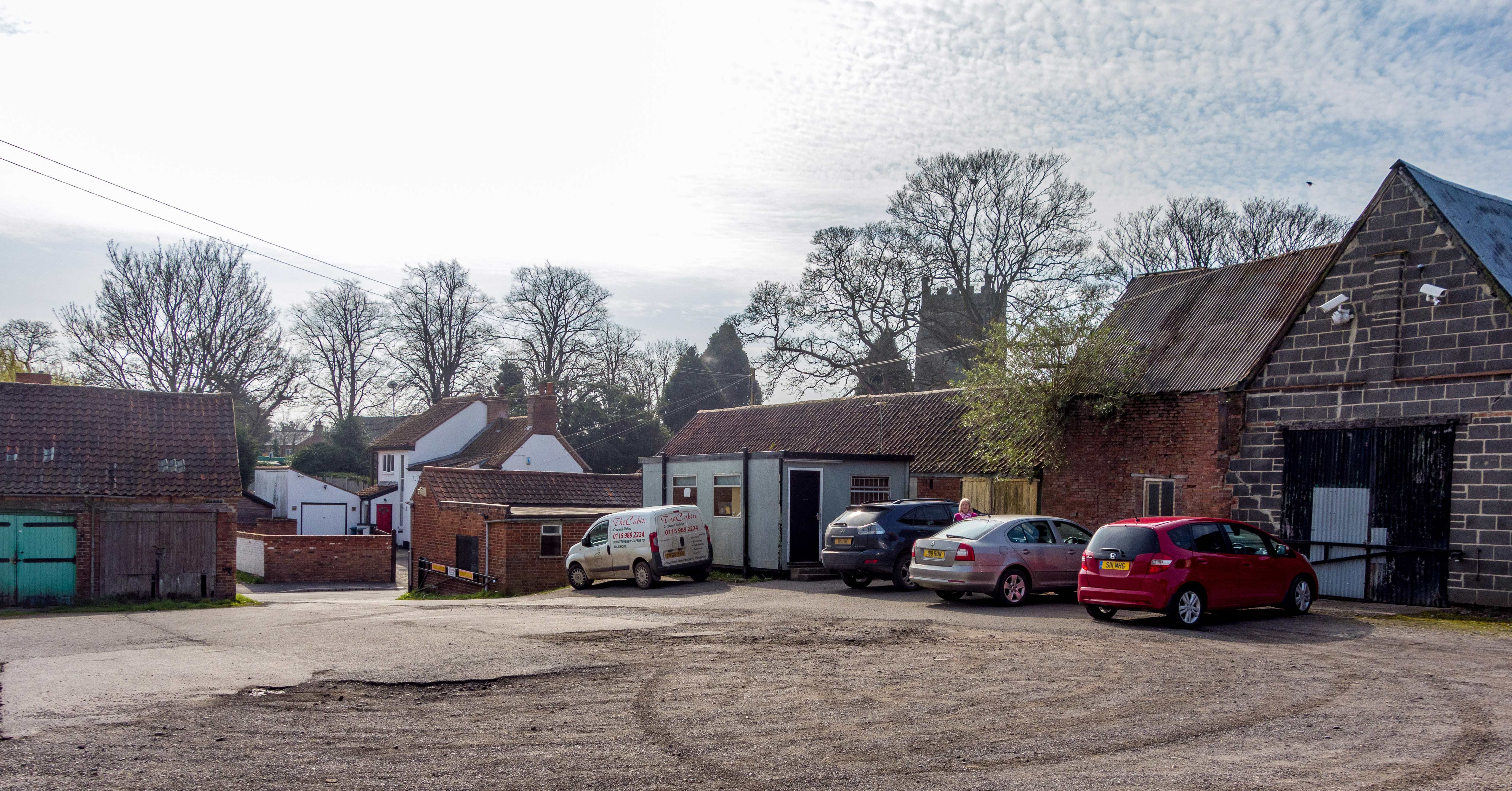
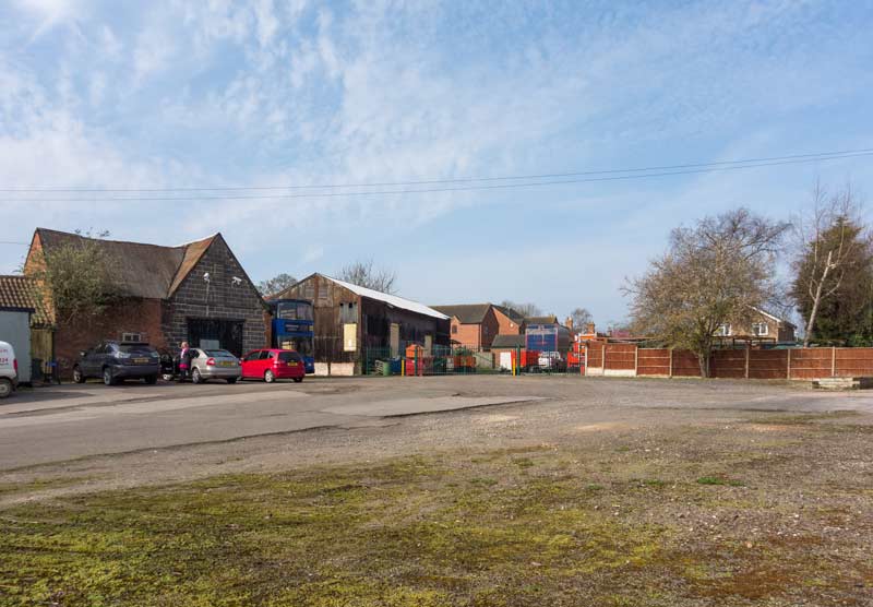
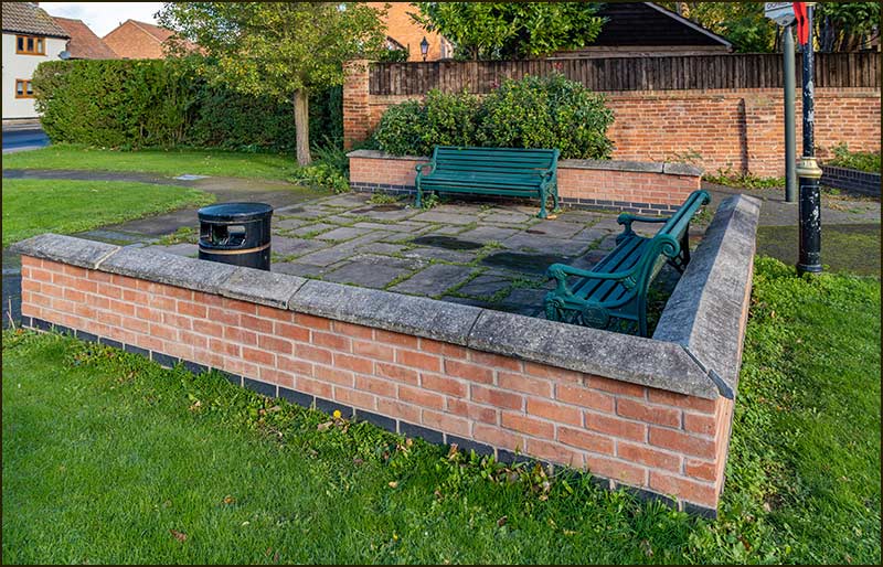
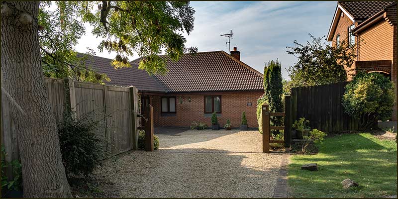
Cropwell Bishop Streets: — Stackyard Close (12-7-20)
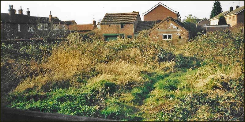
Stackyard Close is the newest housing development in Cropwell Bishop but because it is located in the centre of the village, its site has a long history.
All but one of the homes are brand new buildings but the one alongside Church Street is inside the shell of a large, old building.
This was built as a cartshed for the Shelton family in 1890. George Shelton was a Farmer and Plaster Merchant in 1832. The family became substantial Cropwell farmers and were still in the plastering trade in the 1890s.
The cartshed was built by a Cropwell bricklayer, David Salvin, and is considered an example of some of the finest early brickwork in the village.
Back in 2015, the site of Stackyard Close was, essentially, a storage space. As you can see from the photographs below, it had a large empty yard where cars, lorries and buses had ample room to turn around and park. Buildings of various ages and construction held machinery, containers and vehicles: there were also 7 garages for cars.
But there were times when it was people that filled the yard. In the mid 20th century, methodist evangelists Silverwood and Whitehouse sometimes visited the village and set up a marquee in the stackyard.
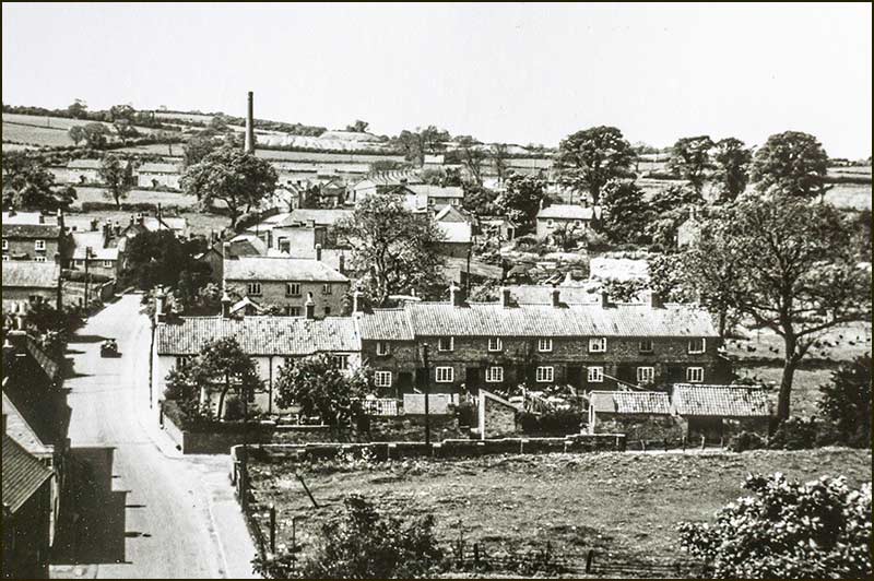
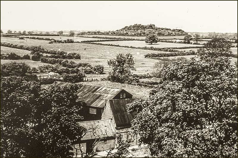
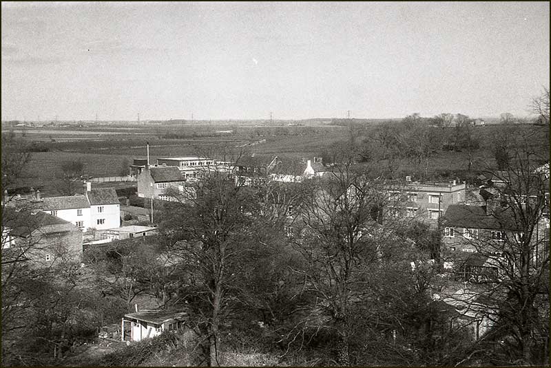
The black corrugated building was at least 70 years old. The black and white photograph below was taken in 1949 from the top of the church tower and the building is in the centre surrounded by grass.
For much of the 20th century, the yard was mainly used to store grain and house lorries owned by Cropwell Bishop's own independent Grain Merchant, H. Simpson and Sons Ltd. Consequently, it was known by local people as Simpsons Yard.
The company had its offices on Church Street and you will learn more about the Simpson family in the Church Street article later this year.
Tony Jarrow
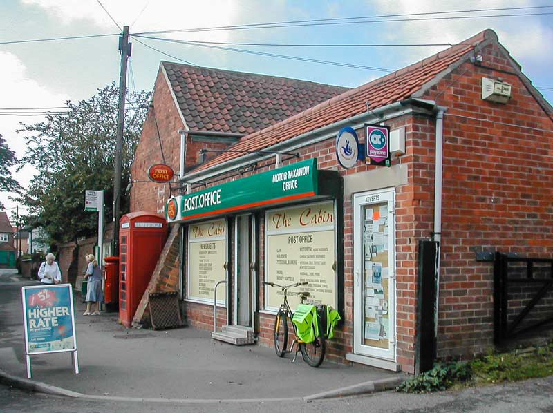
The Cabin Store & Post Office in 2006: demolished in February 2018Benny Snowden's hairdressing shop which was demolished in the 1960 and replaced by The Cabin Looking towards the church. 2015These building are still there. 2015Some of the garages. 2015
The black, corrugated iron building was there in 1949A spacious yard where lorries and buses could turn around and park. 2015
View from the church tower. 1949 (provided by Jane Jones)View from the church tower. 2020
Stackyard Close. 2020Top of Stackyard Close. 2020
The information for these articles comes from my own notes and photographs, the research notes of Anne Terzza, the memory of Pam Barlow and hours of searching the internet.
In spite of this effort, there will certainly be other individuals who are able to provide further information, photographs, comments and corrections that would enhance these articles: I would greatly value such contributions.
If you feel that you might be able to provide any useful information, either before or after a street article is published, please contact me (click "Contacts" for phone & email details).
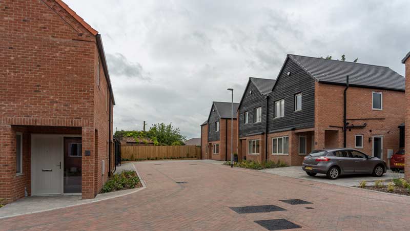
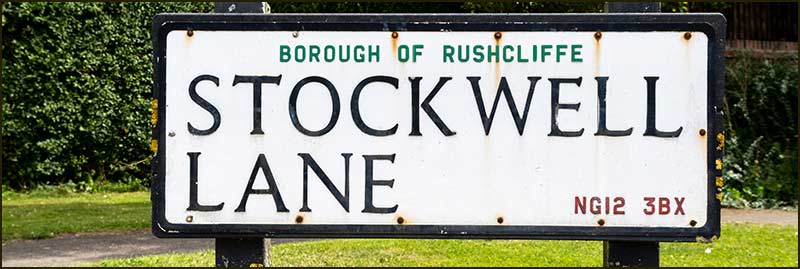
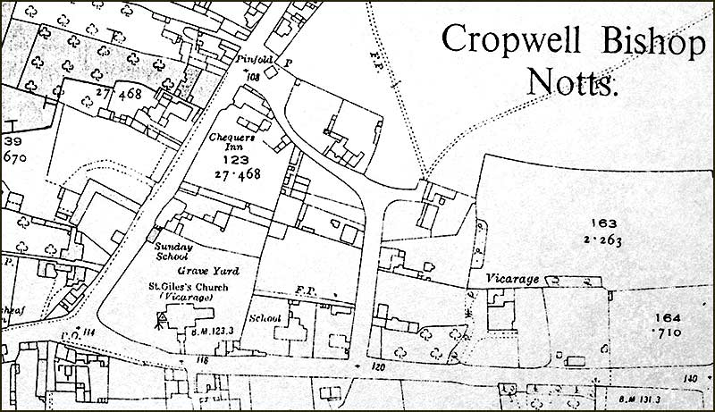
Cropwell Bishop Streets: — Stockwell Lane (24-12-20)
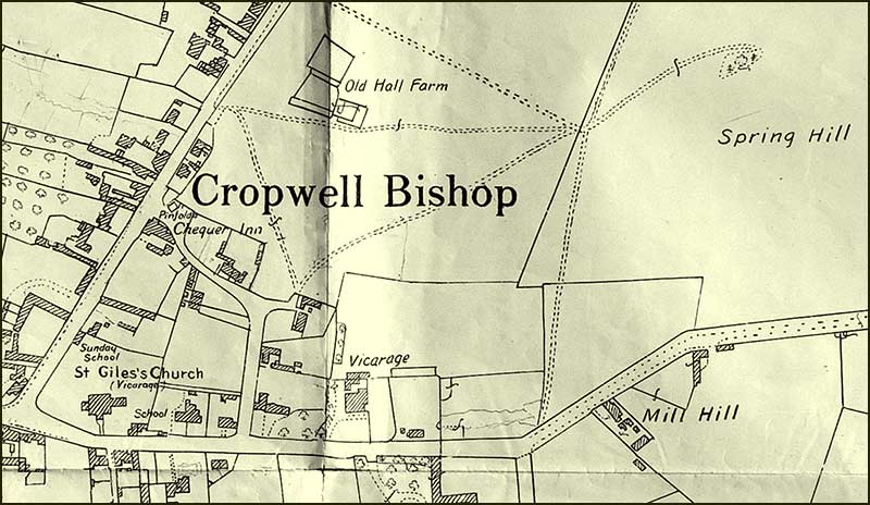
At the bottom of Stockwell Lane is the Pinfold, an ancient part of the village where there was once a pond fed by a spring.
However, once large-scale mining of gypsum occurred around the village in the 1900s, its water supply was disrupted and stopped appearing at the Pinfold.
The Pinfold, being at the centre of the village, was the natural place to put the village stocks: the punishment of miscreants was clearly more local and public in the past.
With stocks, and a fresh supply of spring water, you can see where the name ‘Stockwell Lane’ came from. But it wasn’t always called this.
For a long time – probably centuries – it was called Back Lane, and this is what it was called in the 1871 Census.
Nevertheless, from 1881 it became known as Thraves Lane.
At that time, William Thraves, a tailor, and his wife Sarah, a dressmaker, lived on the Lane. Were they the source of the name, I wonder.
But their father had lived on the same lane since 1830, and during his lifetime (as a farm labourer), the lane was always known as Back Lane.
My guess is that because William and Sarah made clothes, people would have been regularly calling at their house and, consequently, their name became a more popular reference to the lane than Back Lane – hence it became known as Thraves Lane.
When Sarah died in 1910, no one with the name, Thraves, lived on the lane but the name persisted until at least 1939.
I don't know when Stockwell Lane became the new name but it is interesting to note that even in 1911 some homes in the village were referred to as Stockwell Cottages.
The road was made one-way in the 1960s.
These days, we see no reason for our street names to change, but that clearly wasn't the case in past times.
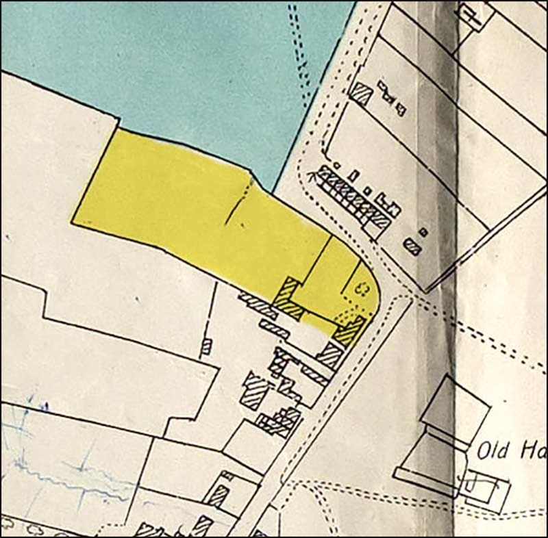
Maps
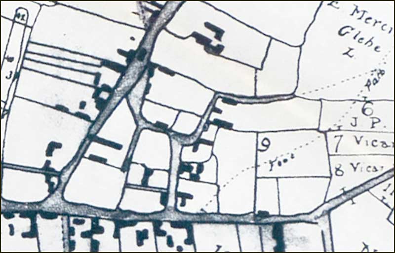
1804 map of Stockwell Lane. Note the narrow lane that leads south from near the Pinfold. In later years, the present cottages, 2-6 Stockwell Lane, were built along this lane. Note also, how the short lane that currently leads up to the school gate, was once a much longer one with several buildings along its length. People would have used this lane to collect water from the spring in the field beyond.1930 map of Stockwell Lane. Note the location of the spring on Spring Hill. The three cottages, 2-6 Stockwell Lane, are shown. The long narrow building that is beside the path to these homes, is the outdoor-toilet and wash-house block for the homes. It is no longer there.
1950s map of Stockwell Lane. Little changed in the twenty years before 1960: a great deal changed in the twenty years that followed. The same was probably true in most of Britain.Satellite view of Stockwell Lane in 2018
Church Views
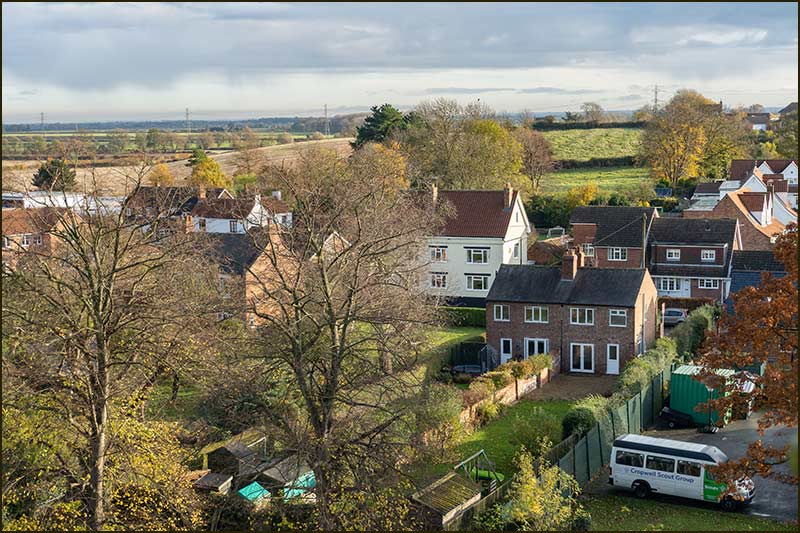
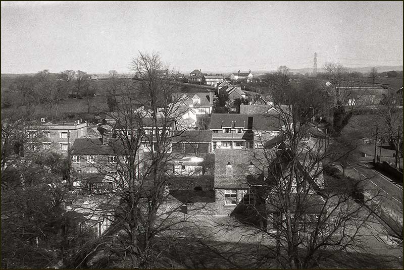
Before drones were invented to take aerial photos, we had to make use of satellite images, and before that airplane and helicopter photos.
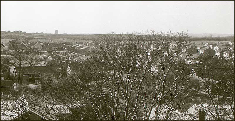
Before all of these, the people of Cropwell Bishop were fortunate in being able to see their village from above by climbing up the church tower (on the inside!) – and it is still a good way to get high resolution photos. Trees are the biggest problem but at least in winter they don't have leaves.
This colour photo was taken in November 2019.
It becomes more interesting when you compare it with photos taken many years ago and are able to spot changes that have happened in the interval.
The two black & white photos below were taken, I estimate, in the 1980s. Compare them with the 2020 photo and try to spot differences.
View from the church tower in 2019
View in the 1980sView in the 1980s
The Pinfold
The area we know as the Pinfold would probably be unrecognisable to the villagers who lived here a century or more ago.
Its name, Pinfold, relates to a time when there was a need to lock-up stray farm animals. In the early 1900s it existed as a low-walled pen with a gate, and was about 6m square. There was a lock on the gate.
A parish officer, called a Pinder, would lock stray animals in the Pinfold and only release them on the payment of a fine.
Near to the Pinfold in those days, stood the village stocks and there was also a pond fed by a spring. The pond would reach a depth of 30cm, or so, and then overflow into a nearby dyke.
With stocks and a fresh supply of spring water, you can see where the name ‘Stockwell Lane’ came from. But it wasn’t always called this. Previously it was known as Thraves Lane (after William and Sarah Thraves who lived there) and, before that, as Back Lane.
Even these days, people will sometimes refer to it as Back Lane without giving it a second thought, it being a perfect description and a bit easier on the tongue.
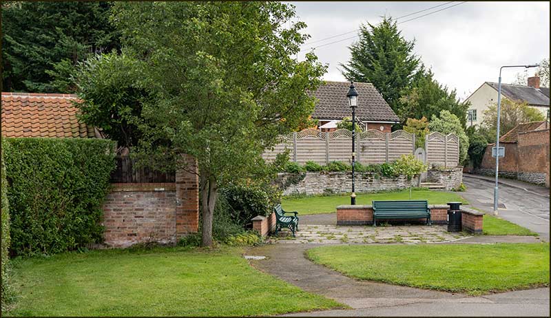
The Pinfold (2020)
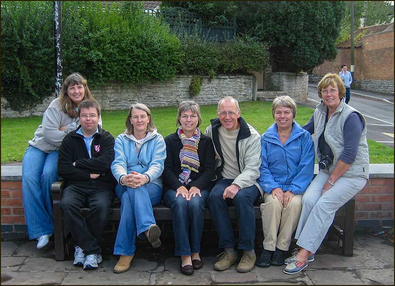
The Pinfold – a place to meet. In this case it is a get-together of some of the Steering Committee for the Cropwell Bishop Village Plan in 2009. From left to right: Linda Hatton, Rob Thorpe, Tracie Berridge, Mel Stanley, Tony Jarrow, Elaine Robinson and Judy Thomas. Alongside the Pinfold in 1989Once an enclosure for local animals: now a resting place for local folk (2020)The Pinfold (2020)A sign for our times (2020)
Up the Lane
Street, Road, Close, Avenue, Drive – all these words are used to describe streets.
With Avenue and Close, I picture a short, dead-end street, although I can't be certain (e.g. 5th Avenue in New York), but none of the rest, stimulate my imagination.
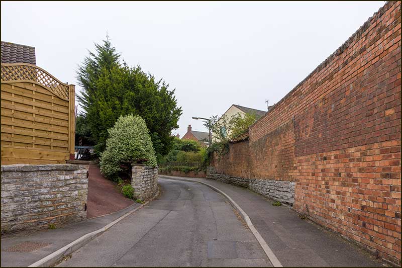
On the other hand, when it comes to Lane, I imagine something old, narrow, curvy, steep sided, with a narrow pavement - or none at all. In fact, to me, this photo of Stockwell Lane looks just how a lane should look.
Stockwell Lane (2020)This is the first house up the Lane. (2020) In its raised position it looks as though it has the job of keeping an eye on the Pinfold. One previous owner was Ethel Harper who, together with her husband, Aubrey Harper, wrote and published the local history book, Chronicles of Cropwell Bishop, back in 1988.
A look back towards the Pinfold (2020)The view round the bend. This photo was taken in 2014, but nothing much will have changed in 6 years: this is a real lane.
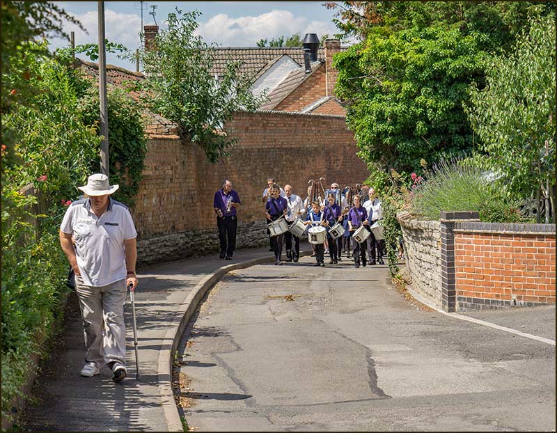
The Girls and Boys Brigade Marching Band makes its way to the Primary School as part of the Celebration Weekend in July 2015Parents, children and supporters follow the band to the School (2015)
1 Stockwell Lane as it was in October 2008. It was soon to be demolished and rebuilt. It had been the home of Margaret Kerr who had been a Parish Councillor. Kerrs Walk is named after her. Number 3, next door, would also be part of the rebuild The completed rebuild in June 2009. The enlarged home is 1 Stockwell Lane: number 3 is now just a memory. A modern, energy-efficient home has replaced old buildings but the style is very much is keeping with both former and nearby homes and enhances the appearance of the Lane.
1 Stockwell Lane in 2020Numbers 1 and 5 Stockwell Lane (2020)
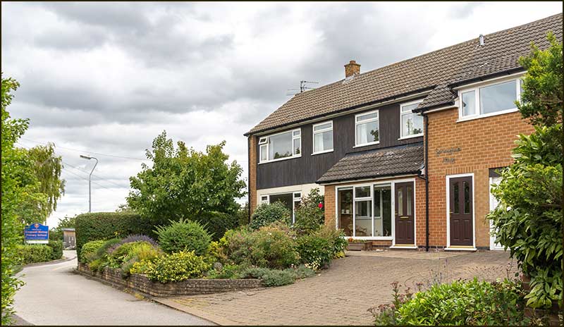
The house on the right, 5 Stockwell Lane, was once the Coach House for the Old Hall that once stood on land now occupied by Springfield Close. (1950s)Compare this 1999 photo with the previous one and you will see that the house has been extended and modified in many ways - although, you would never know it. It looks as though it might have looked this way for centuries. It just shows what is possible when you employ a good architect and builder.
Looking up the Lane towards the bend (2020)A 2020 photo of number 5 showing the full extent of its genuine improvements
On the Bend
This is number 7 Stockwell Lane in 1998. As we compare this photo with others, take your bearings from the School sign with its arrow: its position has hardly changed in 20 years, whilst most everything around it has.Several years later, the owner of Number 7 decided to build a small bungalow in his garden. Here it is next to number 7. The bungalow was given the number 5A.
The new owner of number 7 decided to demolish the old house and build a new one. Here it is in this 2020 photo. I think the appearance of the two new homes is a big improvement on the original house – and the insides will be vastly better. This house in still number 7 and goes by the name, Stockwell House. 9A Stockwell Lane. For great views down the Lane, and red sunsets over the village, this is the place to live.
Dennis Baker
There is no School Lane but, if there was, this would be it (until, that is, the proposed new housing estate is built and the school creates a new entrance).
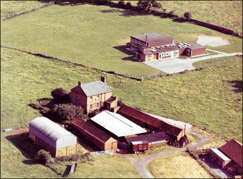
The School was built in 1961 and, once it opened, the School on Fern Road shut its doors for the last time. Compared with the School today, the new building was small: just look at this early photograph of it in its field behind Old Hall Farm.
Cropwell Bishop Primary School in 1965. In front is Old Hall Farm that was demolished to make way for Springfield Close.
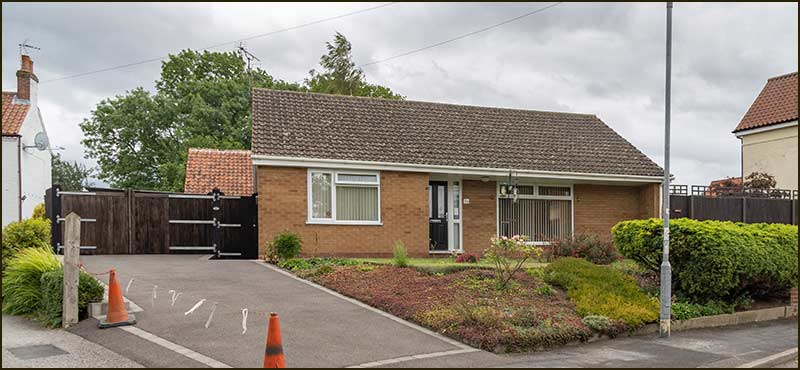
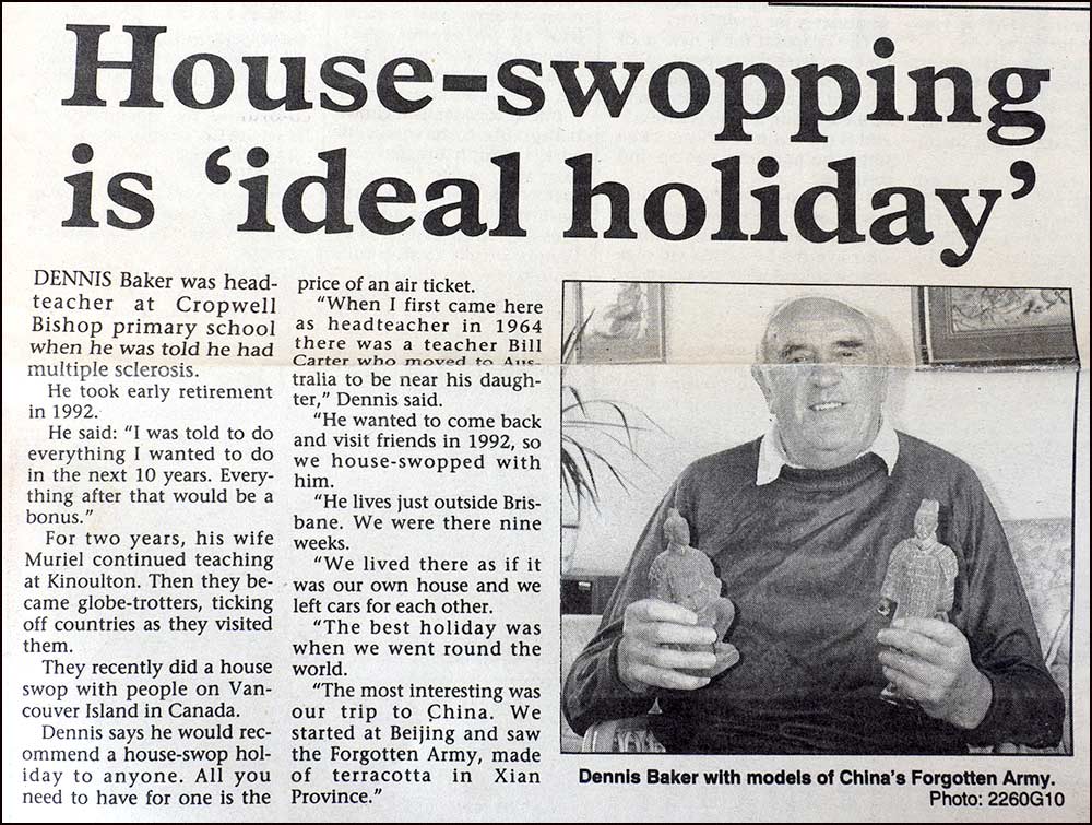
The first Head of the School was Dennis Baker. He was able to keep a close eye on his School 24 hours a day: he lived in the house beside the school gates. As well as giving time to his school duties, he also served as a Parish Councillor.
He served as head for around 20 years but towards the end of that time, life gradually became more difficult for him after he was diagnosed with multiple sclerosis. Although he retired as Head, he did not retire from work for another 10 years.
The following paper-cutting describes his reaction to the diagnosis and how he and his wife, Muriel, took the advice given by doctors: do everything you want to do in the next 10 years. It looks like they did.
Round the world tours, holidays in China, house-swaps in Australia and Canada – Dennis and Muriel made the most of their time together.
I suspect the shock of the MS diagnosis motivated them to do far more than they might have done if Dennis had enjoyed a life of good health. Maybe their reaction is a lesson for all of us.
Muriel, who in her younger years was a teacher at Kinoulton Primary School, can still be seen walking around Cropwell Bishop.
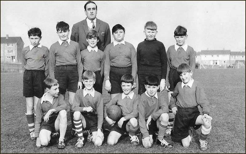
Cropwell Bishop School Football Team 1963/64. Taken at Cotgrave with Head, Dennis Baker
Cropwell Bishop Parish Council 1970. From left to right: Vic Hall, Arthur Barlow, John Foster, David Holmes (clerk), Harold Smith (chairman), Dennis Baker, John Dean and Tom Rawlings.
Springfield House where Dennis and Muriel Baker lived (2020)Springfield House (2020)
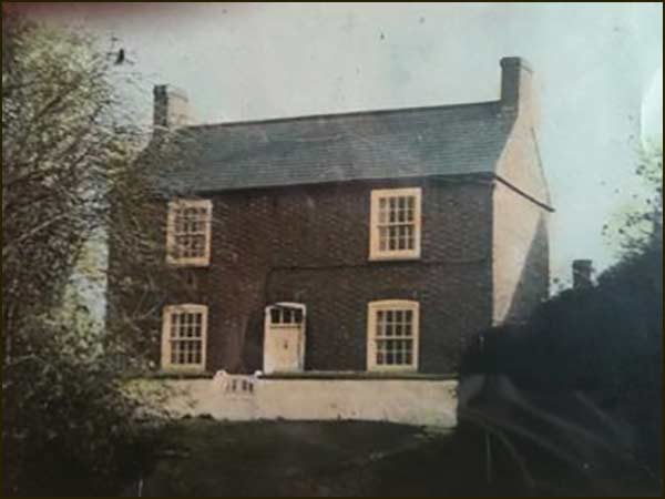
Ivy Cottage
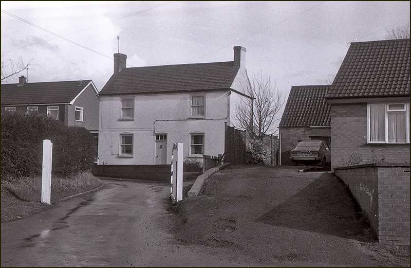
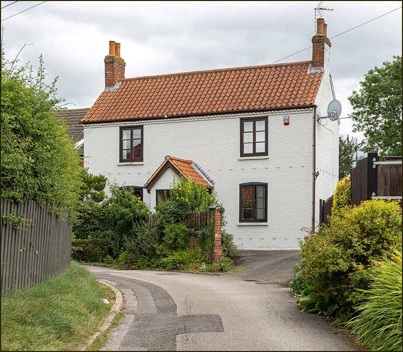
Ivy Cottage has been standing near the bend on Stockwell Lane a long time, at least 140 years. It is one of the oldest buildings on the road and has experienced three name changes of the Lane.
Being just off the Lane, and looking like it is on a private drive, must pose problems for delivery people. At least when they see the bungalow next door is 9A, they will know that number 9 (Ivy Cottage) is not far away.
Delivery people are known to have far greater problems finding Springfield House next door; it hasn't even been granted its own house number.
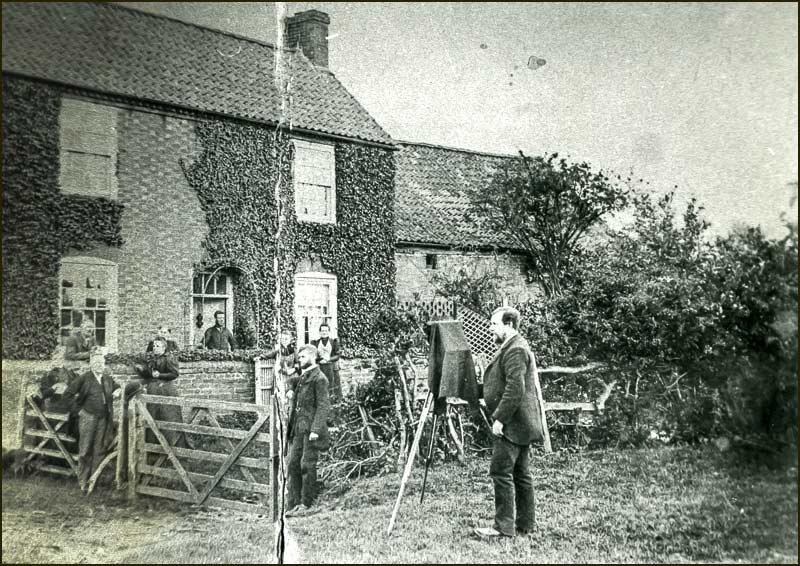
1890s. Photographer taking pictures of the residents of Ivy Cottage1950s photo of Ivy Cottage
1970s photo of Ivy Cottage2020 - Ivy Cottage today.
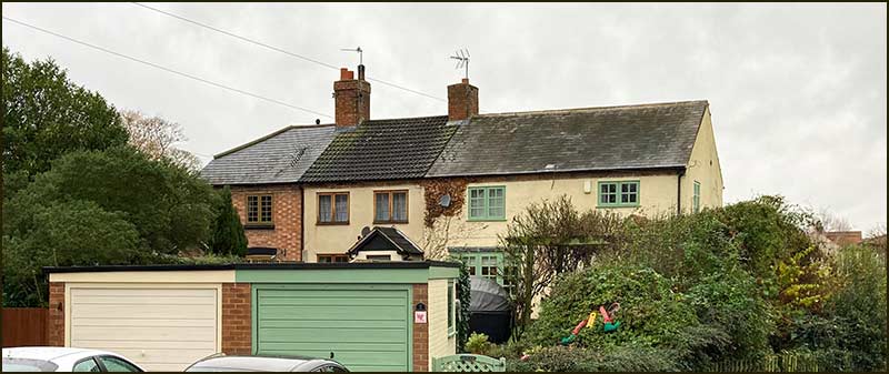
The Cottages, numbers 2, 4 and 6
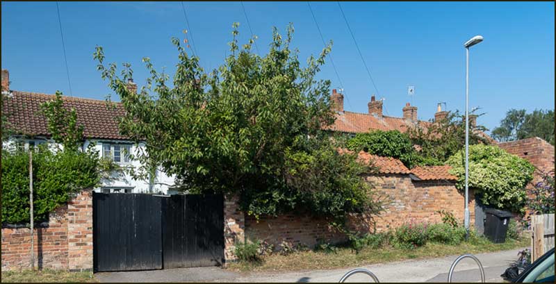
There is a terrace of three cottages sandwiched between the back of The Chequers and the two flat-roofed garages on Stockwell Lane. It's a shame they are now partly hidden, because they once held a commanding presence on Stockwell Lane.
The garages hide the fronts of the homes, but the photo from the 1940s clearly shows the former extent of their front gardens and the apparent tranquillity they once enjoyed.
Where the garages now are, there would have been a long path from the house to the pavement on Stockwell Lane.
At one time, access to the front of the houses was also possible via steps from the lane – somewhere opposite number 1. A newish wall hides any trace of it in 2020.
Numbers 2 Stockwell Lane is the right-hand cottage, number 4 the middle and number 6 at the left-hand end (2020)
A composite of 1940s photos of numbers 6, 4 and 2 Stockwell Lane. I have butted the two separate photos together to make it easier to appreciate what it shows. The left-hand photo was taken from the same spot as the 2020 photo above (cottages 2 and 4 have been excluded). The right-hand photo was taken from near the cream-coloured garage, with the camera pointing towards the Pinfold. On the left is number 2, and on the right is the front of number 1 (in its former state: it has since been rebuilt in a similar style)
The Plough and Harrow
Number 11 has an interesting history: it was once an “off-licence”. This means it was allowed to sell alcohol.
These days, when it seems like every other shop sells alcohol, the phrase is never heard, but before the 1970s, it was where you bought alcohol for drinking at home. Very often, it was a little shop or just a counter attached to a pub.
So, number 11 was a little pub with an off-licence counter. Or, you can think of it as a beer shop with a public bar. Its name was, The Plough and Harrow, but it was more commonly referred to as The Plough.
The building hides its past well, but then it is over a century since it sold its last pint of beer. During those hundred years it has been a private home and has changed its appearance several times, sometimes by choice and sometimes by accident.
Compare the photographs of it as The Plough in the 1890s (below), with its appearance in 1998 (below-right). The windows are all different in size and position and the door has gone. Not surprising really, who wants to have a front room looking like a public bar (don’t answer that).
But what has happened to the roof. Apparently, it was destroyed by fire in 1950. Who decided that a flat roof would look good is unknown, but the architects of the 1950s and 1960s do have a lot to answer for: many of their bleak and ugly buildings were demolished in the following decades although a few can still be seen festering in Nottingham and elsewhere.
Thankfully, a recent owner, roofed over the eyesore and, no doubt, created a few extra rooms in the process.
11 Stockwell Lane in 2020. Few would guess its history.
11 Stockwell Lane in 1890, when it was The Plough & Harrow. In the photo are the occupants, the Green family.11 Stockwell Lane in 1998. To think, a someone thought this a good roof design, a second someone passed the plans, and a third someone paid money to have it completed. That's three misguided "someones".
Groves Cottage
It was back in 1874 that Samuel Smith, of Hickling, married Cropwell Bishop girl, Elizabeth Shelton.
They lived at a house at The Turn, which is the area in front of the Church.
As was common in Victorian times, they had a big family, seven children in all, but the one of interest in our story is their third, George Shelton Smith.
In 1903, when George was 25, he married 18-year-old Cropwell Bishop girl, Winifred Groves. Winifred's father was William Groves.
William was a Carrier. In the period from 1908 to 1912, he transported goods and people from Cropwell Bishop to Nottingham and back again every Saturday and Wednesday.
He was also an agent for the lace out-work that was done by villagers in their homes. He would do all the transporting between Nottingham and Cropwell Bishop.
Over 40 wives and daughters of the village spent their days doing finishing-work on the machine-made lace items manufactured in Nottingham. The piece rates of pay were low, but the money was welcome – especially for those married to low-paid agricultural labourers.
In 1906, William had a house built on the Lane. That house is number 8 Stockwell Lane and it has a plaque high on its wall: "Groves Cottage 1906". George and Winifred also lived in the house along with their growing family.
The house was eventually inherited by Harold Smith, the youngest son of George Shelton Smith and Winifred.
Groves Cottage (2020)
Groves Cottage (2020)Groves Cottage with its paddock/orchard alongside. (2020) The paddock occupies the space between number 8 and number 12 Stockwell Lane. A house was never built where the paddock is, but I suspect the houses were numbered to make room for a number 10 there – one day.
12 & 14 Stockwell Lane
14 Stockwell Lane (2020)12 Stockwell Lane (2020)
Top End
If you look back at the old maps of Stockwell Lane, you will only be able to link one building with the ones currently at the top end of the Lane. That will be the house with homes numbered 12 and 14.
The homes opposite 12 and 14 are obviously relatively recent additions: they were built in the late 1970s. As the old maps show, there was a building there before them - and it had to be demolished. It was an old vicarage.
As a home for the village vicar, you might expect there to be a long history of vicarages in all villages, but that is not the case.
In the distant past, a vicar would very often devote most of his time to personal pursuits rather than the well-being of his congregation. So much so, that he would not even live in the village or bother to visit it regularly. He would appoint all his church responsibilities to someone else, that someone being a curate.
Abraham Dobbin became the vicar of Cropwell Bishop in 1877 but, before that, he too had been a curate in Nottingham. The Cropwell Bishop vicarage that became his home, stood on ground where Dobbin Close now is - it is clearly marked on the 1930 map.
But before his vicarage was built, there had previously been another one in the village. It was not demolished but remained for almost a century after being cast aside by the church. That old vicarage was on Stockwell Lane, opposite 12 and 14 Stockwell Lane. It too is shown on the 1930s map.
It was there until the 1970s and here are photos taken at that time.
The old vicarage on Stockwell Lane in the 1970s. It is near the junction with Fern Road; the photo was taken from the opposite side of Fern Road. As you can see from the sign, "Cottage Style Chalet Houses" will take its place.This is a view of the back garden of the old vicarage at that time. It is clear from both pictures that the building had suffered from years of neglect. The two tree trunks belong to the tall trees in the previous picture.
11A Stockwell Lane (2020)15 Stockwell Lane (with the red car). It is next door to 11A. This is reminiscent of Mill Lane where there is no number 13. (2020)
Two houses with no number. I would guess they are 17 and 19 Stockwell Lane and, I suppose, delivery people have to do the same. I imagine it would be a struggle to complain about mis-placed deliveries if you don't have a number on your house.A photo of the entrance to Stockwell Lane, taken from the same spot as the photo of the old vicarage.
Note: Thanks to Anne Terzza, Pam Barlow, Pam Wregg and Muriel Baker for their help with this article.
Tony Jarrow
Cropwell Bishop Streets: — Thurlby Close (10-10-20)
Cropwell Bishop has 14 streets with only half a dozen or so houses. Being cul-de-sacs, few people are likely to venture down them apart from its residents.
In fact, I doubt more than a handful of people in the village (or world!) have visited them all – not counting post-men/ladies, Jane and Jo (who deliver Cropwell Bishop News) and Amazon delivery drivers.
Thurlby Close is one such street. On the bend, where Church Street becomes Cropwell Butler Road, you don’t notice it. Avoiding cars and buses coming around the corner will be more than enough for your attention.
Its five houses were built in 1971 by the builder, Jacques, of Bingham. The bungalow at the entrance to Thurlby Close, was built more recently, around 2005.
The land on which the bungalow on Thurlby Close was built (2002)
As we know, it is Parish councillors who initiate the process of naming a village road and they have a habit of naming them after people of Cropwell Bishop. Surely, Thurlby Close is no exception.
I am aware of a Thurlby family that once lived in the village but, after first researching their history, I confess that I then started looking for hills, woodlands, ponds, and so on, that might also have been named Thurlby, and so been the source of the street name. Such was the apparently underwhelming history of the Thurlby family.
Was I missing something.
Michael Thurlby was born in Cropwell Butler in 1850. In 1872, when he was 22, he married 26 year-old Ann Plowright who was also born there.
Ann had been brought up from birth by her uncle and aunt in Cropwell Butler, George and Ann Bosworth. The child was no stranger to the couple: she was their niece. She was the child of Ann Bosworth’s younger sister, Alice Plowright.
We don’t know much about Alice, but we do know that she had 3 children and is listed as unmarried in the 1861 Census. All her children retained her surname, Plowright. See the family tree.
Thurlby Family Tree
George had been a schoolmaster and he and Ann married late in life: he was 54 and she was 40 so, maybe, they welcomed the opportunity to raise a child. It could be that the arrangement suited the adults: baby Ann would no doubt form her opinion in later years.
George died at 78 and a few years afterwards, in 1871, we find his (adopted) daughter, Ann Plowright, still living in the house at Cropwell Butler with her adopted mother, Ann Bosworth (aged 68), but also with her birth mother, Alice Plowright (aged 66).
Ann and Alice were, you will recall, sisters. This does suggest that everyone was on good terms with each other.
It was the next year, that young Ann left them to marry Michael Thurlby.
Michael had a variety of jobs in his working life. When he was newly married, the couple lived in Cropwell Butler at the Post Office where he was the sub-postmaster. He was also a baker and ran a grocery shop.
Two young apprentice bakers were living with the family too. No doubt their presence helped pay the rent.
Three bakers in one house – imagine the talk at meal times: How much yeast? An oven temperature that high! Why not this shape of cob? ... and so on.
Within a few years, Michael was also operating a Carriers Cart service to Nottingham on Wednesdays and Saturdays.
When he was 30 years old, he and Ann moved to Cropwell Bishop and 3 years later, in 1883, Ann gave birth to baby Hannah.
They were living at a house on Church Street – referred to as ‘The Cottage’ in a Census but now, simply, 61 Church Street. It is on the inside of the sharp left-hand bend as you go towards Cropwell Butler.
House Number 61 – the house known as 'The Cottage when Michael Thurlby lived there
In 1909 a ‘Valuation List’ was compiled for Cropwell Bishop and records Michael Thurlby as having a ‘house and land’ – it also noted that he was a ‘Carrier and small Market Gardener’.
Comparing a 1930 map and a recent aerial photograph of Thurlby Close, it would be reasonable to assume that the land he owned (and used for his Market Gardening) was his back garden.
Location of the Thurlby's house and land (assumed), on Church Street. (1930 map)
The same location today (2018 approx)
We do know that when the land for Thurlby Close was purchased by the builder in 1970, it was sold by the owners of number 61, Michael Thurlby's old house. So, I think it is safe to assume that Michael Thurlby once owned that land too.
This, I suppose, justifies naming the street after Michael Thurlby. I can find no other valid reason for naming the street after him.
Baby Hannah was to be Michael and Ann’s only child. She was a Cropwell Bishop girl but life was going to become very difficult for her – and Michael.
In 1894 when Hannah was 11 years old, her mother died: she was just 49. We have no knowledge of the cause.
In those days, if a man lost his wife, he would lose no time finding a replacement: being a single parent was a frightening prospect, both economically and socially.
Michael did what almost any other man would have done – or did he?
Within a year of the death of his wife, Michael Thurlby (then 45) married a 19 year-old girl. She came from Thrumpton but he had known her a long time: she was his niece, Kate Plowright. See the family tree.
Michael and Kate Thurlby
When Kate became his new wife, she was only 7 years older than 12 year-old Hannah, Michael’s daughter. How difficult it was for everyone, we don’t know, but we do know that after the marriage Kate’s younger brother also joined the family.
He lived with them and worked for Michael as ‘carter and general worker’. He was 18 years old and his name was Samuel Plowright. Remember the name!
In those days, a person operating as a carrier or carter, would transport people or goods in a horse driven cart. A 4-wheel cart was capable of carrying up to 12 people (sitting very close together).
A Carriers Cart on Fern Road. One like this would transport up to 12 people (sitting very close together!)
We know that when Hannah was 18, she worked as a ‘telegraph clerk’ but in 1908, when she was 25, she was ready to get married and leave home.
She didn’t have to look far to find a suitable man. She chose one who had been living in the same house as her since her mother died: Samuel Plowright, now 31 years old.
You will need to refer to the family tree to appreciate this extraordinary match. Samuel was her step-mother’s brother. Hannah and Samuel’s grandmothers were sisters.
The newly-weds moved 10 miles away to a farm at Barton in Fabis, which is next to Thrumpton, the village where Samuel grew up.
There, Hannah gave birth to 3 boys. The first, John, lived to be 78, but the second, Samuel, died when just 4.
Her third boy, Ronald was born in May 1918 and lived to be 84. However, he was born at great cost: Hannah, died just days after giving birth: she was just 35.
Michael Thurlby died in 1925 at the age of 75. He had lived through the death of his wife, his daughter and a grandson.
Now, all that remains of the Thurlby name in Cropwell Bishop is a street, Thurlby Close.
Tony Jarrow
Note:
Thanks to Anne Terzza, Pam Barlow, Hilary Jarrow and Lol Simpson for their help with this article.